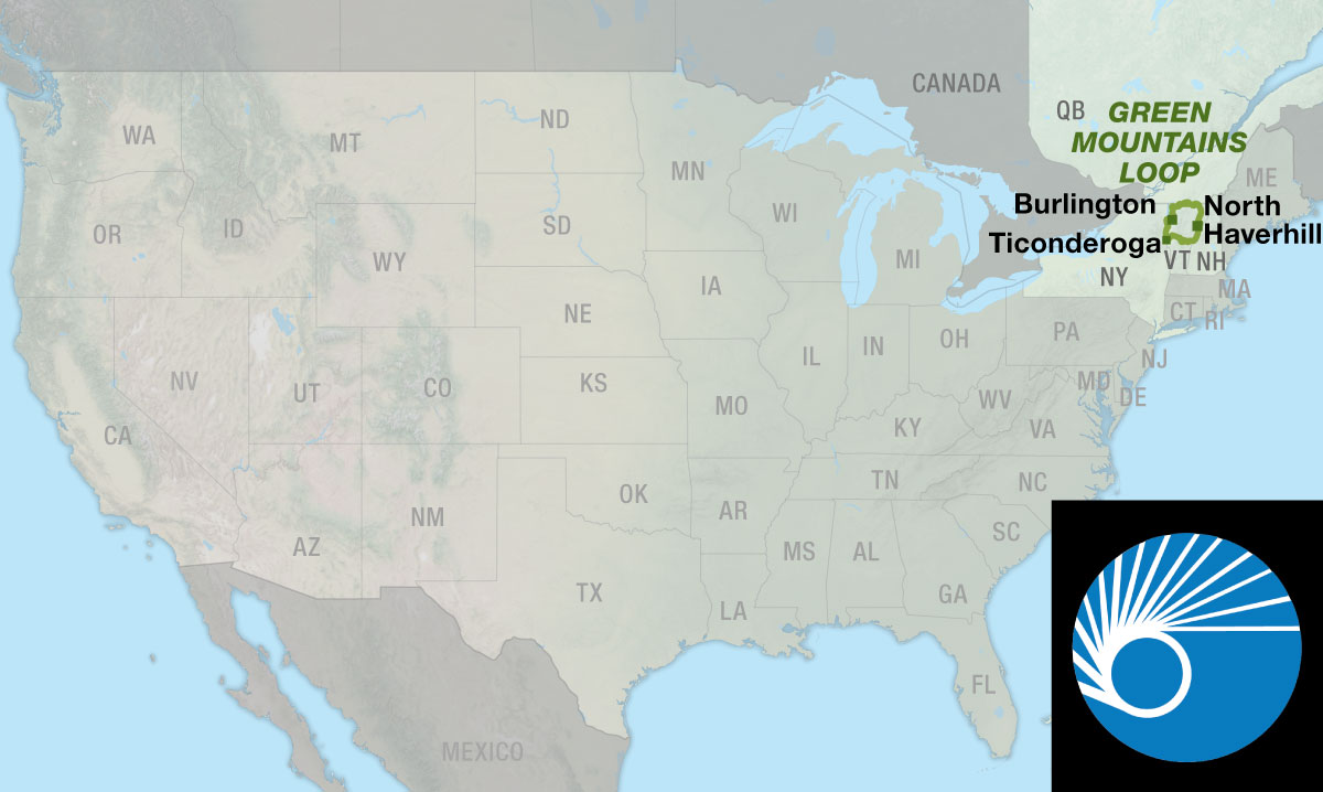
Green Mountains Loop
Due to limited resources, the paper map version of this route has been discontinued. This route is still available digitally.
Rural Vermont and then some.
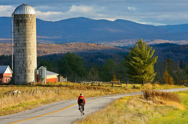
While the Green Mountains dominate the views and the geography of Vermont, the pastoral scenery and rural roads of Vermont are leading reasons for its popularity as a cycling destination. Be sure to enjoy at least one breakfast of pancakes, waffles, or French toast to savor the regional delight of locally produced pure maple syrup.
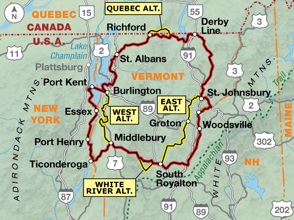
When ridden in a clockwise direction, the main route of the Green Mountains Loop Bicycle Route travels from Burlington, Vermont, north then eastward into New Hampshire along the Connecticut River. It continues back across Vermont then north into New York along the shore of Lake Champlain. If you prefer, alternates provide a route that can be ridden entirely in Vermont. The prettier and more rural, but hillier 68.7-mile East Alternate leaves the main route in St. Johnsbury and rejoins it in South Royalton. Highlights of this alternate include riding 10 miles of the Lamoille Valley Rail Trail, and pedaling through picturesque Peacham which has appeared in more Vermont Life photographs than any other town. From Middlebury, the 55.1-mile West Alternate is a faster return to Burlington that avoids the two ferry crossings of Lake Champlain found on the main route.
The Green Mountains Loop Bicycle Route utilizes three rail trails, all of which are unpaved. The Missisquoi Valley Trail between St. Albans City and Richford has a well-packed crushed limestone surface. The parallel SR 105 is suitable for those who prefer pavement. Both offer good views of the Missisquoi River and Jay Peak to the east.
The Newport-Beebe Bike Path travels north from Newport along Lake Memphremagog almost to the Canadian border. The trail has a hard packed gravel surface. Darling Hill Road is suitable for those who prefer pavement.
Between St. Johnsbury and Danville (on the East Alternate), the route utilizes the Lamoille Valley Rail Trail which has a crushed stone surface. North Danville Road and Bruce Badger Memorial Highway can be used for those who prefer pavement.
Photo by Dennis Coello
Although much of the route lies within valleys, expect many hills of less than 200 feet. Crossing the spine of the Green Mountains involves climbs of 1,640′ between Richford and North Troy, and 1,220′ between Hancock and East Middlebury. To avoid the climb between Richford and North Troy, you may wish to cross the border into Canada onto the Quebec Alternate for a more level 21.6-mile ride. Most of the route uses lightly traveled roads with no shoulder. Paved shoulders prevail where traffic is moderate. For a brief respite from climbing, the 17.6-mile White River Alternate runs along the river valley between Bethel and Rochester avoiding Rochester Gap, but be aware that SR 107 is narrow, winding, with little to no shoulder and carries truck traffic.
| Green Mountains Loop - Main Route | ||||
|---|---|---|---|---|
| Section | Distance | Elevation | Total Climb | Avg. Climb/mile |
| Total | 377.3 miles | Minimum: 95 ft.Maximum:2,140 ft. | 23,440 ft. clockwise23,490 ft. counterclockwise | 62 ft. per mi. clockwise62 ft. per mi. counterclockwise |
| Green Mountains Loop Alternates | ||||
|---|---|---|---|---|
| Name | Section | Distance | Total Climb | Avg. Climb/mile |
| Quebec Alternate | 1 | 21.6 miles | 1,855 ft. clockwise1,720 ft. counterclockwise | 86 ft. per mi. clockwise80 ft. per mi. counterclockwise |
| East Alternate | 1 | 68.7 miles | 5080 ft. clockwise5200 ft. counterclockwise | 74 ft. per mi. clockwise76 ft. per mi. counterclockwise |
| West Alternate | 1 | 55.1 miles | 2,915 ft. clockwise3065 ft. counterclockwise | 53 ft. per mi. clockwise56 ft. per mi. counterclockwise |
| White River Alternate | 1 | 17.6 miles | 960 ft. clockwise640 ft. counterclockwise | 55 ft. per mi. clockwise36 ft. per mi. counterclockwise |
The Green Mountains Loop can be ridden beginning in late May through September. Generally, the cycling season in the region can be extended into mid-October as long as you’re prepared for cool, crisp mornings and brisk evenings. Showers are common throughout the spring, summer, and fall in northern Vermont. Thunderstorms account for most of the rain during the summer. Wind is seldom a problem for cyclists on this route. However, strong southerly winds in the Champlain Valley will occasionally affect riding for a day at a time.
Some campgrounds will charge a cyclist traveling alone less if they have hiker/biker sites, but often they will charge the price of a regular tent or RV site, and that can easily be $10-$40/night. The maps list churches that have opened their doors to cyclists, but they aren’t all that closely spaced. If you’re friendly and ask around, you can often get yourself invited to camp in a yard. Our routes sometimes go through national forests (moreso in the west) and you are allowed to camp anywhere on national forest land as long as you “pack it in, pack it out.” Many city parks are free to camp in.
You may also wish to sign up with Warmshowers, a reciprocal hospitality site for bicycle travelers, for other overnight options.
Route Highlights
Green Mountains Loop Highlights
- Lake Champlain
- Ethan Allen Homestead and Museum, Burlington, Vermont
- Missisquoi Valley Trail
- Long Trail (hiking), Vermont
- Newport-Beebe Bike Path
- Lake Memphremagog
- Brighton State Park
- Lamoille Valley Rail Trail (East Alternate)
- Moosalamoo National Recreation Area
More Route Resources
- How to Ride your Bike with Amtrak
- U.S. Bicycle Route 7
- Missisquoi Valley Rail Trail
- U.S./Canada Visa Information
- Newport-Beebe Bike Path
- Richford/East Pinnacle border crossing
- Kingdom Trails
- Lamoille Valley Rail Trail
- Lake Champlain Bikeways
- Fort Ticonderoga Ferry
- Lake Champlain Ferries
- Connect and share photos with other riders on Instagram: #acaGreenMtns
Updates to Recently Released Maps
If you are planning a bike tour, be sure to get the most recent map updates and corrections for your route by selecting the route, and the appropriate section(s), from the drop-down menu below.
Over time maps become less useful because things change. Every year Adventure Cycling’s Routes and Mapping Department create map updates and corrections for every map in the Adventure Cycling Route Network, which now totals 52,047 miles. With the help of touring cyclists like you, we receive updates on routing, services, camping, and contact information. Until we can reprint the map with the new information, we verify the suggested changes and publish corrections and updates here on our website.
PLEASE NOTE: Covid has been particularly hard on the small businesses along our routes. While we do our best to keep the maps and these online updates current, you may encounter more closed businesses and longer stretches with limited or no services.
Refer to these updates for the most current information we have and submit reports of changes to the Route Feedback Form for the cyclists coming after you.
NOTE: Map updates and corrections only pertain to long term changes and updates. For short term road closures, please see the Adventure Cycling’s Routes Temporary Road Closures discussion in our Forums.