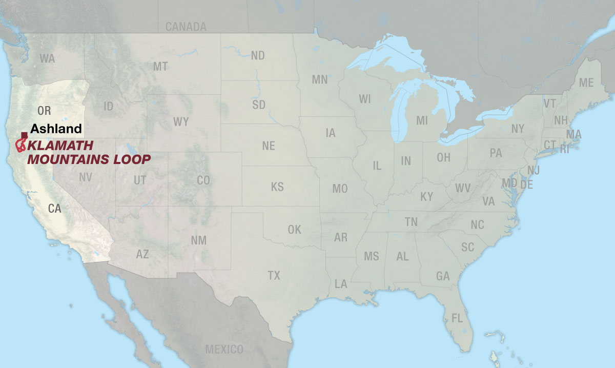
Klamath Mountains Loop
The Klamath Mountains Loop is DIGITAL-ONLY. No paper maps are produced for this route. This route is available digitally.
Mountains. Rivers. Solitude.
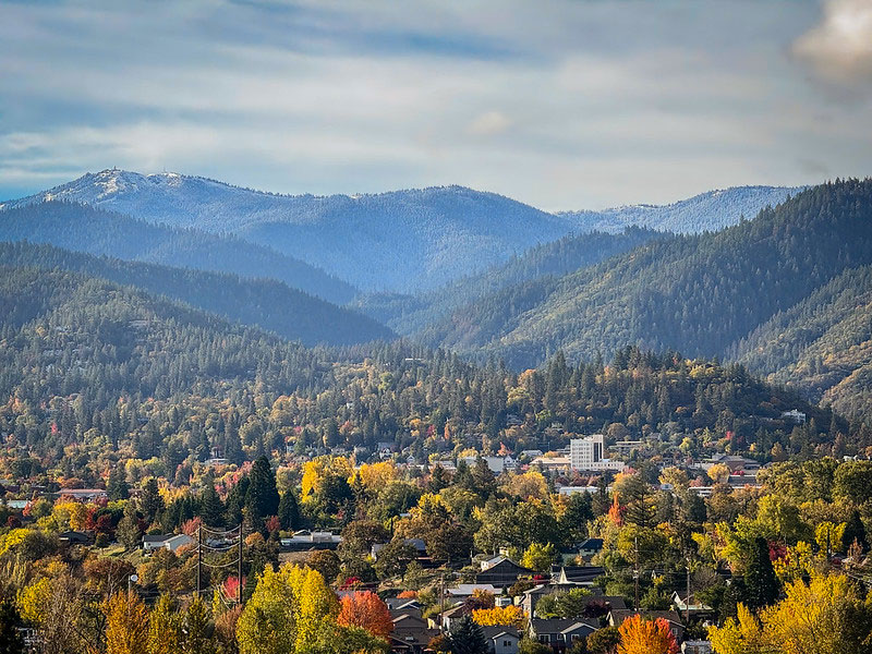
The Klamath Mountains Loop begins in Ashland, Oregon, a vibrant college town celebrated for its lively arts scene and the renowned Oregon Shakespeare Festival. Enjoy the comforts of civilization while you can; the route quickly leaves pavement and people behind as it climbs into the remote highlands of the Siskiyou Crest. At over 7,000 feet, the surrounding views are nothing short of incredible.
The descent from the Crest brings you to the mighty Klamath River, a crystal-clear Wild & Scenic waterway that drains a major portion of northern California and southern Oregon. Following the final demolition of four hydroelectric dams in October 2024, the Klamath returned to its natural free-flowing state for the first time in 106 years, restoring more than 420 miles of salmon habitat throughout the watershed. The route snakes alongside the river for 57 miles, offering countless opportunities to admire its beauty, or even slip in for a refreshing dip.
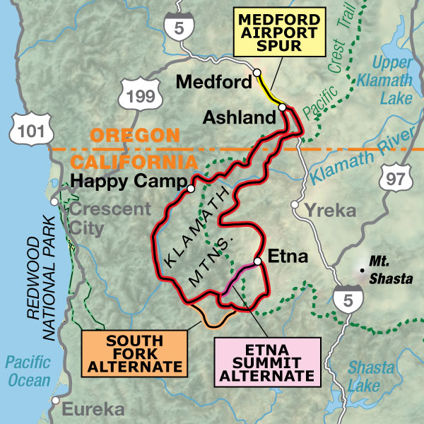
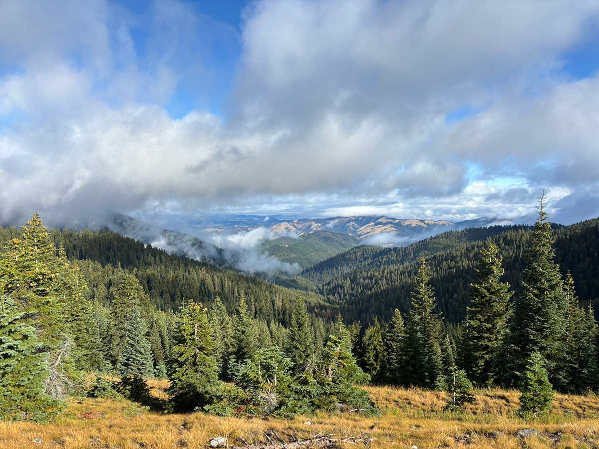
After many miles following the canyons carved by the Klamath and its tributary, the Salmon, the route returns to the rugged mountains with a steep, remote gravel ascent up Eddy Gulch to Blue Ridge. Traces of gold mining still scar the landscape, a reminder of a bygone era when the region buzzed with activity. Today, you’re unlikely to encounter another sole as you make your way toward Eddy Gulch Lookout, where breathtaking 360° views await. The South Fork and Etna Summit Alternates are included as paved options to avoid the challenging climb over Blue Ridge.
Another climb over Carter Meadows Summit leads to Callahan and the southern edge of the Scott Valley. Sheltered in the rain shadow of the western mountains, the valley unfolds into a broad expanse of farmland and historic ranches, a welcome change from the narrow, forested canyons earlier on the route. The small town of Etna, a popular resupply point for Pacific Crest Trail hikers, makes an ideal stop to stock up on groceries or spend the night.
The route follows the Scott River to its confluence with the Klamath, returning riders to the main river as they continue upstream alongside its waters for 17 miles. Vast wildfire scars dominate the surroundings, and the landscape feels noticeably drier and more expansive than the lower canyons of the Klamath River. One final climb to Toll Road Gap along the southern flank of the Siskiyou Crest returns the route to Oregon, completing the loop in Ashland.
Photo by Gernot Bartels
TERRAIN
The main route features three distinct mountainous sections: the Siskiyou Crest, Blue Ridge/Carter Meadows Summit, and again over the southern flank of the Siskiyou Crest. The climbs and descents are challenging, in both elevation gain/loss and steepness. The initial climb from downtown Ashland to Mount Ashland ascends nearly 4,700 feet over just 15.6 miles. The climb up Blue Ridge toward Eddy Gulch Lookout is especially steep, with maximum grades reaching 21%. While the summit rewards riders with incredible views, the South Fork or Etna Summit alternates provide options to bypass some of this extra climbing. Regardless of the chosen route, every option departing Forks of Salmon involves significant climbing to reach Etna. Although slightly higher in elevation, Carter Meadows Summit (elev. 6,207 ft.) offers a more gradual climb compared with Etna Summit (elev. 5,987 ft.)
Between these major climbs, the route is generally flat or gently graded as it follows the river canyons.
Overall, the main route is 64% paved and 36% unpaved. Both alternate routes and the spur into Medford are fully paved.
| Klamath Mountains Loop - Main Route | ||||
|---|---|---|---|---|
| Section | Distance | Elevation | Total Climb | Avg. Climb/mile |
| Total | 329.3 miles | Minimum: 548 ft.Maximum:7,069 ft. | 32,725 ft. counterclockwise33,618 ft. clockwise | 99 ft. per mi. counterclockwise102 ft. per mi. clockwise |
| Klamath Mountains Loop Alternates | ||||
|---|---|---|---|---|
| Name | Section | Distance | Total Climb | Avg. Climb/mile |
| Medford Airport Spur | 1 | 17.4 miles | 786 ft. south bound222 ft. north bound | 45 ft. per mi. south bound12 ft. per mi. north bound |
| South Fork Alternate | 1 | 28.0 miles | 3,659 ft. counterclockwise998 ft. clockwise | 130 ft. per mi. counterclockwise36 ft. per mi. clockwise |
| Etna Summit Alternate | 1 | 24.5 miles | 3,903 ft. counterclockwise3,161 ft. clockwise | 159 ft. per mi. counterclockwise129 ft. per mi. clockwise |
LOGISTICS
The route formally begins and ends in Ashland, Oregon, but you can start and finish anywhere on the loop that is most convenient to you. Ashland makes an excellent launching point thanks to its accessibility and wide range of accommodations and services. For those flying in, Rogue Valley International-Medford Airport is located 17.4 miles north of Ashland in Medford. The Medford Airport Spur follows the Bear Creek Greenway and offers an easy, pleasant connection to the loop’s starting point in Ashland.
The route was originally designed and researched counterclockwise but can be ridden in either direction. There are no significant advantages or drawbacks to choosing one direction over the other.
This route can be ridden anytime between early summer and fall (typically mid-June through October). Depending on the severity of the previous winter, snowfields and drifts can linger on the high-elevation ridges of the Siskiyou Crest well into June. The highest point on the route is near Observation Peak on the Siskiyou Crest at 7,061 feet, just north of the Oregon-California border.
Conversely, the lower canyons of the Klamath River can be swelteringly hot during the summer months. July and August are the hottest periods, with average highs in the mid-90s and record temperatures reaching up to 115°F in Happy Camp. The lowest elevation on the route is near Somes Bar, only 542 feet above sea level. To avoid both the intense heat of the lower canyons and lingering high-elevation snow, the best time to ride is often September and October, with a possible narrow window in late-June.
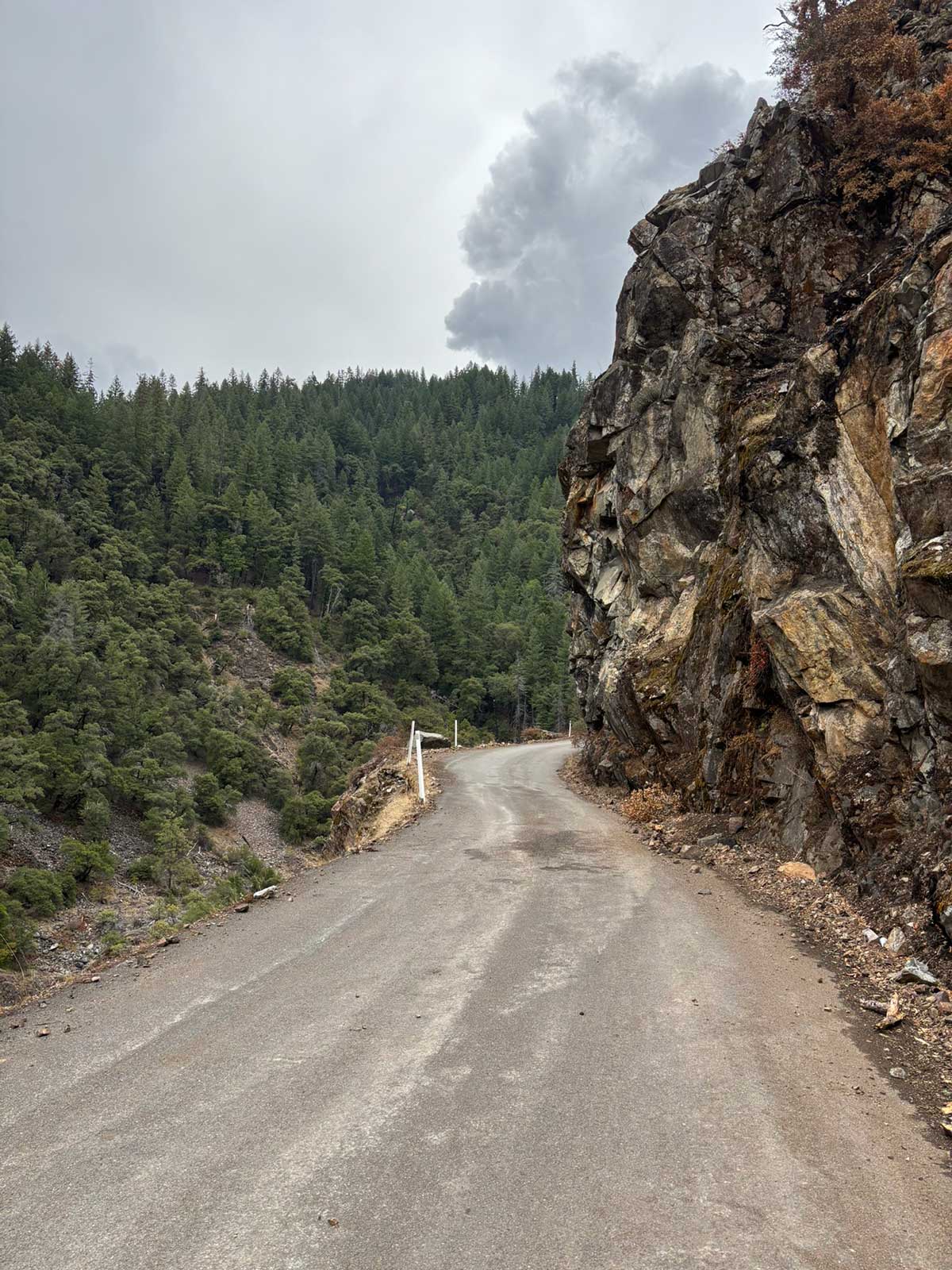
Wildfire is a very real concern along the entirety of this route, as evidenced by several large burn scars visible along the way. Fire season typically peaks from July through October, which unfortunately overlaps with the ideal riding season. Because conditions vary from year to year, riders should regularly check current wildfire status through the National Interagency Fire Center at advcy.link/fireinfo. Ranger stations in Happy Camp and Fort Jones can also provide up-to-date information on active fires and local fire danger.
Careful resupply planning is essential on this route due to its remoteness. While camping opportunities are plentiful, most services are concentrated in just four towns: Ashland, Happy Camp, Etna, and Fort Jones. It is 128 miles between Happy Camp and Etna, with only limited convenience stores available in Somes Bar and Callahan along the way.
Surface water is plentiful along most of the route, but should always be treated or filtered before drinking.
The ideal bike for this route is a bike that’s comfortable on gravel but still efficient on pavement. A gravel bike designed for long-distance with the largest tires you can fit, at least 45mm, is a solid choice to keep the ride smooth and enjoyable.
Route Highlights
Klamath Mountains Loop Highlights
- Ashland, Oregon
- Mount Ashland
- Siskiyou Crest
- Klamath River
- Salmon River
- Eddy Gulch/Blue Ridge
- Carter Meadows Summit
- Scott Valley
- Etna
- Scott River
More Route Resources
RIDING CONDITIONS
The Klamath Mountains Loop begins and ends at the Ashland Plaza in downtown Ashland, Oregon. Home to Southern Oregon University and the renowned Oregon Shakespeare Festival, Ashland is a vibrant small town with plentiful services and accommodations, making it an ideal starting point. Cyclists flying into nearby Medford can access the route via the Medford Airport Spur, which links the airport terminal to Ashland along the Bear Creek Greenway.
Ashland, Oregon. Photo by David Wood under the Creative Commons BY 2.0 license.
The route begins with a bang as it climbs south on gravel roads toward Mount Ashland through the scenic Ashland Watershed. Home to more than 53 miles of multi-use trails for hikers, mountain bikers, and equestrians, the area is internationally recognized for its natural beauty and remarkable biodiversity. For 6.6 miles between the White Rabbit Trailhead and the Bull Gap Trailhead, the route is gated and closed to vehicles, offering a peaceful, car-free ascent through the forest. Riders interested in exploring the many local singletrack trails can download the free Ashland Municipal Watershed Trails digital map on Avenza: advcy.link/ashlandwatershed. Please note that cycling on any part of the Pacific Crest Trail (PCT) is strictly prohibited.
A brief return to pavement brings you to Mount Ashland and its namesake ski area. If the weather is clear, look to the southeast for your first glimpse of Mount Shasta, rising to 14,179 feet in the distance. This dormant volcano is the second-highest peak in the Cascade Range and a defining landmark across the region.
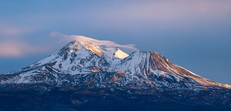
Mount Shasta. Photo by Frank Schulenburg under the Creative Commons BY 2.0 license.
For the next 38 miles, the route traverses the Siskiyou Crest, a major east-west chain of peaks dividing the Rogue River drainage to the north from the Klamath River drainage to the south. This extraordinary landscape sits at the intersection of the Cascades and Klamath Ranges with influences from both coastal Oregon and the more arid interior, resulting in remarkable botanical diversity with many rare and endemic plant species. Open glades, wet and dry meadows, rocky montane chaparral, fields of wildflowers, and stands of stunted conifers provide incredible scenery along the way.
Atop these high-elevation ridges, snowfields can linger well into June, making the route impassable earlier in the year. Several springs and small streams can be found along this stretch and are marked on the map, but it’s recommended that you filter all water due to cattle grazing in the area. The three-mile climb between Siskiyou Gap and Wrangle Gap is noticeably steeper and rougher than the surrounding terrain. Strong riders may be able to pedal it continuously, but many will likely dismount and walk short sections.
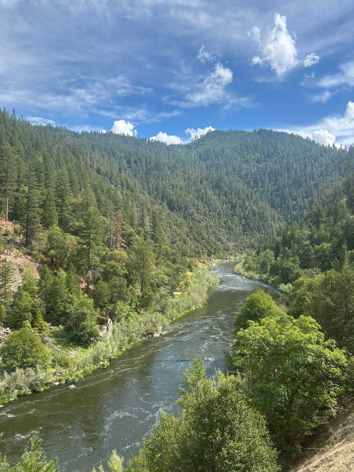
Seiad Valley is a small resupply town shared with hikers on the Pacific Crest Trail. This is also where riders first meet the mighty Klamath River, recently recognized as California’s longest undammed river following the completion of one of the world’s largest dam-removal projects in 2024. For the next 57 miles, the route follows CA Highway 96 as it winds through the canyon carved by this powerful river. The Klamath and several of its tributaries were designated within the National Wild & Scenic Rivers System in 1981 and are popular for paddling and fishing. There are several river access points along the route for wading and swimming, but caution is advised. The Klamath River is known to have dangerous undercurrents, even where the surface appears calm. Shoulders are narrow along much of this stretch, but the lanes are wide and traffic is typically light.
The mighty Klamath River. Photo by Gernot Bartels.
Happy Camp is the main resupply town in the area and the headquarters of the Karuk Tribe. This small community (pop. 905) has all the basic services and is the last true town on the route until Etna, 128 miles away. It is recommended to lock your bike when leaving it unattended.
At Somes Bar, the route departs CA Highway 96 and the Klamath River to begin its journey upstream along the Salmon River, a major tributary of the Klamath. Salmon River Road continues as a two-lane road for 7.5 miles before narrowing to a single-lane paved road that clings to the canyon walls. Traffic is very light, but there is significant exposure, sharp blind turns, and occasional vehicles, so it is imperative to stay alert.
Salmon River Road clings to the canyon walls above the river. Photo by Gernot Bartels.
At Forks of Salmon, the route splits to follow both the North and South Forks of the Salmon River. The main route ascends the North Fork to Sawyers Bar, then turns south for an incredible gravel climb and descent over Blue Ridge. From Sawyers Bar, riders may also choose to take the Etna Summit Alternate, a fully paved but very steep shortcut to Etna. The South Fork Alternate offers the path of least resistance to Etna, though it is longer overall and still includes a significant climb over Carter Meadows Summit after rejoining the main route at Sixmile Creek. This alternate is also fully paved.
Continuing along the main route, Sawyers Bar Road between Forks of Salmon and Sawyers Bar remains a narrow, one-lane shelf road carved into the canyon wall above the river. The tiny former gold-mining community of Sawyers Bar offers no services. From here, the route turns south and climbs steeply up Eddy Gulch to Blue Ridge, where placer mines in the mid-1800s produced more than 150,000 ounces of gold. Blue Ridge awards the effort with sweeping scenery and 360° views of the Salmon Mountains, Marble Mountains, and Trinity Alps. For an even more impressive vantage point, climb an additional mile to Eddy Gulch Lookout, a lonely fire tower perched atop a lofty 6,483-foot summit. The route traverses the ridge for a few miles before switchbacking down to meet the South Fork of the Salmon River at Sixmile Creek.
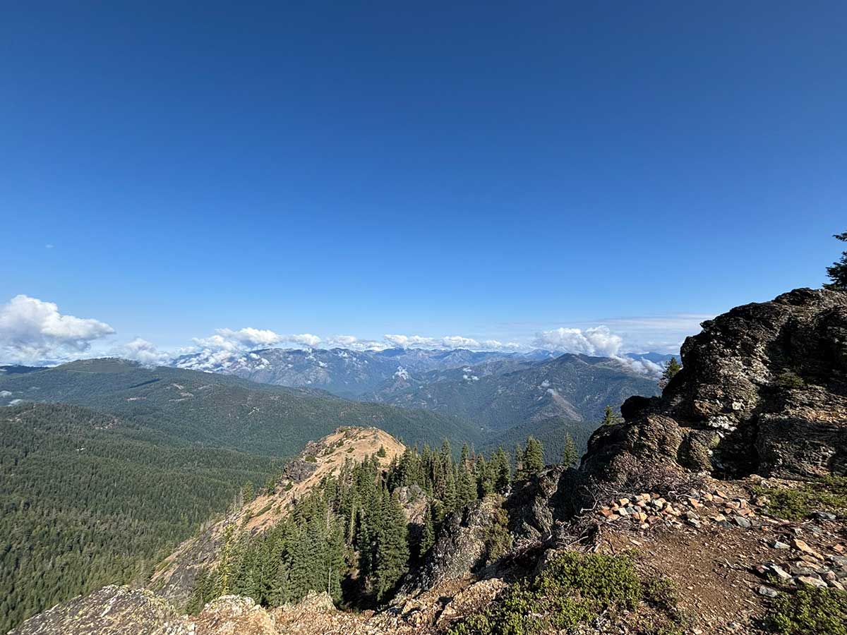
Incredible views atop Blue Ridge. Photo by Gernot Bartels.
The route returns to pavement for three miles before detouring onto Carter Meadows Road, a scenic yet bumpy dirt road with opportunities for both dispersed and designated Forest Service camping. For a smoother ride, riders can opt to stay on paved Cecilville Road, though there will be some light traffic. The climb peaks at Carter Meadows Summit, where the PCT intersects the route once again. From the summit, all that hard work is rewarded with a fast, 3,000-foot descent into the town of Callahan.

Carter Meadows Road. Photo by Gernot Bartels.
Somewhat of a ghost town today, Callahan was once a significant stop along the California-Oregon Stage Road. The Callahan Ranch Hotel, built in 1854, stands as a testament to that era and is currently a private residence. Across the street, the Callahan Emporium, originally a hotel, now operates as a convenience store and bar with food and live music. Adjacent to the Emporium is an old Wells Fargo building built from stone, its windows still covered by iron shutters.
Beginning in Callahan, riders will become acquainted with a new river, the Scott. The first five miles of the Scott River are scarred by extensive dredge tailings from Callahan’s gold mining era between 1900 and 1930. Beyond this stretch, the landscape becomes more pastoral as the route passes several historic ranches. Enjoy the flat, smooth, low-traffic ride while gazing west at the rugged mountains recently crossed. The vibrant town of Etna, another PCT resupply town, offers a welcome stop with a full range of services.
Leaving Etna, the route continues north through Scott Valley, passing farmland and picturesque ranch homes. The small town of Fort Jones provides basic services and is home to the main ranger station for the Scott/Salmon Ranger District of the Klamath National Forest.
The first several miles of Scott River Road pass through more farmland until the valley narrows into a timbered canyon slicing between the Marble Mountains and Scott Bar Mountains. The road also narrows to a single lane, so stay alert for oncoming traffic.
Near the tiny community of Hamburg, the Scott River reaches its end and riders return once again to the Klamath, this time riding upstream alongside the river. CA Highway 96 has no shoulders but carries low traffic, and Walker Road provides a respite from the highway for seven miles. Five miles after the Walker Road turnoff, McKinney Creek crosses Walker Road. During times of high water the road can become flooded and impassable. Do not attempt to cross if water is flowing across the road. Back on CA Highway 96, Quigley’s Station is the last resupply before climbing back across the Siskiyou Crest and returning to Ashland.
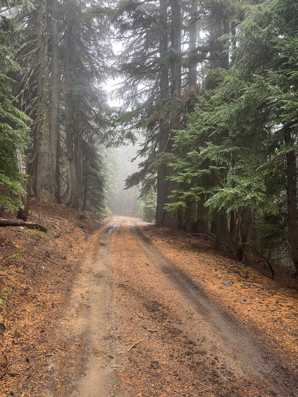
A misty ride through the trees. Photo by Gernot Bartels.
Leaving the Klamath River and the highway behind, the route makes its final major climb toward Toll Road Gap on Beaver Creek Road. The surface starts as pavement and fades to gravel as it climbs and then skirts the southern face of the Siskiyou Crest. From Toll Road Gap back to Ashland, the route is paved and almost entirely downhill. OR Highway 273, also known as Old Highway 99, was once the primary route through this corridor until it was replaced by Interstate 5 in 1957. This historic road provides a delightful, winding descent through the forest, even looping back under itself in an uncommon traffic pattern. Upon reaching OR Highway 66, the terrain levels and the surrounding hills transition into open slopes dotted with oaks trees. Traffic increases as the route travels past Emigrant Lake and into the outskirts of Ashland.
To bypass this final stretch of pavement, riders can climb back up to the Crest on either gravel Forest Road 40S11 or paved Mount Ashland Road to backtrack through the Ashland Watershed into town.
CLIMATE
Summer mornings in Ashland are typically cool and dry, quickly warming into clear, hot afternoons characteristic of the Rogue Valley’s Mediterranean climate. As the climb begins up the Siskiyou Crest toward Mount Ashland, temperatures drop noticeably with elevation. Even in midsummer, riders will encounter crisp mountain air and the possibility of a passing afternoon thunderstorm. Early-season travelers may find lingering snowfields along the crest.
Descending off the high country into Seiad Valley and Happy Camp, the climate shifts dramatically. These deep canyons along the lower Klamath River are some of the hottest locations in northern California, characterized by intense summer heat, dry air, and exposed stretches that radiate warmth well into the evening.
Turning upstream at Somes Bar, the temperatures remain high but cool slightly as the route gradually climbs. The narrower tributary canyons of the Salmon River are still hot in summer, but offer more shade, cooler creek valleys, and a higher likelihood of afternoon cloud build-up.
The climb over Blue Ridge and Carter Meadows Summit returns riders to higher-elevation conditions. The air becomes thinner, cooler, and temperatures swing more dramatically between midday highs and evening lows. Weather can shift quickly here, with late-afternoon thunderstorms occurring more frequently.
Dropping into the Scott Valley toward Etna, the route settles into the warm, dry, agricultural valley lying in the rain shadow of the mountains to the west. Summers are typically hot but less extreme than in the lower Klamath canyons, with reliably clear skies and occasional breezy afternoons as air drifts down from the surrounding peaks.
The final climb toward Toll Road Gap brings riders back into a mountain environment where temperatures cool and forests deepen. Weather can be unpredictable at the pass, especially early or late in the season, with fog, wind, or brief showers possible even during otherwise stable conditions. From the crest, the descent back toward Ashland returns riders to the Rogue Valley’s dry, warm, basin.
PUBLIC LANDS & CAMPING
This route travels extensively on public land within the Rogue River-Siskiyou and Klamath National Forests administered by the US Forest Service (USFS). There is an abundance of established campgrounds along the route, ranging from reservable sites with RV hookups and showers, to first-come-first-serve sites with fire rings and pit toilets. Campgrounds are open seasonally and open/close dates will vary. Contact Ranger Districts to confirm status, especially in the shoulder season. To make reservations or get more information on individual US Federal campgrounds, call 877-444-6777 or visit www.recreation.gov.
In addition to established campgrounds, it is legal to camp on USFS land for free following the guidelines found here: advcy.link/dispersecamp.
REMOTE RIDING CONDITIONS
Many wild, remote stretches exist along this route. High temperatures, lofty elevations, wild animals, inclement weather (including lightning storms, snowstorms, and extremely strong winds), wildfires, and other potential hazards are plentiful. Understand in advance how to prepare for and cope with them.
Piped water sources tend to be limited, so replenish your supplies whenever the opportunity presents itself. A high-quality water treatment setup should be on your equipment list. Plenty of surface water can be found along the route, but it should be ingested only after running it through a good water filter or using a chemical treatment.
Pack along bug repellent, sunscreen, and a first-aid kit. Carry bicycle tools, a tire pump, and spare tubes. Be prepared for any possibility.
Most of this route is in black bear country. Always be bear-aware, and follow these rules when camping (these will help ward off other unwanted visitors too, such as raccoons and mice):
- Store all food, garbage, and other attractants in a bear-resistant manner, well away from your tent. This can include hanging them in a stuff sack from rope slung over a high, isolated tree branch, or storing them in a bear-proof container provided at campgrounds.
- Attractants such as food leftovers, fish entrails, and bacon grease should not be buried or burned in campfires. Leftover food and waste should be placed in a sealed bag or container and packed out with garbage. If leftover food or other attractants must be burned, do so in a contained cookstove or in an appropriate container over a campfire, then pack out the ash.
We discourage you from attempting to ride this route solo; in fact, a minimum group size of three is strongly recommended. If a rider is debilitated in the backcountry, you will want to have at least one person to stay with the injured/sick rider, and another to go for help. Be aware that cell phone reception is very spotty along much of the route, and it is recommended to carry a satellite phone in case of emergency.
LAND ACKNOWLEDGEMENT
As we travel by bicycle through these lands, we pause to reflect on our relationship with this place. We ride with respect and honor for the Indigenous peoples who have stewarded these mountains, forests, and waters since time immemorial. We commit to caring for this land by staying on paths, leaving no trace, and listening to the wisdom of the Indigenous peoples, including the Shasta, Karuk, Modoc, Takelma, Confederated Tribes of Siletz Indians and Grand Ronde, and others who call these territories home. May your journey be guided by respect, gratitude, and responsibility.
ACKNOWLEDGMENTS
Updates to Recently Released Maps
If you are planning a bike tour, be sure to get the most recent map updates and corrections for your route by selecting the route, and the appropriate section(s), from the drop-down menu below.
Over time maps become less useful because things change. Every year Adventure Cycling’s Routes and Mapping Department create map updates and corrections for every map in the Adventure Cycling Route Network, which now totals 52,047 miles. With the help of touring cyclists like you, we receive updates on routing, services, camping, and contact information. Until we can reprint the map with the new information, we verify the suggested changes and publish corrections and updates here on our website.
PLEASE NOTE: Covid has been particularly hard on the small businesses along our routes. While we do our best to keep the maps and these online updates current, you may encounter more closed businesses and longer stretches with limited or no services.
Refer to these updates for the most current information we have and submit reports of changes to the Route Feedback Form for the cyclists coming after you.
NOTE: Map updates and corrections only pertain to long term changes and updates. For short term road closures, please see the Adventure Cycling’s Routes Temporary Road Closures discussion in our Forums.
No route data found