Eastern Canada Route
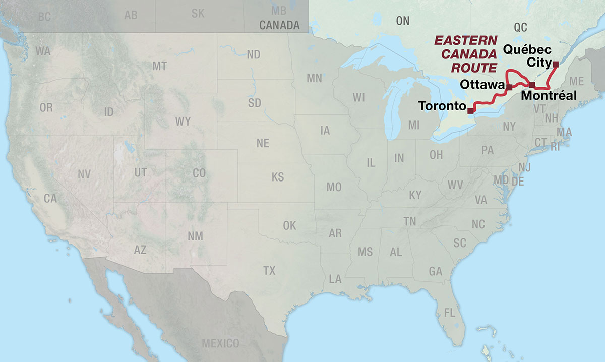
The Eastern Canada Route is DIGITAL-ONLY. No paper maps are produced for this route. This route is available digitally.
O Canada!
The Eastern Canada Route travels through southern Ontario and Québec, connecting the major cities of Toronto, Ottawa, Montréal, and Québec City while passing through a landscape of farmland, wetlands, forests, lakes, rivers, and rolling hills. Along the way, the route visits a diverse collection of small towns, historic communities, provincial and national parks, and extensive networks of paved and unpaved trails.
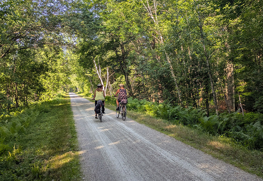
The Eastern Canada Route was largely inspired by the Trans Canada Trail (TCT, also known as Sentier Transcanadien), an extensive trail system that spans the country and holds the distinction of being the world’s longest multi-use trail system. Our route highlights one of the most complete portions of the TCT, showcasing the region’s exceptional cycling infrastructure and building on the excellent work already completed. Along the way, we’ve added our own touch through carefully selected routing, detailed navigation, and route resources that make exploring the region by bike even easier. Learn more about the TCT and find ways to support this incredible organization at tctrail.ca.
The route begins in Toronto, where riders quickly transition from Canada’s largest city into a mixture of suburban communities, farmland, wetlands, and quiet rural roads. The route passes through Uxbridge, Lindsay, Peterborough, Campbellford, Stirling, Tweed, and other small communities before entering the Canadian Shield, a vast geologic region dominated by lakes, wetlands, and endless forests. Highlights include the Doube’s Trestle Bridge, Ranney Gorge Suspension Bridge, and the K&P Trail.
From the Canadian Shield, the route continues east toward Ottawa through Perth, Smiths Falls, Carleton Place, and surrounding communities before reaching Canada’s national capital. Ottawa provides an excellent opportunity to take a rest day, with numerous museums, historic sites, restaurants, and accommodations.
Section 2 offers two distinct ways to travel between Ottawa and Montréal. The Main Route heads north through the Laurentians, following a scenic corridor of rivers, lakes, forests, and small communities. From Ottawa, it passes through Wakefield, Gracefield, and Maniwaki before reaching Mont-Laurier, where the route turns south onto Le P’tit Train du Nord, a former railway corridor that stretches 145 miles (234 kilometers) toward Montréal.
The River Alternate on Section 2 provides a more direct route between Ottawa and Montréal and follows the Ottawa River corridor through a predominantly agricultural landscape. Leaving Ottawa, the route uses the Ottawa River Pathway and Prescott-Russell Trail before using the Long-Sault Bridge at Hawkesbury to enter Québec. The route continues along Route Verte 1 past Oka National Park before rejoining the Main Route in Laval, just northwest of Montréal.
Montréal’s extensive cycling infrastructure makes it relatively easy to navigate the city, while attractions such as the Notre-Dame Basilica, Mount Royal Park, and Marché Jean-Talon provide plenty of opportunities for exploration. Beyond the city, the route follows the Chambly Canal and other sections of the Route Verte, passing through Saint-Jean-sur-Richelieu, Granby, Magog, and Sherbrooke.
Beyond Sherbrooke, the route leaves the hillier terrain and crosses Québec’s agricultural heartland. Quiet roads and paved and unpaved bike paths connect the communities of Richmond, Warwick, and Victoriaville, offering a quieter side of Québec that is less frequently visited by tourists. The journey concludes with a ferry ride across the St. Lawrence River into Québec City, where cobblestone streets, Old World architecture, fortified walls, and French culture create a distinctly European feel.
Photo by Jen Rose Smith
TERRAIN
The Eastern Canada Route travels through southern Ontario and Québec, passing through a landscape of agriculture, wetlands, forests, hills, lakes, rivers, and charming small towns between the major metropolitan areas of Toronto, Ottawa, Montréal, and Québec City. The route is relatively low-elevation, with a high-point of just 428 meters (1,405 feet) near Mont-Blanc on Section 2. Several portions of the route are hilly, particularly through the Canadian Shield and Laurentians, but grades are often moderated by trails built on former railway corridors. There are no major climbs over mountain passes. Section 3 is the flattest overall, while Section 2 (Main Route) requires the most climbing per mile.
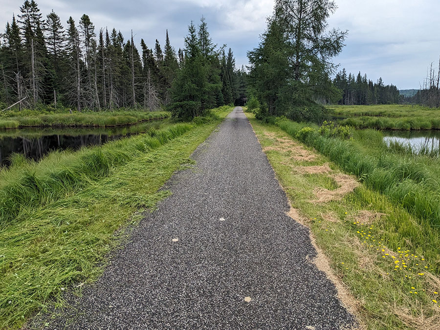
Much of the route, particularly in Sections 1 and 2, is dominated by wetlands and vast forests. Photo by Dave Bone.
The Main Route of the Eastern Canada Route is approximately 65% completely car-free, using either fully separated bike paths or protected bike lanes. Most of the remaining 35% follows low-traffic residential, rural, and urban streets, often with wide shoulders or designated bike lanes (unprotected). Section 3 has the highest percentage of bike paths on route at 85%, followed by Section 2 at 70% and Section 1 at 45%. The River Alternate on Section 2 is approximately 40% on bike paths.
Keep in mind that you may need to travel slightly off route to reach accommodations and services, which can affect these percentages.
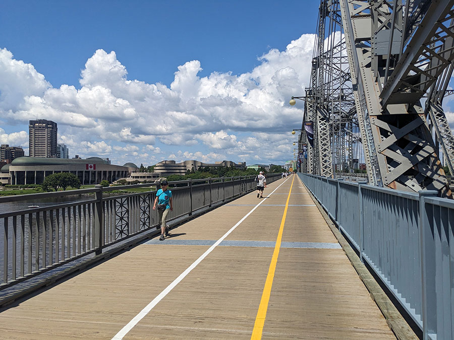
Ontario and Québec both have outstanding cycling infrastructure, as can be seen here on the Alexandra Bridge in Ottawa. Photo by Dave Bone.
Approximately 60% of the overall Main Route is paved, including both roads and bike paths. The remaining 40% follows unpaved roads and trails that have good, smooth surfaces, although conditions can be affected by weather, seasonal changes, and maintenance. Sections 1 and 3 are each about 50% paved and 50% unpaved, while Section 2 is approximately 80% paved. The River Alternate on Section 2 is 70% paved.
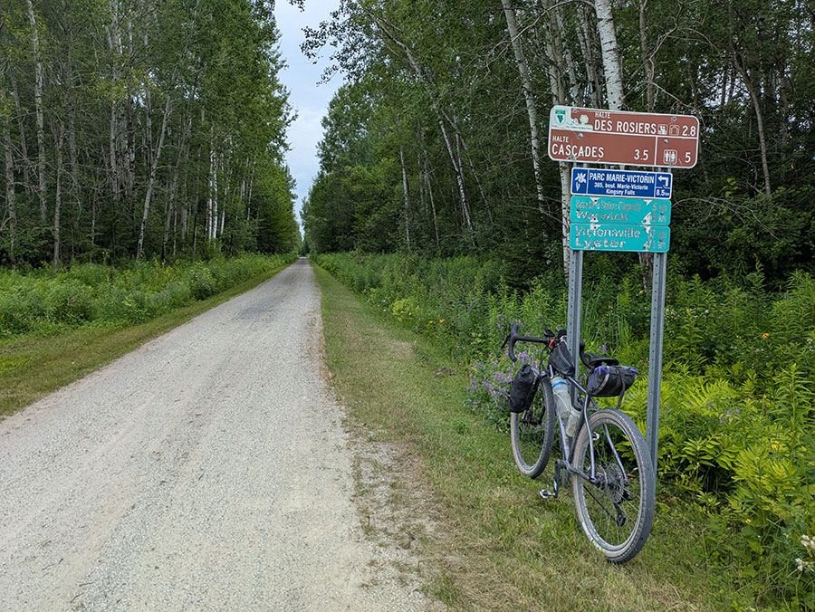
Smooth gravel bike path near Victoriaville. Photo by Jen Rose Smith.
| Eastern Canada Route - Main Route | ||||
|---|---|---|---|---|
| Section | Distance | Elevation | Total Climb | Avg. Climb/mile |
| Total | 926.6 miles | Minimum: 0 ft.Maximum:1,405 ft. | 29,000 ft. east bound28,259 ft. west bound | 31 ft. per mi. east bound31 ft. per mi. west bound |
| 1 | 364 miles | Minimum: 151 ft.Maximum:1,289 ft. | 10,994 ft. east bound9,975 ft. west bound | 30 ft. per mi. east bound27 ft. per mi. west bound |
| 2 | 289.8 miles | Minimum: 39 ft.Maximum:1,405 ft. | 11,475 ft. east bound11,736 ft. west bound | 40 ft. per mi. east bound40 ft. per mi. west bound |
| 3 | 272.8 miles | Minimum: 0 ft.Maximum:1,399 ft. | 6,531 ft. east bound6,548 ft. west bound | 24 ft. per mi. east bound24 ft. per mi. west bound |
| Eastern Canada Route Alternates | ||||
|---|---|---|---|---|
| Name | Section | Distance | Total Climb | Avg. Climb/mile |
| River Alternate | 2 | 136 miles | 2,842 ft. east bound3,040 ft. west bound | 21 ft. per mi. east bound22 ft. per mi. west bound |
LOGISTICS
The Eastern Canada Route is conveniently divided into three sections, separated by four of eastern Canada’s largest cities: Toronto, Ottawa, Montréal, and Québec City. All four cities have international airports, making travel to and from the route relatively straightforward. The cities are also connected by the VIA Rail train network, though bicycle accommodations vary by segment. Bikes are currently permitted on VIA Rail trains between Ottawa, Montréal, and Québec City, but are not permitted between Toronto and Ottawa. This may change in the future, so check current VIA Rail policies when planning your trip.
The route can generally be ridden from late spring through fall, with summer and early fall offering the most favorable conditions for a bike tour. In Québec, some unpaved sections of the Route Verte close between mid-October and mid-May to protect trail surfaces from damage caused by wet conditions. Many campgrounds are also seasonal, with most open from May through October. October can be an especially beautiful time to ride, when the forests put on a spectacular display of color.
Biting insects can be particularly bothersome in the more remote portions of the route that pass through areas dominated by wetlands and lakes, especially from late spring through midsummer. Black flies are often worst in May and June, while mosquitoes can persist throughout the summer. Deer and horse flies become more prevalent later in the summer, particularly in July and August. Ticks are less of a constant nuisance but are worth checking for, as some can transmit disease. Carry plenty of insect repellent and consider a head net or bug jacket if traveling during peak insect season.
English is the official language of Ontario, while French is the official language of Québec. In urban areas, most residents are bilingual and will happily accommodate English speakers, especially if initially greeted in French. In more remote villages, however, riders may need to communicate in French. Smartphone translation apps such as Google Translate can be helpful, as they offer voice translation and can scan menus and signs using the phone’s camera. Downloading French translation files ahead of time is useful for areas with poor cell service, which are also where riders are more likely to have non-English interactions. Taking a few French lessons before the trip is recommended to learn some basic vocabulary, phrases, and grammar.
Opportunities for dispersed (wild) camping are limited along the route, which largely passes through urban areas, towns, parks, and private and agricultural land. Commercial campgrounds are available along every section outside of the major urban areas, although distances between campgrounds can sometimes be significant. Careful planning may be necessary to ensure a suitable place to camp each night, and in some areas, riders may need to choose indoor accommodations instead.
In Québec, the cycling advocacy organization Vélo Québec operates a certification program (Bienvenue Cyclistes) for bike-friendly campgrounds, hotels, restaurants, and other businesses. A certified hotel or inn must provide secure overnight bike storage or allow bicycles in guest rooms and must waive minimum-stays requirements for cyclists. Certified campgrounds also must waive minimum-stay requirements and guarantee a campsite to arriving cyclists, even without a prior reservation. These policies are sometimes inconsistently applied, so it is always a good idea to call ahead when possible.
The most remote and logistically challenging portion of the route is likely between Tweed and Perth (165 km/103 mi) on Section 1. Several campgrounds are located near the route, but traditional indoor accommodations, such as hotels and inns, are sparse, with the exception of Northbrook and Sharbot Lake. Private cottages and cabins are popular in the area and are often available through vacation rental services, but they are not marked on the map. An internet search may reveal additional options for indoor accommodations.
Much of the route passes through bear country, particularly in the more remote portions of the Canadian Shield, Laurentians, and Eastern Townships around Mont-Orford. Use caution, keep your distance, and take appropriate precautions to secure food, garbage, and other scented items when camping.
Québec is famed across Canada for its thermal spas, generally indoor-outdoor facilities in the Nordic tradition where visitors alternate between hot and cold pools. Several notable spas are located very close to the route, including Nordik Spa-Nature in Chelsea, Bota Bota in Montréal, Spa Eastman in Eastman, Le Spa Manoir Hovey in North Hatley, and Strom Spa Nordique Vieux-Québec in Québec City. Some spas have onsite accommodations.
The route features a mixture of unpaved and paved roads and bike paths. For the best overall riding experience, we recommend a gravel or touring bike equipped with tires 35mm or wider.
Route Highlights
Eastern Canada Route Highlights:
- Toronto, Section 1
- Doube’s Trestle Bridge, Section 1
- Lang Pioneer Village Museum, Section 1
- Ranney Gorge Suspension Bridge, Section 1
- K&P Trail, Section 1
- Stewart Park in Perth, Section 1
- Railway Museum of Eastern Ontario in Smiths Falls, Section 1
- Ottawa, Sections 1 & 2
- Historic Wakefield Covered Bridge, Section 2
- Paugan Dam, Section 2
- Véloroute des Draveurs, Section 2
- Le P’tit Train du Nord, Section 2
- Montréal, Sections 2 & 3
- Ottawa River Pathway, Section 2 River Alternate
- Prescott-Russell Trail, Section 2 River Alternate
- Ancienne Prison de L’Orignal Old Jail, Section 2 River Alternate
- Oka National Park, Section 2 River Alternate
- Fort Chambly National Historic Site, Section 3
- Chambly Canal, Section 3
- Mont-Orford National Park, Section 3
- Québec City, Section 3
More Route Resources:
- Trans Canada Trail
- VIA Rail
- Toronto Cycling Map
- Don River Trail
- The Meadoway
- Great Lakes Waterfront Trail
- Lang Hastings Trail
- Ottawa Valley Recreational Trai
- Capital Pathway
- Ottawa Cycling Map
- Voie Verte Chelsea
- Véloroute des Draveurs
- Vélo Québec
- La Route Verte
- P’tit Train du Nord
- P’tit Train du Nord shuttle
- Exo transit (greater Montréal)
- Montréal Cycling Map
- Prescott Russell Recreational Trail
- Oka National Park
- Chambly Canal Path
- La Montérégiade Bike Path
- L’Estriade Bike Path
- Véloroute Gourmande
- Mont-Orford National Park
- La Montagnarde Bike Path
- Parc linéaire des Bois-Francs
- Québec-Lévis ferry
- Québec City Cycling Map
Riding Conditions
Section 1 of the Eastern Canada Route begins in Toronto, Ontario at Biidaasige Park (pronounced “bee-daw-si-geh”), meaning “sunlight shining towards us” in Anishinaabemowin. The 40-hectare (99-acre) park opened in 2025 with a goal of celebrating waterway restoration and reconciliation. Today, the park features public art and stunning views of the Toronto skyline, set against the backdrop of Canada’s largest city and the fourth largest in North America.

The iconic Toronto skyline. CC image courtesy of Timothy Neesam on Flickr.
Leaving Toronto, the route follows some of the city’s best and longest stretches of urban cycling infrastructure. It begins along a collection of trails following the Don River, including an impressive, multi-level pedestrian bridge over the railroad affectionately nicknamed the “Thunderdome”. A short on-road connection then leads to the Meadoway, a hydro-corridor transformed into a greenspace and meadow habitat that provides a vital bikeway through the suburban neighborhoods of Toronto and Scarborough.
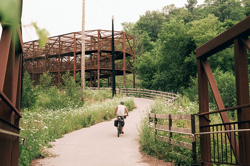
The “Thunderdome”. Photo by Chad Mohr.
The route turns back toward the waterfront on the Highland Creek Trail, a wonderfully wooded path that follows the creek to Lake Ontario. The Waterfront Trail provides spectacular views of the lake for a short distance before the route is forced inland for a not-so-fun detour around Rouge Beach due to construction improvements in the area. The trail is expected to reopen in 2027, so keep an eye out for the newly improved waterfront connection.
Back at the lake, the Waterfront Trail continues to provide incredible lake views as it winds through parklands and crosses a wooden-planked bridge over Petticoat Creek. The trail loops around Frenchman’s Bay, where small twin lighthouses stand guard at the entrance. Pickering’s Nautical Village, a picturesque neighbourhood lined with quaint shops and cozy cafés, is the perfect place to stop for lunch or an ice cream treat before continuing on. A brief ride through an industrial area brings the route to the Duffins Trail, a creekside path that carries the route away from the lake for the final time.
Along the route, cyclists will see signs for the Trans Canada Trail (TCT), an extensive trail system that spans the country and holds the distinction of being the world’s longest multi-use trail system. Much of the Eastern Canada Route utilizes the TCT, building on the excellent work already completed while adding our own personal touch and ensuring the route is suitable for touring cyclists. Learn more about the TCT and find ways to support this incredible organization at tctrail.ca.
Heading north on a combination of paved and gravel rural roads, the route begins the most significant climb of Section 1 over the Oak Ridges Moraine, a prominent glacial landform that stretches across southern Ontario. From there, it’s all downhill to the town of Uxbridge, where the route returns to bike trails that form part of the Trans Canada Trail. The rail trails between Uxbridge and Peterborough are well maintained and predominantly surfaced with crushed limestone. The terrain is mostly flat, and the trails are reasonably well protected by trees and vegetation, providing welcome shade. The surrounding landscape is a mix of farms and wetlands.
A notable highlight is the Beaver River Wetlands Conservation Area, where you may spot great blue herons, red-winged blackbirds, muskrats, and beavers. There are also numerous scenic bridge crossings along this section, including Doube’s Trestle Bridge, a 450-meter (1,500-foot) repurposed rail bridge just east of Omemee. Periodically, you’ll find pleasant amenities for cyclists, including benches, small pavilions, and a few repair stations.
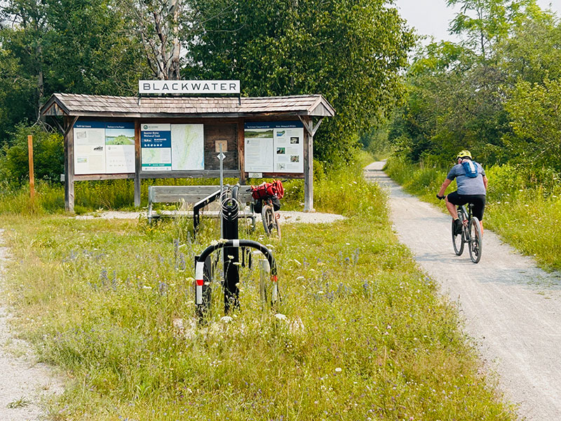
Blackwater rest stop near Beaver River Wetlands Conservation Area. Photo by Chad Mohr.
The cities of Uxbridge, Lindsay, and Peterborough are well spaced along the route, and each has most of what a traveling cyclist might need. Keep in mind, however, that there is very little between them, so stock up on snacks and water before heading out. Peterborough is the largest of the three, with a population of about 83,000, and sits along the banks of the Otonabee River. While there, visit the Canadian Canoe Museum, home to the world’s largest collection of canoes, kayaks, and other paddled watercraft. In Lindsay, don’t miss Kawartha Dairy, a beloved local ice cream shop that has been operated by the same family since it was founded in 1937.
East of Peterborough, the towns become smaller, and the route gradually begins to feel more remote. The Lang-Hastings Trail leads to the small village of Hastings on the Trent River, a popular destination for tourists, boaters, and fisherman. The river is known for its abundant fishing, with muskie, pickerel, pike, walleye, large and smallmouth bass, catfish, perch, crappie, and bluegill all found in the area.
Beyond Hastings, the route leaves the Trans Canada Trail in favor of paved and gravel farm roads. Be prepared for some short but steep rolling hills, as the route terrain is no longer flattened by former railroad grades. The Ranney Gorge Suspension Bridge in Campbellford, which spans the Trent River, is a scenic highlight of this section. The small village of Stirling makes a pleasant stop, with several inviting shops and cafés and a historic covered bridge that now serves as a public pavilion in the town center.
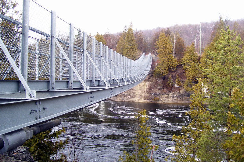
Ranney Gorge Suspension Bridge in Campbellford. CC Image courtesy of Robert Taylor on Flickr.
The rolling hills continue as the route turns north, following a more forested stretch along the Moira River to Tweed. Crossing the river at Chisholm’s Mills offers a unique glimpse into the area’s lumber history. Where the Moira River flows into Stoco Lake, the village of Tweed marks the route’s official entry into the Canadian Shield, a vast geologic region dominated by lakes, wetlands, and forests. Services become increasingly sparse, making careful planning for both food and overnight accommodations essential. Campgrounds and motels are marked on the map, but private cottages/cabins, which are often available through vacation rental services, are not. An internet search may reveal additional options for indoor accommodations.
The Canadian Shield of northern Ontario is known for its incredible scenery, but biting insects can be particularly bothersome in this remote section, especially from late spring through midsummer. Black flies are often worst in May and June, while mosquitoes can persist throughout the summer. Deer and horse flies become more prevalent later in the summer, particularly in July and August. While less of a constant nuisance, ticks are also worth checking for, as some can transmit diseases. Carry plenty of insect repellent and consider a head net or bug jacket if traveling during peak insect season.
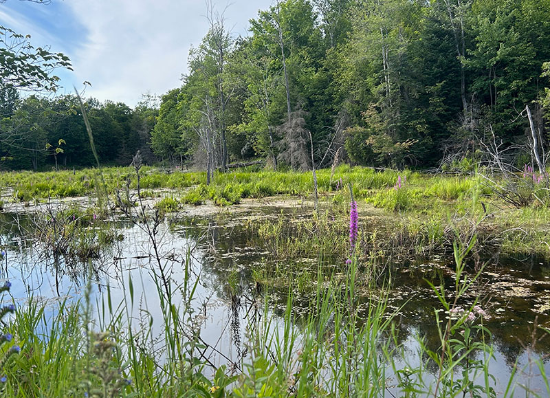
Typical wetland scenery seen along the route. Photo by Chad Mohr.
The K&P Rail Trail offers a mostly flat, stone-dust ride into the small community of Sharbot Lake, where a grocery store, lodging, and café await. Leaving Sharbot Lake, the route follows a short 1 km (0.6 mi.) stretch of the Trans-Canada Highway. The roadway has wide shoulders but can carry heavy traffic and large trucks, so ride with caution.
The route meanders through beautiful countryside of wetlands, forests, lakes, and farmlands to the town of Perth, a medium-sized community with plenty of amenities, antique shops, and good restaurant options. Often called one of the prettiest towns in Ontario, Perth’s downtown core is a designated Heritage Conservation District filled with well-preserved stone and limestone buildings. Nearby Stewart Park is a picturesque stretch of manicured grounds along the Tay River, with stone footbridges, gazebos, giant willow trees, and peaceful riverside paths.
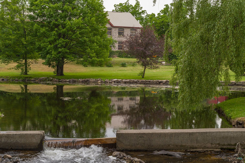
Stewart Park in Perth. CC image courtesy of Douglas O’Brien on Flickr.
The town of Smith Falls lies just 30 km (19 mi.) beyond Perth along the banks of the Rideau River. The town is home to a railway museum and pleasant riverfront parks along the historic Rideau Canal. Leaving Smith Falls, the route follows the Ottawa Valley Recreational Trail to Carleton Place, another riverfront community with plenty of shops, restaurants, and other amenities. The town’s river, the Mississippi, has no geographic relation to the famous American river of the same name.
From Carleton Place, the route turns northeast for its final approach to the section end in Ottawa. Stittsville marks the entry into the sprawling Ottawa metropolitan area, with the routing slicing through numerous suburban neighborhoods and strip malls. At Bells Corners, the route detours onto a busy stretch of Moodie Drive due to major washouts on the Greenbelt Pathway. Fortunately, this stretch is relatively short (about 2 km/1.2 mi.), and the road has bike lanes. Ride with caution, and check whether the Greenbelt Pathway has reopened to avoid this undesirable stretch. Wesley Clover Campground, the last opportunity for camping before entering the city, is located just west of Moodie Drive.
The cycling infrastructure within Ottawa is excellent. The Capital Pathway offers incredible views of the Ottawa River and provides an enjoyable, traffic-free entry into the heart of the city. During periods of high water, some sections of the trail may close. Exercise caution and respect all barricades and signage.
Section 1 ends at Parliament Hill in Ottawa, Canada’s capital city. The area is surrounded by beautiful Gothic Revival buildings, including the iconic Parliament buildings. Ottawa is popular with tourists and offers several worthwhile museums, including the Canadian Museum of Nature and the National Gallery of Canada. Accommodations in the city can be expensive, so plan accordingly.
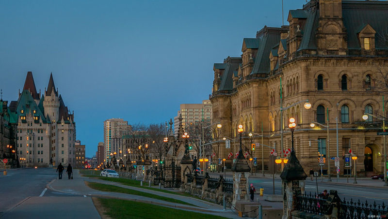
Parliament Hill in Ottawa. CC image courtesy of Asif A. Ali on Flickr.
Land Acknowledgement
As we travel by bicycle through these lands, we pause to reflect on our relationship with this place. We ride with respect and honor for the Indigenous peoples who have stewarded these shores, forests, and waters since time immemorial. We commit to caring for this land by staying on paths, leaving no trace, and listening to the wisdom of the First Nations, including the Mississaugas of the Credit, the Anishnabeg, the Chippewa, the Haudenosaunee, the Wendat peoples, the Haudenosaunee, the Omàmìwininì (Algonquin), and others who call these territories home. May your journey be guided by respect, gratitude, and responsibility.
Climate
The route passes through southern and eastern Ontario, where summers are generally warm and humid, while spring and fall can bring highly variable temperatures. July and August are typically the warmest months, with average daytime highs around 25–27°C (77–81°F), although temperatures can occasionally reach 30°C (86°F) or higher. Summer thunderstorms are common, and cyclists should be prepared for periods of heat, humidity, and heavy rain.
Late spring and early summer can be particularly wet and buggy, especially in the forests and wetlands of the Canadian Shield. Black flies are most prevalent in May and June, while mosquitoes can persist through the summer. September often brings cooler temperatures and fewer biting insects, making it a pleasant time to ride. October still typically offers pleasant daytime cycling weather, along with the added bonus of spectacular fall colors. By November, temperatures usually drop significantly, and the forests lose their vibrant autumn color.
Acknowledgements
Special thanks to Chad Mohr for scouting this route during the summer of 2026. Chad’s notes, insights, and recommendations were invaluable in the creation of this section of the Eastern Canada Route.
Riding Conditions
Section 2 of the Eastern Canada Route begins at Parliament Hill in Ottawa, Ontario, Canada’s capital city. The area is surrounded by beautiful Gothic Revival buildings, including the iconic Parliament buildings. Ottawa is popular with tourists and offers several worthwhile museums, including the Canadian Museum of Nature and National Gallery of Canada. Accommodations in the city can be expensive, so plan accordingly.
Cycling infrastructure in Ottawa is excellent, with scenic trails along the Ottawa River and the Rideau River and Canal. Upon leaving Ottawa, riders cross the historic Alexandra Bridge and depart Ontario for French-speaking Québec. Just before the bridge, Major’s Hill Park and Kìwekì Point are both worthwhile stops, offering excellent views of the river and city.
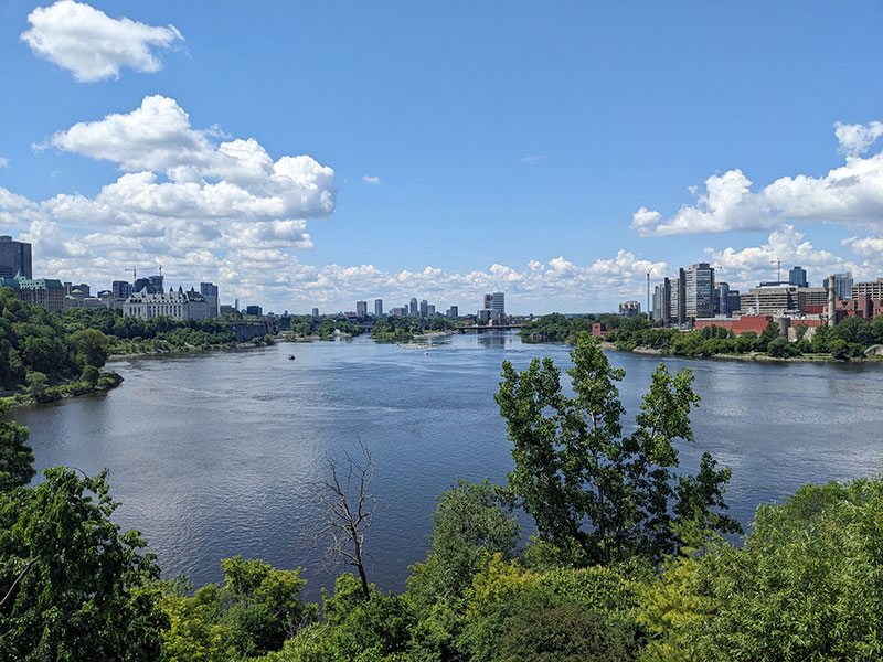
View of the Ottawa River from Major’s Hill Park in Ottawa. Photo by Dave Bone.
English is the official language of Ontario, while French is the official language of Québec, the primary region for this section of the route. In urban areas, most residents are bilingual and will happily accommodate English speakers, especially if initially greeted in French. In more remote villages, however, riders may need to communicate in French. Smartphone translation apps such as Google Translate can be helpful, as they offer voice translation and can scan menus and signs using the phone’s camera. Downloading French translation files ahead of time is useful for areas with poor cell service, which are also where riders are more likely to have non-English interactions. Taking a few French lessons before the trip is recommended to learn some basic vocabulary, phrases, and grammar.
Leaving the capital city, the route follows a series of trails marked Route Verte 1 that hug the Ottawa River through Jacques-Cartier and Lac Leamy parks on the way north to the Gatineau River. La Route Verte (The Green Route) is a network of bicycle paths, multi-use trails, and designated roads spanning some of Québec’s most scenic regions. It is one of the longest interconnected cycling networks in North America with connections to cycling routes in Ontario, New Brunswick, and the United States. Visit routeverte.com/en/ for more information.
Along the route, cyclists will also see signs for the Trans Canada Trail (TCT, aka Sentier Transcanadien), an extensive trail system that spans the country and holds the distinction of being the world’s longest multi-use trail system. Much of the Eastern Canada Route utilizes the TCT, building on the excellent work already completed while adding our own personal touch and ensuring the route is suitable for touring cyclists. Learn more about the TCT and find ways to support this incredible organization at tctrail.ca.
A brief on-road connection brings the route to the Voie Verte Chelsea (Chelsea Greenway), a former railroad line that follows the Gatineau River to the outskirts of Wakefield. Use caution on the unpaved trail at intersections, where runoff has created ruts near the crossings.
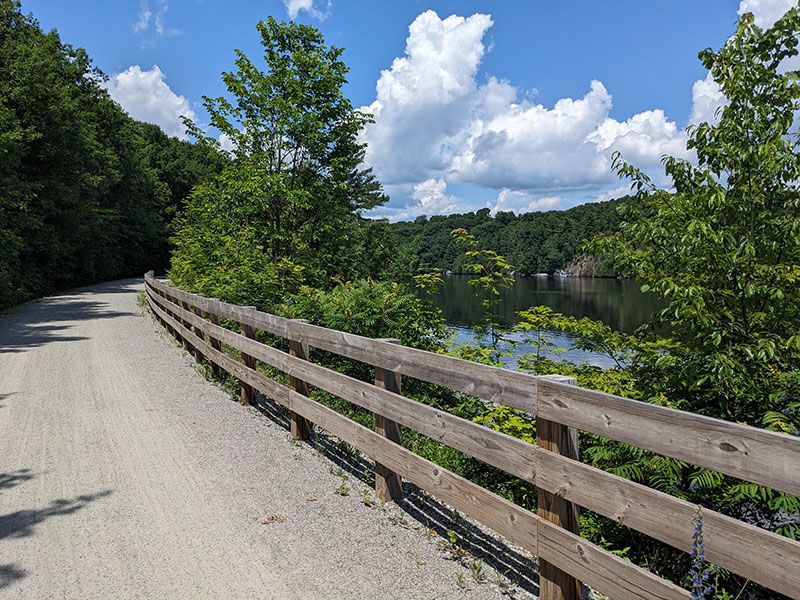
The Voie Verte Chelsea alongside the Gatineau River. Photo by Dave Bone.
Wakefield is a charming village with lodging, dining, swimming, and a well-stocked grocery store. Highlights include the historic Wakefield Covered Bridge and the Fairburn House Heritage Centre. Wakefield also offers the last on-route hotels for 110 km (68 mi.) until Maniwaki, so plan accordingly. Private cottages and cabins are popular in the area and often available through vacation rental services, but they are not marked on the map. An internet search may reveal additional options for indoor accommodations. Camping options become plentiful around Gracefield and continue beyond. Some of these campgrounds also offer cabins or other on-site indoor accommodations.
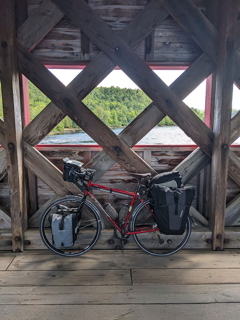
A view from inside the Historic Wakefield Covered Bridge. Photo by Dave Bone.
Leaving Wakefield, the route follows a collection of quiet gravel roads along the east side of the Gatineau River, with attractive waterfront and farmland views. North of Farrellton, the route moves farther from the river, with manageable but more strenuous climbs. Just east of the small community of Low, the route crosses the Paugan Dam, a hydroelectric dam completed in 1932. The narrow steel grate deck can be slippery when wet, but traffic is light, so walking across is also possible.
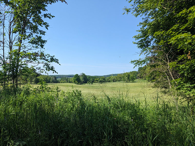
Pleasant countryside views near Farrellton. Photo by Dave Bone.
Continuing north, the hilly terrain persists until Kazabazua, where basic amenities are available in town. Lac-Sainte-Marie, a small community located on the shores of a lake of the same name, is located a few kilometers off route and offers a small municipal campground on the water’s edge.
Just west of Kazabazua, the route shifts onto a paved portion of the Véloroute des Draveurs (Log Drivers Cycle Route), a former railway line named for the log drivers who transported lumber from the Laurentian Mountains to the urban centers to the south. The terrain flattens, and the scenery is dominated by a mix of forest, open fields, and wetlands. The small city of Gracefield offers groceries, multiple restaurants, and several campgrounds nearby.
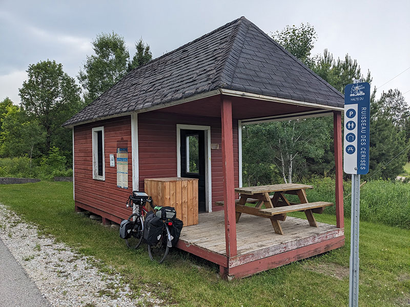
A rest stop (halte) along the Véloroute des Draveurs. Photo by Dave Bone.
The Laurentian Mountains of southern Québec are known for their incredible scenery, but biting insects can be particularly bothersome, especially from late spring through midsummer. Black flies are often worst in May and June, while mosquitoes can persist throughout the summer. Deer and horse flies become more prevalent later in the summer, particularly in July and August. Ticks are less of a constant nuisance but are also present and worth checking for. Carry plenty of insect repellent and consider a head net or bug jacket if traveling during peak insect season.
The remaining stretch of the Véloroute des Draveurs passes through a more populated area dotted with pristine lakes, summer cottages, and woodlands. Blue Sea Lake is one of the bigger lakes in the area, and the trail offers several opportunities for riders to stop for a refreshing swim along the way.
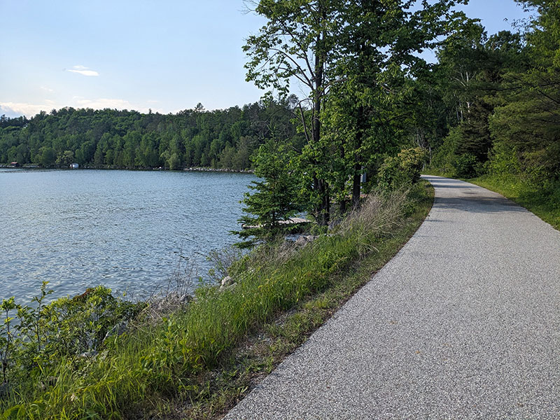
The Véloroute des Draveurs alongside Blue Sea Lake. Photo by Dave Bone.
The route departs the Véloroute des Draveurs at the Farley Rest Stop, following a quiet paved road along the west shore of Pitòbìg Lake through a reserve administered by Kitigan Zibi Anishinabeg, an Algonquin First Nation. Maniwaki serves as the regional hub for the Gatineau Valley and offers a variety of amenities. Points of interest include the Kitigan Zibi Cultural Centre, the preserved Pythonga Tugboat, and Trois Clochers Recreation Site, located at the confluence of the Gatineau and Désert Rivers.
From Maniwaki to Mont-Laurier, the route leaves the Gatineau Valley and enters a more remote region of the Laurentian Mountains (Les Laurentides). Autoroute QC-107 carries mostly local traffic, and although much of the shoulder is covered with loose gravel, the edge of the paved roadway provides adequate riding space. Route 117, the Trans-Canada Highway, is heavily traveled but has a very wide, clear shoulder. Services are limited along this section, so plan accordingly.
Mont-Laurier, known as the capital of the Laurentian Mountains, is the largest municipality in the region. The town has multiple grocery stores, a well-stocked bike shop, and plenty of lodging and dining options. The route takes a quieter approach into town, avoiding the busy commercial strip along the highway before crossing the Lièvre River at a historic hydroelectric plant and scenic falls.
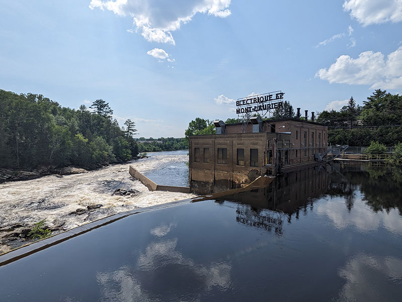
A scenic vista at a former hydroelectric plant in Mont-Laurier. Photo by Dave Bone.
Mont-Laurier is the northwestern terminus of the P’tit Train du Nord (Little Train of the North), an iconic 234-km (145-mi.) rail trail that runs to the outskirts of Montréal and attracts thousands of cycling tourists each year, along with countless local recreational users. The trail is part of Québec’s Route Verte cycling network as Route 2. Small, attractive towns are conveniently spaced along the trail, with infrastructure that includes charming caboose-shaped covered rest stops, bike repair stations, and restrooms. In several towns, former railway stations have been converted into information centers, cafés, and local history museums.
The organization that manages the trail maintains an excellent website (ptittraindunord.com) with an interactive map, trail conditions, and trip planning resources. A mobile app is also available to help travelers find information and services along the way. Navigation is simple: get on the trail and pedal. Trail markers clearly indicate your progress, with distances counting down from 199 km (124 mi) at Mont-Laurier to 0 km in St. Jerome.
The P’tit Train du Nord trail leaves Mont-Laurier at the historic train station and heads east and south through forests and farmland, passing numerous lakes and streams along the way. Wildlife is abundant, with the trail offering miles of peaceful scenery. Restaurants, groceries, camping, and lodging are available in Val-Barrette, Lac-Saguay, Nominigue, Rivière-Rouge, and Labelle, making these convenient stops along the northern portion of the trail.
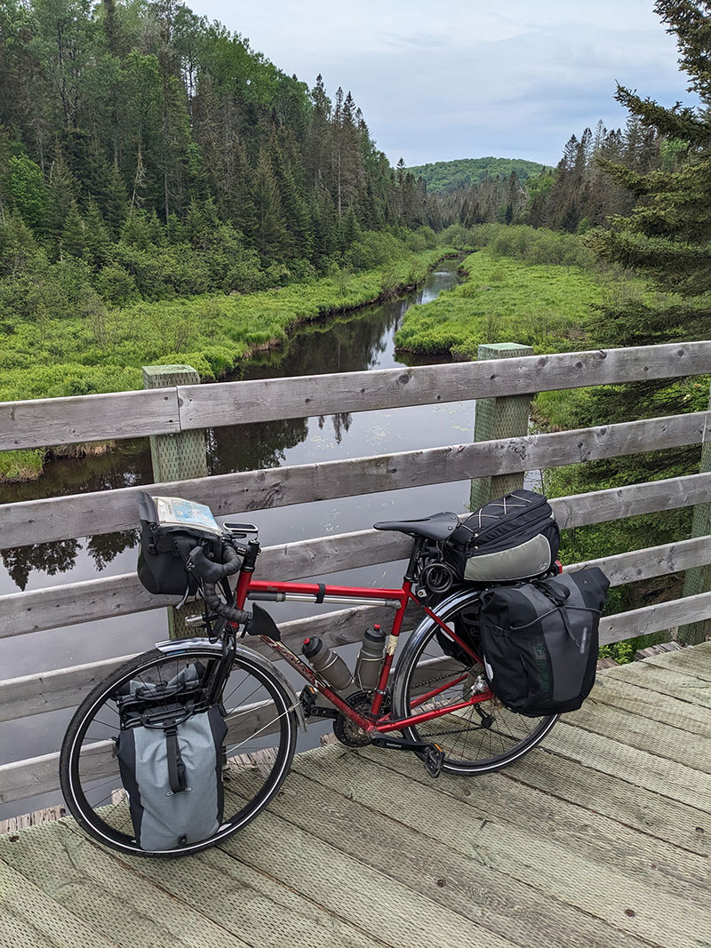
Views along the northern section of the P’tit Train du Nord. Photo by Dave Bone.
The central portion of the P’tit Train du Nord passes through several attractive towns that are popular for recreational activities in both summer and winter, including Mont-Tremblant, Sainte-Agathe-des-Monts, and Val-David. The trail surface generally improves farther southeast, and services become more frequent. At the 36-km (22-mi.) marker, the trail transitions to a well-maintained unpaved surface that is smooth and fast. Numerous opportunities exist to stop for a swim in the streams and lakes along the trail. Val-David is a particularly attractive stop, with numerus restaurants, a grocery store, and a friendly, well-stocked bike shop just off the trail.
The trail terrain is generally mild, with the steepest grades reaching up to 4% on a steady climb east of Mont-Tremblant to the summit near Mont Blanc. Roads leading off route to services can be significantly steeper than the former railroad grade of the trail, and this may be something to consider when selecting overnight accommodations.
As the P’tit Train du Nord approaches Saint-Jérôme, the towns become larger and busier, and several of the former train stations now house restaurants or cafés. The trail surface remains excellent, and the scenery is often striking as the trail parallels the Rivière du Nord.
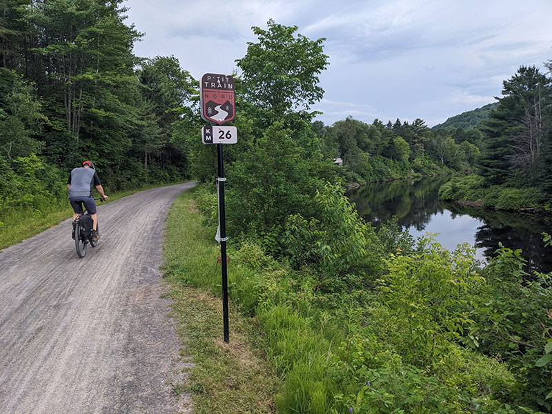
An unpaved portion of the P’tit Train du Nord. Photo by Dave Bone.
Saint-Jérôme offers a variety of practical amenities, including a modern multimodal transit station directly on the trail. From the station, travelers can load their bikes onto a train and ride directly to the heart of Montréal. Visit the exo regional transit website for schedules, fares, and more information: exo.quebec/en.
Travelers should also note that it is possible to arrange a shuttle service between Saint-Jérôme and Mont-Laurier, as well as luggage transport between lodging establishments along the trail. Autobus Le Petit Train du Nord operates near the former train station in Saint-Jérôme. Visit the company’s website for more information: www.autobuslepetittraindunord.com.
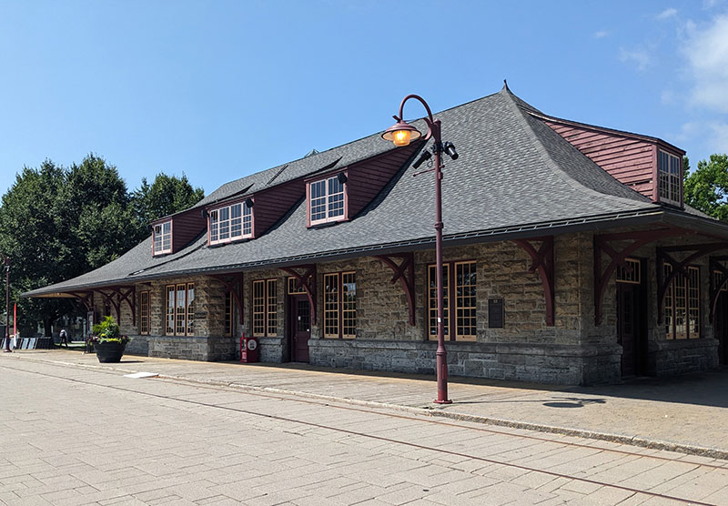
The Old Saint-Jérôme Train Station. Photo by Dave Bone.
South of Saint-Jérôme, the trail remains pleasant and scenic, passing through farmland and quiet suburban neighborhoods while often paralleling active railroad tracks. Additional convenient transit stations are available in Saint-Janvier and Blainville if desired. Navigation becomes somewhat more challenging in this section due to less signage and numerous intersecting bike paths. In general, riders can follow Route Verte 2 signs toward downtown Montréal, but signage is not present at every intersection.
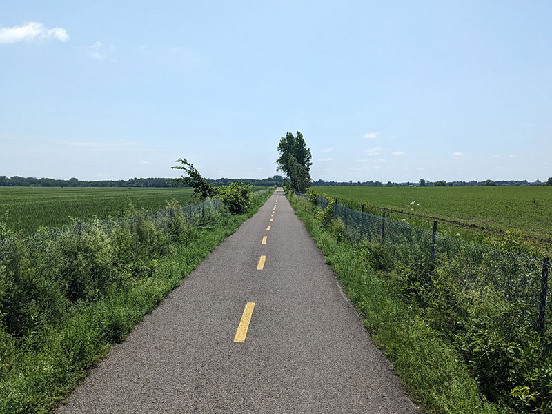
Long, straight, paved bike trails between Saint-Jérôme and Saint-Janvier. Photo by Dave Bone.
After crossing the Rivière des Mille Îles (Thousand Islands River), the route continues on Route Verte 2 along a series of bike-friendly roads with wide bike lanes before transitioning to an off-road trail through Laval. Three more transit stations, Sainte-Rose, Vimont, and De La Concorde provide opportunities for transport around the region. The route then crosses the Rivière des Prairies on the Perry Island Bridge to the Island of Montréal before briefly following bike paths and quiet roads along the river and turning east toward downtown. Efficient, protected bike lanes guide riders through the final several kilometers to the section’s end in Old Montréal.
Cycling in Montreal is a pleasure, with an extensive network of separated bike lanes and an easy-to-navigate street grid. The cosmopolitan city offers dozens of points of interest, including the Notre-Dame Basilica, Mount Royal Park, Marché Jean-Talon Market, and the freshly made bagels at Fairmont Bagel.
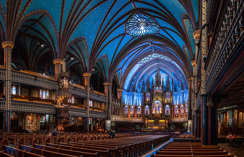
Inside the stunning Notre-Dame Basilica of Montréal. CC Image courtesy of Gord McKenna on Flickr.
River Alternate
The River Alternate was created to provide a more direct connection between Ottawa and Montréal, loosely following the banks of the Ottawa River. The alternate begins at Parliament Hill in central Ottawa, crossing the Rideau River and passing several official government buildings and embassies. Rockcliffe Driveway offers excellent views back toward the city across the water.
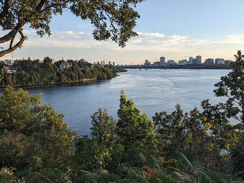
View of Ottawa from Rockcliffe Driveway. Photo by Dave Bone.
The route continues onto the Ottawa River Pathway, a fantastic trail network that hugs the riverfront. At Green’s Creek Bridge, the route merges onto the Sir George-Étienne Cartier Parkway for a southward, on-road connection to the Prescott-Russell Trail. Blackburn Hamlet offers a cluster of services. For 1 km (0.6 mi.), the route follows a busy six-lane stretch of Innes Road. Although the road has bike lanes, riders should use caution, particularly when making the left turn onto Anderson Road.
For the next 49 km (30 mi.), the route follows the Prescott-Russell Recreational Trail, a popular destination for both cyclists and snowmobilers in the winter. The trail follows a former railway and is remarkably flat and straight as it passes through farmland and forest. Services are limited along the trail, with basic amenities available in the small off-route communities of Navan, Hammond, and Bourget. Convenient trailside pavilions in Hammond, Bourget, and Plantagenet Station provide covered shelter, picnic benches, and pit toilets, but no running water. Be sure to carry plenty of water, especially on hot summer days.
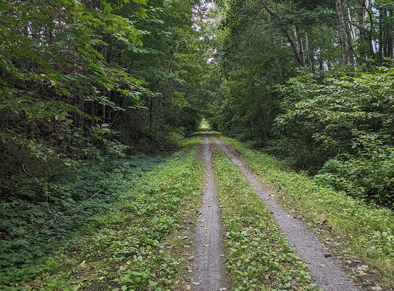
The Prescott-Russell Trail. Photo by Dave Bone.
The route leaves the Prescott-Russell Trail at the Plantegenet Station pavilion, heading north on County Road 9 into the heart of the small town of Plantegenet on the South Nation River. The town offers several restaurants, a convenience store, and a comfortable motel.
Heading north out of Plantegenet, the route continues on County Road 9 to the tiny community of Treadwell, back at the Ottawa River. Here, the route turns east onto County Road 24, tracing the river’s shoreline for 38 km (24 mi.) to the city of Hawkesbury. This is a beautiful stretch of road, with light traffic, smooth pavement, nice shoulders, and glorious views of the river to the north and farmland to the south. A ferry is available in Lefaivre for cyclists who want to cross the Ottawa River to reach accommodations or services in Montebello. Lefaivre also offers a pleasant waterfront park, perfect for a rest or lunch break.
L’Original is the largest town between Plantagenet and Hawkesbury and offers a convenience store and a few restaurants along Highway 17. The Old Jail (Ancienne Prison de L’Original), a popular tourist attraction, is just one block from the route. L’Original also has a pleasant waterfront park with a sandy beach and designated swimming area.
The route enters Hawkesbury on County Road 4, which can have heavy local traffic but has wide, paved shoulders. After passing through the main downtown area, the route crosses the Ottawa River on the Long Sault Bridge into Grenville, Québec. The bridge can be busy and has minimal shoulder space, but the sidewalk on the western side provides a protected option for cyclists. Both Hawkesbury and Grenville offer multiple restaurants and groceries with a selection of big-box stores and a sporting goods store available on the south side of Hawkesbury.
On the Québec side of the river, the route primarily follows Route Verte 1, with much of the routing along the shoulder of QC 344. A nice diversion follows the VéloRoute d’Argenteuil through the Von Allmen Woods (Boisé Von Allmen), where an attractive pedestrian bridge crosses the Rivière du Nord.
Highway 344 between Saint-André-d’Argenteuil and Oka is a busier stretch of road, and the shoulder can be covered in rough gravel. Cyclists will find a market and a few restaurants in Saint-Placide, where a waterfront park features benches and a pavilion that make the most of its location along the river.
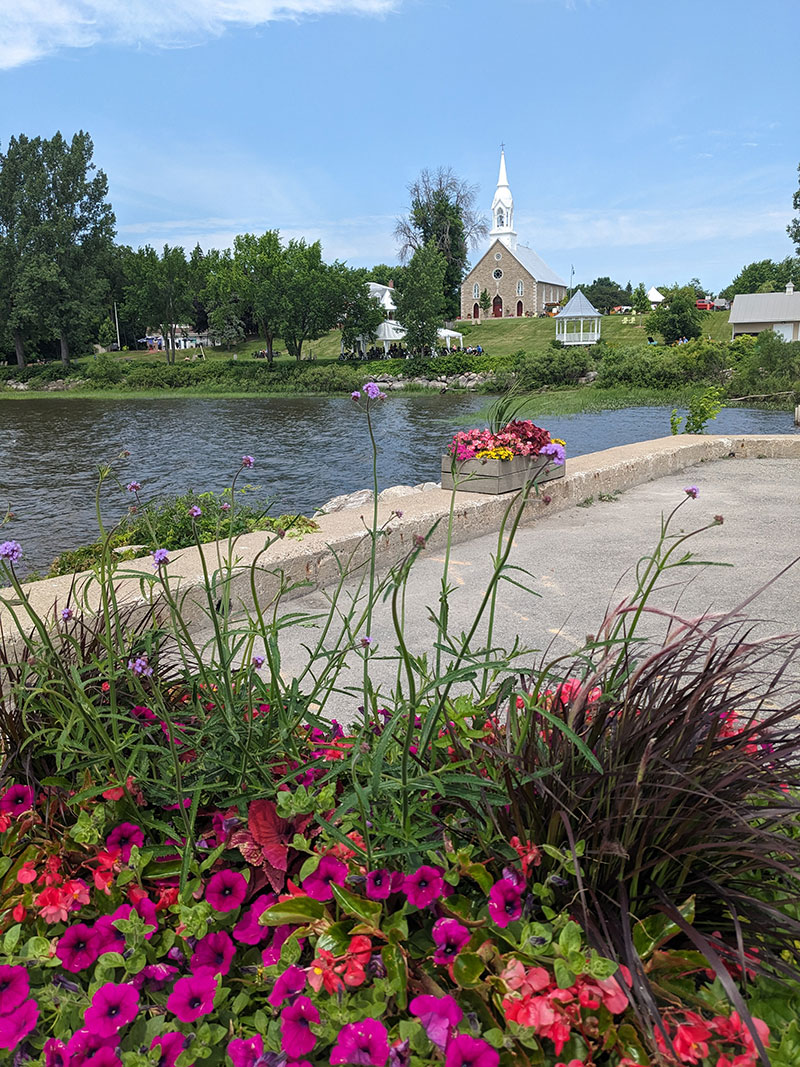
Riverfront park in Sainte-Placide. Photo by Dave Bone.
The final stretch of QC 344 leading into Oka grows busier and passes through the Kanesatake Lands, a native Mohawk community. At Oka, the route shifts onto quiet streets before joining an off-road paved trail through Oka National Park. The park’s expansive campground has a dedicated Bienvenue Cyclistes (Welcome Cyclists) group site, offering a special rate for cyclists and an opportunity to socialize with other traveling cyclists. The park also offers opportunities for swimming, kayak rentals, and wildlife watching amid the beautiful maple forest.
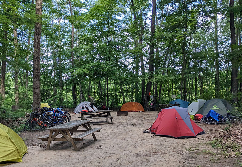
Cyclist camping in Oka National Park. Photo by Dave Bone.
Oka National Park limits the number of visitors permitted each day, so cyclists are strongly encouraged to purchase a right of access online in advance or obtain an annual pass, even if not camping. The park can also be bypassed by staying on the bike path, La Vagabonde, alongside Collines Road (Chemin des Collines).
From Oka National Park, La Vagabonde bike path runs through the towns of Pointe-Calumet and Sainte-Marthe-sur-le-Lac to Duex-Montagnes, as the route enters the outskirts of the sprawling Montréal metropolitan area. A pedestrian bridge across the Rivière des Mille Îles (Thousand Islands River) brings the route onto the island of Laval. Frequent Route Verte 1 signs help guide the way.
Along this section, cyclists pass multiple riverfront parks, some with swimming beaches. In the village of Sainte-Rose, Parc de la Rivière des Mille Îles has a welcoming picnic area with benches and comfortable Adirondack chairs, making it a perfect spot for a mid-ride rest. A small café inside the visitor center sells prepared food and pastries. This portion of the route is very cyclist-friendly but increasingly urban, so ride cautiously and defensively.
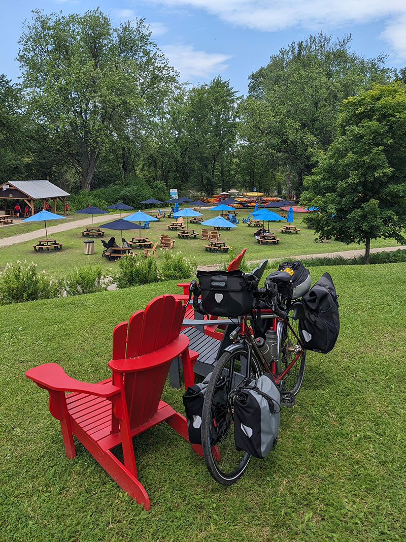
Parc de la Rivière des Mille Îles in Sainte-Rose. Photo by Dave Bone.
The River Alternate ends where it T-junctions with the Main Route just east of Sainte-Rose. Follow the Main Route through the remainder of Laval into the heart of Montréal, where this section concludes.
Land Acknowledgement
As we travel by bicycle through these lands, we pause to reflect on our relationship with this place. We ride with respect and honor for the Indigenous peoples who have stewarded these shores, forests, and waters since time immemorial. We commit to caring for this land by staying on paths, leaving no trace, and listening to the wisdom of the First Nations, including the Anishinaabe Algonquin, Kanien’kehá:ka (Mohawk), and others who call these territories home. May your journey be guided by respect, gratitude, and responsibility.
Climate
This route is best ridden from late May through October, with July and August bringing the warmest conditions. The climate varies noticeably along the route, from the relatively warm Ottawa Valley and Montréal area to the cooler, more mountainous Laurentians. Summer days are generally warm and humid, with daytime temperatures commonly reaching the low to mid-20s°C (70s°F), while evenings can be noticeably cooler in the higher elevations around Mont-Laurier and Mont-Tremblant.
Rain can occur throughout the riding season, with late spring and summer generally being the wettest period. Thunderstorms are possible during the warmer months, so be prepared for rapidly changing conditions and carry rain gear even when the forecast looks favorable. The route’s forested sections and higher elevations can also remain cooler and damp after rainfall.
Spring arrives later in the Laurentians than in Ottawa and Montréal, and cool nights are possible well into May. By September, temperatures become more comfortable for long-distance cycling, although mornings can be chilly, particularly north of Mont-Tremblant. October typically offers pleasant daytime cycling weather, along with the added bonus of spectacular fall colors. By November, temperatures usually drop significantly, and the forests lose their vibrant autumn color.
Biting insects can be an issue, particularly in the more remote and forested sections between Wakefield, Gracefield, Maniwaki, and Mont-Laurier. Black flies are most troublesome in May and June, while mosquitoes can persist throughout the summer. Deer and horse flies are more common during the warmer months. Ticks are also present throughout Québec, particularly in wooded and grassy areas.
Montréal and Ottawa have somewhat longer and warmer shoulder seasons than the Laurentians, making the more southerly River Alternate a more comfortable option for early- and late-season riding.
Acknowledgements
Special thanks to Dave Bone for scouting this route during the summer of 2026. Dave’s notes, insights, and recommendations were invaluable in the creation of this section of the Eastern Canada Route.
Riding Conditions
Section 3 of the Eastern Canada Route begins in the oldest part of Montréal, a cobblestoned, riverfront neighborhood filled with shops, museums, restaurants, and historic landmarks that draw visitors from around the world. A zig-zagging network of paved bike paths leads out of the city, south along the industrial-chic waterfront, across the St. Lawrence River onto Saint Helen’s Island (Île Sainte-Hélène), and past the Formula One racetrack on Notre Dame Island (Île Notre-Dame).
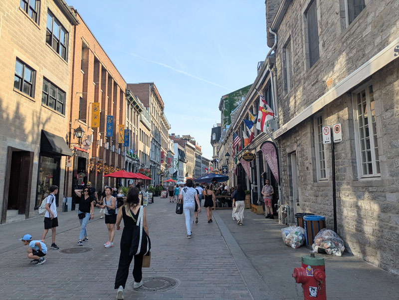
Cobblestone streets in Old Montréal. Photo by Jen Rose Smith.
This portion of the route can be crowded and difficult to navigate on busy weekends when the path draws strolling families unaccustomed to bike traffic. Ride slowly and cautiously, and consider getting an early start on Saturdays and Sundays.
French is the official language of Québec, the province this section of the route passes through. In urban areas, most residents are bilingual and will happily accommodate English speakers, especially if initially greeted in French. In more remote villages, however, riders may need to communicate in French. Smartphone translation apps such as Google Translate can be helpful, as they offer voice translation and can scan menus and signs using the phone’s camera. Downloading French translation files ahead of time is useful for areas with poor cell service, which are also where riders are more likely to have non-English interactions. Taking a few French lessons before the trip is recommended to learn some basic vocabulary, phrases, and grammar.
Across the St. Lawrence River, the route briefly follows quiet residential streets before merging with the Route Verte 1. La Route Verte (The Green Route) is a network of bicycle paths, multi-use trails, and designated roads spanning some of Québec’s most scenic regions. It is one of the longest interconnected cycling networks in North America with connections to cycling routes in Ontario, New Brunswick, and the United States. Visit routeverte.com/en/ for more information.
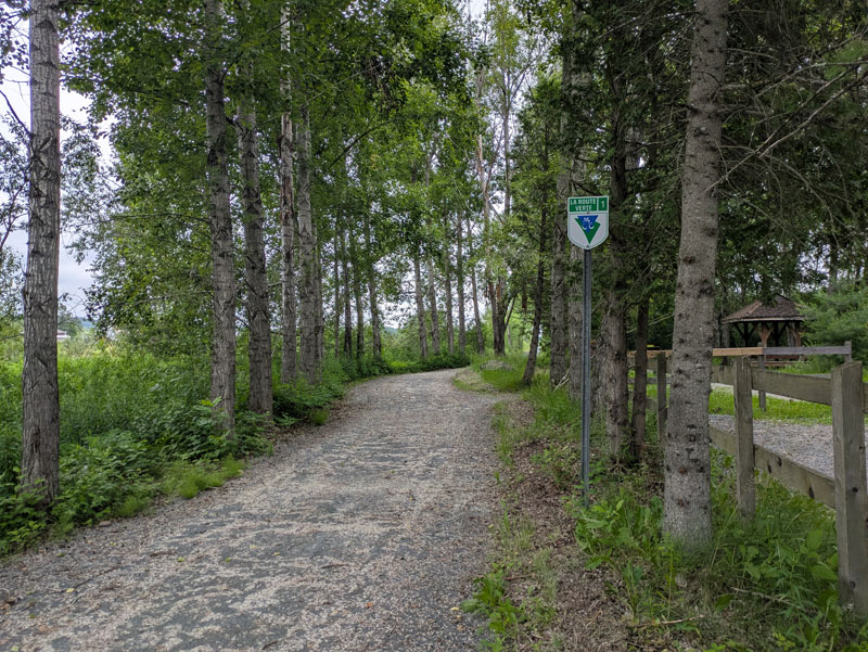
Signage along La Route Verte between Richmond and Danville. Photo by Jen Rose Smith.
Along the route, cyclists will also see signs for the Trans Canada Trail (TCT, aka Sentier Transcanadien), an extensive trail system that spans the country and holds the distinction of being the world’s longest multi-use trail system. Much of the Eastern Canada Route utilizes the TCT, building on the excellent work already completed while adding our own personal touch and ensuring the route is suitable for touring cyclists. Learn more about the TCT and find ways to support this incredible organization at tctrail.ca.
Chambly, a small, attractive city on the Richelieu River, makes an appealing first stop after leaving Montréal. It is also the northern terminus of the historic Chambly Canal, whose hand-cranked locks (écluses) extend 19 km (12 mi) south to Saint-Jean-sur-Richelieu. Fort Chambly National Historic Site (Lieu historique national du Fort-Chambly) is a square-shaped stone fortress in a magnificent setting on the banks of the Richelieu River. Just a few blocks from the route, the fort is worth a visit to explore what life was like in the region hundreds of years ago.
The riding surface transitions from asphalt to crushed stone as the route turns south at Chambly to follow the entire length of the canal—a spectacular section that sometimes features a slender causeway between the canal and the Richelieu River. Saint-Jean-sur-Richelieu offers all services and multiple bike shops, but accessing them from the causeway trail can be tricky due to the infrequent bridges. Plan ahead if you need to leave the route to access services in town.
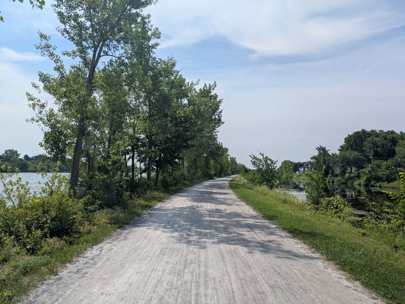
The bike path along the Chambly Canal. Photo by Jen Rose Smith.
From Saint-Jean-sur-Richelieu the route climbs almost imperceptibly, following off road bike paths that alternate, sometimes quite frequently, between asphalt and crushed stone. This section follows a portion of the Route Verte known as La Montérégiade, a former railway line between Saint-Jean-sur-Richelieu and Granby via Farnham through the agricultural region of Montérégie. It is also part of the Véloroute Gourmande, a 235-km (146-mi) route connecting Montréal and Sherbrooke that highlights more than 100 gourmet culinary stops. Visit veloroutegourmande.com/en for an interactive map featuring locations to enjoy gourmet coffee, cheese, wine, beer, pastries, chocolate, and more.
After leaving Granby, the route begins a gradual climb into the foothills of the Appalachian Mountains on the paved L’Estriade bike path, passing through a region known as the Eastern Townships. The scenery is dominated by forests, wetlands, open fields, and several parks. The outdoor-sports hub of Bromont is just off route along La Villageoise bike path and offers multiple bike shops and other amenities.

L’Estriade near Granby. Photo by Jen Rose Smith.
Beyond Waterloo, the route follows a series of hilly, quiet paved and gravel roads to connect with the La Montagnarde bike path at Lac d’Argent. La Montagnarde leads into Mont-Orford National Park (Parc national du Mont-Orford), where the route climbs to a high-point as it slips between a series of promontories. At the park entrance, a small, self-serve kiosk allows visitors to pay the entrance fee by cash or credit card. Cyclists passing through the park on the La Montagnarde are exempt from the entrance fee, but those planning to camp or explore the park’s other trails must pay.
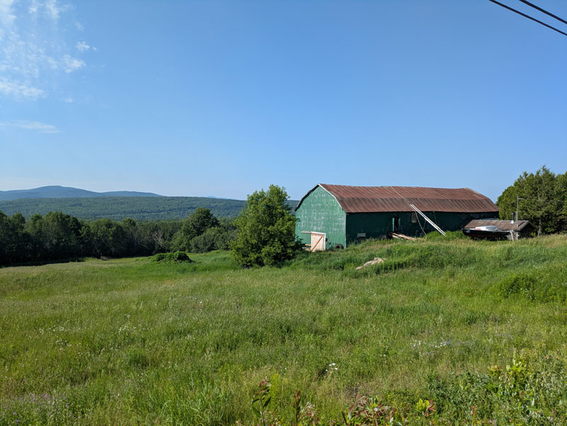
Countryside views between Waterloo and Mont-Orford National Park. Photo by Jen Rose Smith.
From the national park, the route descends to the lively city of Magog. The park along the northern tip of Lake Memphremagog, home to a Nessie-like lake monster named Memphré, is an ideal spot for a swim or a picnic lunch. Magog itself is a popular vacation destination, with boat tours and souvenir shops selling Memphré-themed swag.
The route continues northeast from the city of Magog, wrapping around the northern shore of Magog Lake, with more swimming and picnicking opportunities at the Municipal Beach Park. Dipping south, the route reaches Lake Massawippi and the pretty vacation village of North Hatley, which offers several waterside restaurants, parks, and beaches.
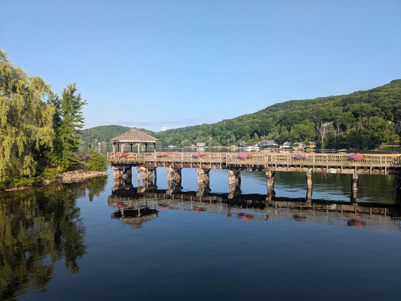
The pier in North Hatley. Photo by Jen Rose Smith.
Turning northeast once again, the route follows a shaded, crushed-stone path along the Massawippi River into the Sherbrooke borough of Lennoxville, home to the small, English-language Bishop’s University. The route passes directly through the university’s 19th-century campus, where the neo-Gothic St. Mark’s Chapel is classified as a heritage building.
The route crosses the Saint-François River and follows the riverside trail into the heart of Sherbrooke, the largest city in the Eastern Townships. Sherbrooke offers multiple bike shops, a wide range of services, and several worthwhile museums.
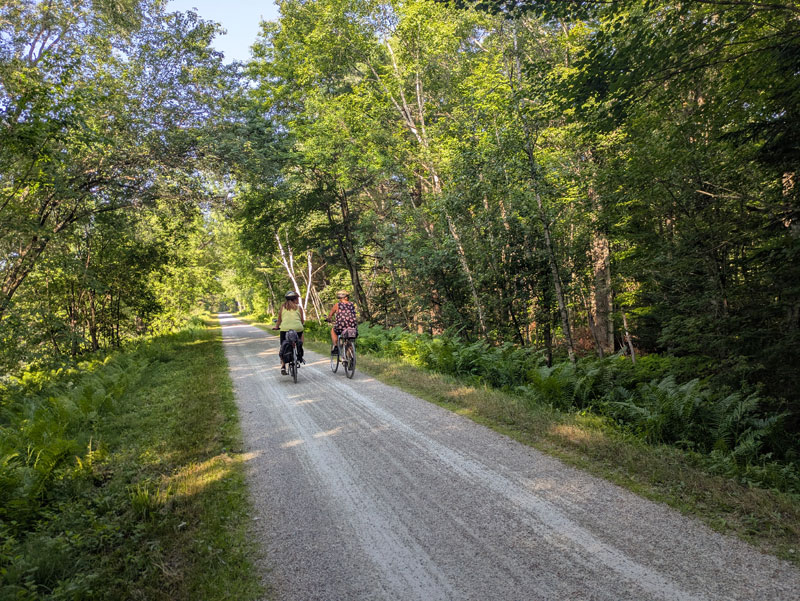
Beautiful gravel bike paths between North Hatley and Sherbrooke. Photo by Jen Rose Smith.
After leaving Sherbrooke, the route alternates between surface streets and off-road bike paths through the borough of Bromptonville, the small town of Windsor, and finally the railroad town of Richmond. It’s all flat or downhill from here as the route leaves the maze of waterways behind to cross Québec’s agricultural heartland, a region less visited by tourists that offers a glimpse of country life. The towns of Danville and Warwick provide opportunities to resupply and spend the night before reaching the larger city of Victoriaville.
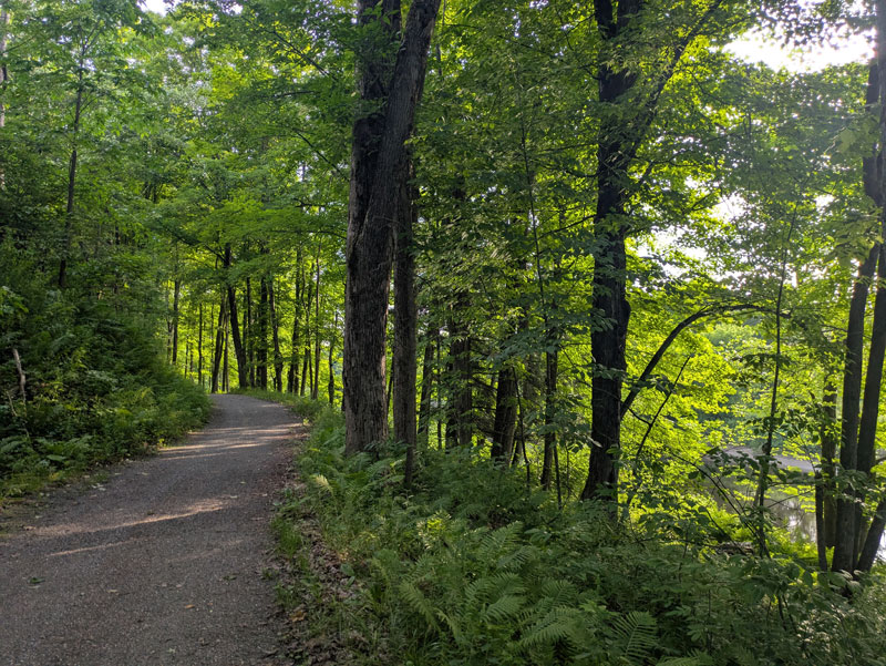
Forest views between Windsor and Richmond along the Saint-François River. Photo by Jen Rose Smith.
Victoriaville (aka “Victo”) sits on the banks of the Nicolet River and offers all services, including several well-stocked bike shops. From here to the route’s end in Québec City, the route runs almost arrow-straight through a landscape of farmland, forest, and small towns. Beyond Victoriaville, the route parallels a noisy 4-lane highway until just past the small farm town of Princeville. The route crosses or parallels the same highway (Route 116) several more times before reaching Québec City, but the stretch between Victoriaville and Princeville is the busiest and loudest of these sections.
Plessisville is known as “the maple capital of the world” for its long history of maple syrup production and has hosted an annual Maple festival since 1958. Look closely at the woods along the trail, and you’ll spot plastic tubing used to collect sap from the maple trees. Plessisville is also the best place to stock up on food before tackling the final stretch to Québec City. A few shops and snack bars can be found in the small towns of Lyster, Dosquet, and Saint-Agapit but services are more limited.
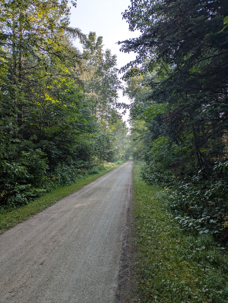
Long, straight gravel bike path near Plessisville. Photo by Jen Rose Smith.
At the south-shore city of Lévis (pronounced lay-VEE), the route briefly follows surface streets before entering Parc des Chutes-de-la-Chaudière (Chaudière Falls Park). Here, a 113-meter (370-foot) suspension bridge spans the Chaudière River above an impressive waterfall. Dismount and walk your bike across the wooden-planked bridge.
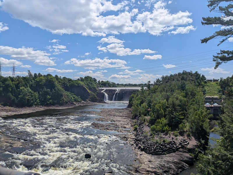
Chaudière Falls. Photo by Jen Rose Smith.
The route becomes increasingly urban as it navigates suburban streets, greenways, and city parks toward the Lévis Ferry terminal at the St. Lawrence River, where cyclists can buy a one-way ferry crossing ticket to Québec City. The ferry schedule varies by season, but during the summer months, boats generally depart every 30 minutes until 6pm, then hourly until 2am. The route concludes in French-speaking Québec City, where an extensive network of bike paths provides easy access to numerous services and tourist attractions.
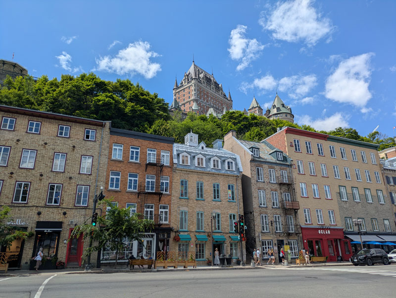
Historic buildings in Québec City. Photo by Jen Rose Smith.
Land Acknowledgement
As we travel by bicycle through these lands, we pause to reflect on our relationship with this place. We ride with respect and honor for the Indigenous peoples who have stewarded these shores, forests, and waters since time immemorial. We commit to caring for this land by staying on paths, leaving no trace, and listening to the wisdom of the First Nations, including the Kanien’kehá:ka (Mohawk), Abenaki, Wendat, Innu, and others who call these territories home. May your journey be guided by respect, gratitude, and responsibility.
Climate
Summer along this section of the route is typically warm and humid, with occasional periods of heat and thunderstorms. Spring can be cool and rainy, particularly in the higher-elevation areas around Mont-Orford National Park, while fall brings crisp mornings and comfortable daytime temperatures along with colorful foliage. Montréal and the southern portions of the route generally warm up earlier in spring and stay milder later into fall than the hillier areas to the east. By November, temperatures begin to drop noticeably, and early snow and wintry conditions can occur.
Acknowledgements
Special thanks to Jen Rose Smith for scouting this route during the summer of 2026. Jen’s notes, insights, and recommendations were invaluable in the creation of this section of the Eastern Canada Route.
Updates to Recently Released Maps
If you are planning a bike tour, be sure to get the most recent map updates and corrections for your route by selecting the route, and the appropriate section(s), from the drop-down menu below.
Over time maps become less useful because things change. Every year Adventure Cycling’s Routes and Mapping Department create map updates and corrections for every map in the Adventure Cycling Route Network, which now totals 52,047 miles. With the help of touring cyclists like you, we receive updates on routing, services, camping, and contact information. Until we can reprint the map with the new information, we verify the suggested changes and publish corrections and updates here on our website.
PLEASE NOTE: Covid has been particularly hard on the small businesses along our routes. While we do our best to keep the maps and these online updates current, you may encounter more closed businesses and longer stretches with limited or no services.
Refer to these updates for the most current information we have and submit reports of changes to the Route Feedback Form for the cyclists coming after you.
NOTE: Map updates and corrections only pertain to long term changes and updates. For short term road closures, please see the Adventure Cycling’s Routes Temporary Road Closures discussion in our Forums.
No route data found
