What is the U.S. Bicycle Route System (USBRS)?
The U.S. Bicycle Route System (USBRS) is a developing national network of officially recognized, numbered, and signed bicycle routes which use existing roads, trails, and other facilities appropriate for bicycle touring.
Which states have established U.S. Bicycle Routes?
To date, over 24,000 miles of U.S. Bicycle Routes have been established in 35 states: Alaska, Arizona, Arkansas, California, Connecticut, Delaware, Florida, Georgia, Idaho, Illinois, Indiana, Kansas, Kentucky, Maine, Maryland, Massachusetts, Michigan, Minnesota, Missouri, Nevada, New Hampshire, New York, North Carolina, North Dakota, Ohio, Oklahoma, Pennsylvania, Tennessee, Utah, Vermont, Virginia, Washington, West Virginia, Wisconsin, Wyoming, and the District of Columbia.
Check out Maps & Route Resources for more information on established U.S. Bicycle Routes.
What kinds of facilities do U.S. Bicycle Routes use?
Designated routes are on any facility that is suitable for touring bicycles, which includes paved roads, paths and trails, as well as hard-crushed gravel surfaces. U.S. Bicycle Routes do not include mountain bike routes.You can contact the state department of transportation to learn more about specific facilities along each route in a given state.
The American Association of State Highway and Transportation Officials (AASHTO) is responsible for approving USBR designation and recommends that states utilize the AASHTO Guide for the Development of Bicycle Facilities, but AASHTO does not require construction of bicycle facilities or design standards for U.S. Bicycle Routes.
What criteria is used for developing U.S. Bicycle Routes?
To be included in the National Corridor Plan and considered for designation, U.S. Bicycle Routes must connect at each end to another state, international border, or existing U.S. Bicycle Route.
AASHTO does not oversee the suitability of a route; rather, this is determined by the individual state DOT. To assist route creators, AASHTO developed the USBRS Corridor & Route Criteria, with primary and secondary considerations for corridor and route development. It is meant to be a guide for consistency; however, each state department of transportation is responsible for signing off on the suitability of U.S. Bicycle Routes for bicycling and determining the specific criteria used for U.S. Bicycle Routes developed in their state.
Route criteria, including acceptable traffic volumes, prioritized types of infrastructure and surfaces, directness of the route, frequency of services, etc, vary depending on what each state determines is suitable for bicycling. AASHTO does not require construction of bicycle facilities or design standards, but recommends that states utilize the AASHTO Guide for Development of Bicycle Facilities.
For more on what is required by AASHTO for the USBRS, read the Purpose and Policy Statement and check out the example criteria provided on the Implementation Resources page.
How did the USBRS get started?
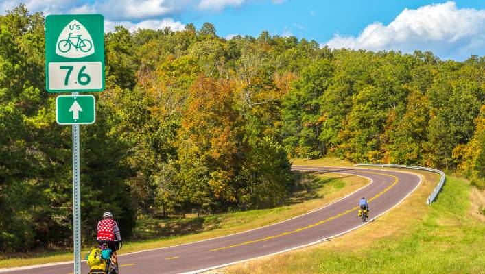
In 1982, the American Association of State Highway and Transportation Officials (AASHTO) approved two U.S. Bicycle Routes: USBR 1 in Virginia and North Carolina and USBR 76 in Virginia, Kentucky, and Illinois. After these two routes were designated, no additional routes were nominated and the project lay dormant for over 20 years.
In 2003, in an effort to reinvigorate the U.S. Bicycle Route System, AASHTO formed a Task Force on U.S. Bicycle Routes, which included Adventure Cycling Association, among other organizations. The Task Force formalized a process in 2007 that states could use to designate U.S. Bicycle Routes, including creating the National Corridor Plan and the AASHTO application. Adventure Cycling began providing staff support to help state partners designate routes in 2005 and continues to be the go-to resource for USBRS information and guidance.
RIDING THE USBRS
Where can I find map resources to ride a USBR?
In 2017, we began a partnership with Ride with GPS to provide fully navigable digital maps and route information. Take a look at the USBRS Maps and Route Resources page to see all designated USBRs.
Additionally, the National Corridor Plan shows established U.S. Bicycle Routes as solid lines. The lighter colored dotted lines indicate corridors where routes may be developed. The corridor plan is a template that is used by route planners in each state to show the possible route connections between states.
How do I know which U.S. Bicycle Routes are signed?
You can find out which USBRs are signed on the Maps & Route Resources page. Adventure Cycling maps display signed USBRs where they intersect with Adventure Cycling routes with a numbered sign icon.
Are USBRs appropriate for all types of bicyclists?
U.S Bicycle Routes are designed with confident cyclists in mind. Some route sections may be appropriate for beginning bicyclists and families (separated bike paths, trails, and lanes); however; many route sections are more appropriate for seasoned bicycle travelers (roads with little or no shoulder). Over time, as more cyclists use these routes, more bicycle-specific facilities appropriate for all bicyclists may be created and maintained.
What opportunities exist for train travel along USBRs?
You can check out this USBRS-Amtrak overlay map to see the possibilities for Amtrak connections along USBRs. Use the Adventure Cycling interactive route network map along with the Amtrak Routes overlay to see possibilities for Amtrak connections along Adventure Cycling routes.
ADVENTURE CYCLING & THE USBRS
What is Adventure Cycling’s role in the USBRS?
Adventure Cycling Association is the only national organization that provides staff support to the USBRS project. Our staff offers technical assistance, coordination, and outreach to help states achieve official designation of USBRs. We also work to build awareness and interest of the U.S. Bicycle Route System in the transportation and tourism sector, as well as in cycling and trail communities.
What is the difference between the USBRS and the Adventure Cycling Route Network?
They are both national route networks and the major differences are listed in the table below. You can see how the two route networks intersect by choosing the OpenCycleMap background on this interactive map. The colored lines display Adventure Cycling routes and the red lines display USBRS routes. You may need to zoom in to see USBRs.
U.S. Bicycle Route System |
Adventure Cycling Route Network |
|
Publicly-owned. |
Owned by Adventure Cycling Association. |
|
Created and approved by local, state, and national agencies, road owners, and volunteers. |
Created by Adventure Cycling Association. |
|
Routes are officially approved by AASHTO, state departments of transportation, and local road owners. |
Routes are not approved by official agencies. |
|
Numbered and signed routes. |
Routes are named and are not numbered and signed. |
|
Mapped by state departments of transportation. |
Mapped by Adventure Cycling Association. |
|
The USBRS incorporates Adventure Cycling routes and other existing routes into a numbered bicycle route system like the state highway system. |
Adventure Cycling routes do not incorporate other routes and are created in response to member demand for touring routes. Routes may be aligned to correspond with USBR routing when appropriate. |
|
USBRs will connect cities to provide bicycle routes in and out of major transportation hubs. |
Adventure Cycling routes favor rural back roads and tend to avoid major cities. |
|
Routes are only in the U.S. |
Routes are in the U.S. and Canada. |
|
Official recognition by the state department of transportation provides basis for maintaining roadways that are suitable for cycling (i.e. appropriate rumble strip placement, improved bicycle facilities, etc.). |
Not officially recognized and occasionally must be re-routed in response to changes that make routes unsuitable for cycling (i.e. oil boom traffic in North Dakota, roads closed to cycling, etc.). |
|
Favors connectivity of urban, suburban, and rural areas featuring historic, cultural, and scenic attractions. |
Favors regional tourism destinations featuring historic, cultural, and scenic attractions. |
USBRS DEVELOPMENT & GETTING INVOLVED
How does a U.S. Bicycle Route get created?
State departments of transportation (DOTs) develop and nominate U.S. Bicycle Routes for numbered designation through the American Association of State Highway and Transportation Officials (AASHTO), which also assigns numbers to U.S. highways and interstates.
When will the USBRS be complete?
Currently, an average of 1,500-2,000 miles of U.S. Bicycle Routes are designated each year. The USBRS is a constantly evolving project, and even when all of the prioritized corridors are established, many routes will be shifted and/or added to improve connectivity and route suitability as new opportunities arise.
Where can I find current information about my state’s involvement in the USBRS?
If you would like to learn about your state's involvement with the USBRS, you can email us at usbrsinfo@adventurecycling.org. For information on established USBRs visit our Maps and Route Resources page. Subscribe to our newsletter to receive updates directly in your inbox.
How can I get a USBR in my state/community?
You can volunteer with the lead organization involved in implementing a USBR, which may be your state department of transportation, state bicycle advocacy group, or other organization.
Also, when your state (or city) transportation agency creates or updates a bicycle and pedestrian plan, you can submit a letter or comments in support of including U.S. Bicycle Routes in the plan.
You can contact Adventure Cycling for more information at usbrsinfo@adventurecycling.org.
How can I contribute to this effort?
The process to implement USBRs has, in many cases, been initiated and carried out by volunteers with the support of the state department of transportation and Adventure Cycling. If you're interested in volunteering to help get a USBR implemented in your state, you can contact Adventure Cycling at usbrsinfo@adventurecycling.org and we'll get you started.
We welcome donations to help fund the USBRS. Your contribution will help us to meet our fundraising goal and support our work to develop and sign the USBRS. You can donate to Adventure Cycling or join as a member to support our work to inspire and empower bicycle travel. Thanks for your support!
Photo by Dennis Coello