Ten Best Rail Trails For Cyclists
Rail trails are flat or gently sloping paths open to people but not cars. They follow the lines of old, abandoned railroad tracks, and often connect interesting towns and historical sites. These unique paths make great stand-alone cycling adventures or form the perfect start to a longer journey. Because they do not share space with motor vehicles they are an appropriate choice for newer riders, families, and anyone who is tired of automobile noise and exhaust. In no particular order, here are ten amazing rail trail experiences in the United States that are part of Adventure Cycling Association’s route network.
1. Mickelson Trail
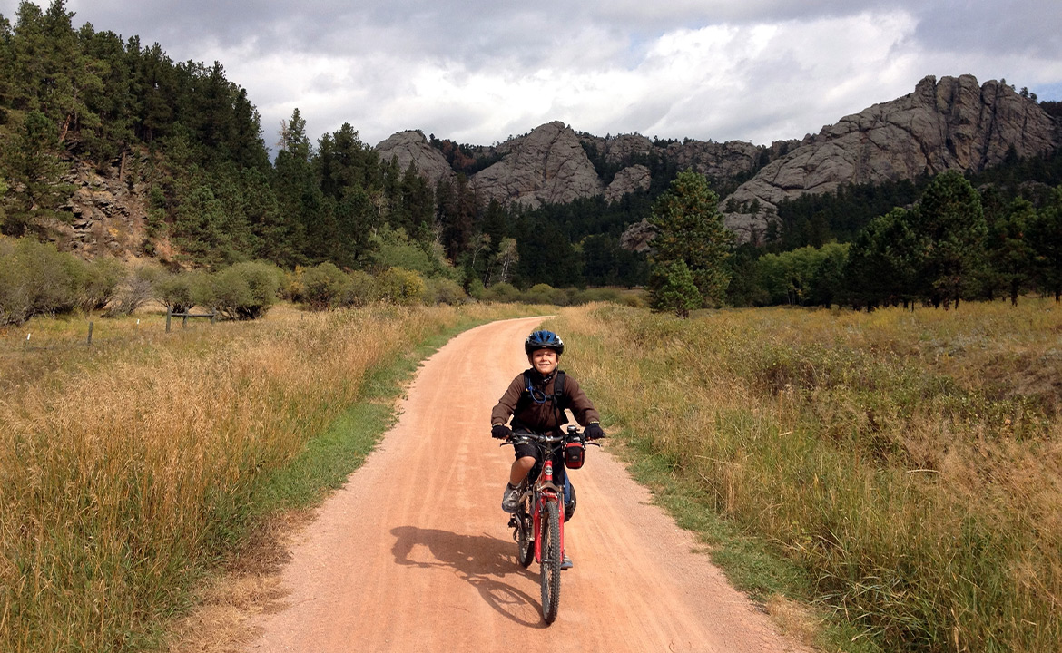
Pedal on South Dakota’s first rail-to-trail project, through the heart of the Black Hills on gently sloping gravel and crushed limestone paths, quietly passing through small towns, spruce/ponderosa forests, grassy meadows, and narrow valleys.

The Mickelson Trail contains more than 100 converted railroad bridges and four rock tunnels. Read a three-day family trip report on our blog with recommendations for sightseeing and accommodations.
Length: 109 miles
Location: South Dakota
Connects to: Parks, Peaks, and Prairies Bike Route (Section 2)
2. Olympic Discovery Trail

Wind across the wild Pacific Northwest’s Olympic Peninsula, with views of snowy peaks, ocean vistas, and clear lakes. The Olympic Discovery Trail links roads and multi-use paths and includes some non-traditional construction, including ship and ferry loading ramps and flat railroad cars with opportunities to spot a variety of wildlife, from whales to spawning salmon to eagles.
Length: 135 miles
Location: Washington State
Connects to: Washington Parks (Section 1)
3. Virginia Capital Trail

Sometimes referred to as “The Cap Trail,” this well-maintained, fully paved trail leads cyclists and pedestrians from Virginia’s current capital, Richmond, to the Colony of Virginia’s original capital, Jamestown. According to a November 2022 update on the trail’s website, over 100 additional miles of multi-use trails that will connect with the Cap Trail are already either in the planning or construction phases.
The Virginia Capital Trail passes over 45 attractions including parks, museums, and historical sites. U.S. Bicycle Route 76 and USBR 176 use part of the Virginia Capital Trail. Enjoy the this trail on our Colonial Virginia Loop guided tour.
Length: 51.7 miles
Location: Virginia
Connects to: TransAmerica Bike Route (Section 12) and Atlantic Coast Bike Route (Section 4)
4. Erie Canalway Trail

Explore the villages, countrysides, and historical sites of the Erie Canal. The Erie Canalway Trail forms the east-west portion of the 750-mile Empire State Trail. The trailway runs from Buffalo to Albany and skirts the bottom of New York’s Adirondack Park, the largest protected wilderness area in the contiguous United States.
Thanks to the kind folks over at Parks & Trails New York, an advocacy group for New York’s state park system, we can offer a detailed breakdown of the Erie Canalway Trail’s surface composition: 45 percent of the trail is paved, 41 percent is a crushed stone surface that is basically as smooth as pavement so long as it’s dry and not newly laid down, and 14 percent of the trail is on the road (and so riders will have to keep alert as they’ll have to share the road with cars).
Length: 360 miles
Location: Upstate New York
Connects to: Northern Tier Bike Route (Section 10)
5. Florida Keys Overseas Heritage Trail

Pedal across the sunny and warm Florida Keys! The Florida Keys Overseas Heritage Trail is part of USBR 1 and passes some of Florida’s most epic wildlife parks, including Everglades National Park and ten Florida State Parks.
Please be aware that some of the parts of the trail may not be open due to hurricane damage. Even with the storm damage, it may still possible to traverse the entire 106-mile corridor from Key Largo to Key West, although riders may have to share part of this journey with automobile traffic.
Length: 90 miles
Location: Florida
Connects to: Atlantic Coast Bike Route (Section 7)
6. Central Lakes State Trail
Pass through open grasslands, farmlands, wetlands, and forested rolling hills from Osakis to Fergus Falls in northwestern Minnesota. The Central Lakes Trail is paved and accessible in winter for snowmobiling (the only motorized vehicles permitted on the trail). It’s part of USBR 20 in Minnesota and also connects to the Lake Wobegon Trail.
Believe it or not, thanks to Minnesota’s arctic winter temperatures, the trail also offers ample opportunity for in-line skating, something that not many multi-use trails in the country can boast. And since the Central Lakes State Trail is 55 miles long, it can be a day trip or a bike overnight.
Length: 55 miles
Location: Minnesota
Connects to: Northern Tier Bike Route (Section 5)
7. Little Miami Scenic Trail

Contrary to what the name might indicate, this trail is actually in southwestern Ohio! It’s fully paved and mostly wooded. Most of the Little Miami Scenic Trail is in a car-free zone called Little Miami State Park and runs along the banks of the Little Miami River, named for the Native American Algonquin-speaking people who occupied the land that the trail runs through before they were relocated by the United States Government.
For any cyclists out there who also enjoy time in the saddle of a different sort, the portion of the Little Miami Scenic Trail that runs through Greene County allows horseback riders. The trail is also part of USBR 21 and USBR 50 crosses it.
Length: 78 miles
Location: Ohio
Connects to: Underground Railroad Bike Route (Section 4)
8. Greater Allegheny Passage (GAP)

Not to be confused with the Cap Trail, the GAP is a rail trail that stretches from Cumberland, Maryland, crosses over the Mason Dixon Line, and ends in Pittsburgh, Pennsylvania. It is part of USBR 50 in both states. Much of the GAP runs along rivers – the major ones include the Casselman, Youghiogheny, and Monongahela rivers – and so cyclists get to enjoy many different riparian benefits, including shade trees, diverse wildlife, and opportunities for a refreshing dip in the water.
Notable pitstops along the GAP include Point State Park in Pittsburgh, world-class white water rafting at Ohiopyle State Park, and the Eastern Continental Divide, which is also the highest point along the GAP at a respectable 2,392 feet of elevation.
When the GAP opened, Pennsylvania was crowned as the state with the most miles of rail trails. Though Missouri has it beat for longest trail with the Katy Trail, according to the Rails to Trails Conservancy, Pennsylvania boasts a whopping 2,214 miles of rail trails in total.
One of the coolest parts of the GAP is that it connects to the Chesapeake and Ohio Towpath – number 9 on our list! – at its Cumberland trailhead.
Length: 150 miles
Location Pennsylvania & Maryland
Connects to: Chicago to NYC (Philadelphia Alternate 1)
9. Chesapeake & Ohio Canal Towpath (C&O)

Together with the GAP, the C&O Towpath forms a 350-mile rail trail system that runs from the Capitol in Washington, D.C., to Pittsburgh, Pennsylvania.
The 184.5-mile C&O Towpath is actually a long, skinny National Historic Park that runs along the C&O Canal. Unlike almost every other rail trail in the country, the C&O didn’t start out as a railroad, but rather as a towpath. Towpaths are just what they sound like: a path along a body of water that allows barges to be towed by horses, oxen, or even by people.
Many rail trails are polished and manicured, but the C&O Towpath is of a different make; although there are a few stretches of crushed limestone and even some posh pavement to be found, the vast majority of the towpath is dirt. It is part of USBR 50 in Maryland and Washington D.C.
Adventure Cycling offers a guided tour of the GAP and C&O canal.
Length: 184.5 miles
Location: Maryland & Washington, D.C.
Connects to: Chicago to NYC (Philadelphia Alternate 1)
10. Katy Trail

Cycle through some of the most scenic and historical areas in Missouri, closely following the Missouri River. The Katy Trail has 26 trailheads and four fully restored railroad depots along the way.
As writer and former Adventure Cycling Association staff member, Michael McCoy, says:
“Katy Trail State Park is one of the crown jewels of North America’s rail-trail system. It follows a former route of the Missouri-Kansas-Texas Railroad – the MK&T, or Katy for short – between Clinton and Machens, Missouri. A quiet artery, the Katy Trail transports cyclists and other self-propelled travelers through the heart of Missouri. On a grander scale, the riverside portions of the trail between St. Charles and Boonville serve as components of a pair of trails that are national in scope: the Lewis and Clark National Historic Trail and the coast-to-coast American Discovery Trail.
The trail takes travelers past dense hardwood forests, wetlands, sheltered valleys, manipulated crop fields, and occasional patches of restored tallgrass prairie. Redbud and a host of spring wildflowers bid colorful adieu to the drab days of winter, while autumn explodes in a multi-colored confusion of shrubs and hardwoods, highlighted with the flaming reds of sugar maples. Some cyclists tackle the entire trail over a period of four or five days, usually staying at indoors accommodations. More common are day trips, either out and back on the trail, or on a loop fashioned by pedaling a portion of the Katy Trail along with some adjacent low-traffic roads. (The contrast is startling: while the Katy Trail is flat and straight, the roller-coaster roads surrounding it are anything but.)
My wife Nancy and I pedaled a day-ride sampler that began in Rocheport, an attractive burg containing numerous bed-and-breakfast inns and pre-Civil War homes. From the trailhead, we rode east on the trail as it squeezed between marshlands to our right and timbered bluffs on the left. Soon we came in beside the Missouri River – wide, deep, brown, and alive with twirling whirlpools and bobbing logs. The sight of scores of swallows darting in and out of their bluffside abodes was accompanied by a less expected vision: that of the occasional Canada goose roosting on a rock ledge. We also spotted red-headed woodpeckers and numerous other birds in huge cottonwood snags protruding from a trailside slough. Looking through a dense veil of vegetation, we could see steep drainage ravines cutting through private lands to the north. Elsewhere, we zipped through sun-dappled fields where gorgeous spreads of spiderwort – with its trio of violet-blue petals and bright yellow stamens – rivaled the electrifying brilliance of an indigo bunting we saw flashing past. At our turnaround, near a series of sycamore-smothered bluffs, we watched blue herons standing tall in wetlands lying between the river and the trail. On returning to Rocheport, we stood on the bridge spanning Moniteau Creek, peering down at the water to see red-eared sliders drifting downstream aboard logs.”
If you’d like to ride with others, Adventure Cycling offers a week-long guided inn-to-inn tour of the Katy Trail.
Length: 240 miles
Location: Missouri
Connects to: Lewis and Clark Bike Route (Section 1)
Bonus Combos!
Minnesota Combo: Central Lakes + Lake Wobegon + Lake Wobegon Spur + Soo Line + Paul Bunyan State Trail + Heartland State Trail
Want to see more of Minnesota? We already talked about how cool the Central Lakes Trail is; link these rail trails across the state for a longer journey to pass epic scenery, towns, and historical sites. Use Adventure Cycling Association’s Northern Tier Route Sections 5 and 6 maps to navigate between them.
Combined length: 323.9 (Central Lakes, 55; Lake Wobegon, 65; Lake Wobegon Spur, 12.9; Soo Line Trail, 27; Paul Bunyan State Trail, 115; Heartland State Trail, 49)
Location: Minnesota
Connects to: Northern Tier Bike Route (Sections 5 and 6)
Indiana Combo: Converse Junction Trail + Sweetser Switch Trail + Cardinal Greenway

This is Indiana’s largest span of recreational trails. The Cardinal Greenway hosts events throughout the year for cyclists, walkers, and runners. Use Adventure Cycling Association’s Chicago to New York City Bike Route Section 1 map to navigate between them.
Combined Length: 68 miles (Converse Junction, 2; Sweetser Switch, 4; Cardinal Greenway, 62)
Location: Indiana
Connects to: Chicago to New York City Bike Route (Section 1)
Additional research and contributions from Tyler Ayers.
