Pacific Coast Route Section 1
46 in stock
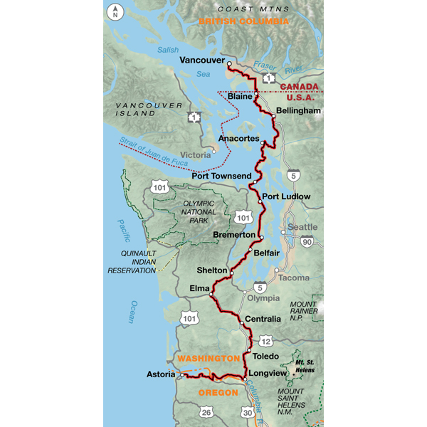
Vancouver is a relatively easy city to bicycle through. After crossing the border into Washington, you'll be riding on narrow two-lane roads on level terrain. There are no shoulders, and traffic is light. Bellingham is a larger town with moderate traffic and some congested intersections. Separated bike paths are used along the route wherever possible. Whidbey Island has occasional rolling to hilly terrain. There are several narrow two-lane sections and congested areas near the island's towns; traffic is generally light away from SR 20. South of Port Townsend, the route is rolling to hilly on mostly low-trafficked rural roads through farms and forests. West of Longview, in southern Washington, SR 4 carries moderate recreational traffic in the summer. After crossing the Columbia River via ferry, in Oregon, you'll ride west on US 30, which carries moderate traffic and has shoulders most of the way into Astoria, the beginning and end points for the TransAmerica Bicycle Trail and the Lewis & Clark Bicycle Trail.
Map Resources
- Map Features
- Map Updates and Corrections (Addenda) - Always be sure to check for map updates and corrections before leaving on your trip.
- Temporary Road Closure Information
- Frequently Asked Questions



Reviews
There are no reviews yet.