Parsing the New Parks, Peaks, and Prairies Route
Adventure Cycling cartographers are overjoyed to announce the release of the latest route in the Adventure Cycling Route Network (ACRN): Parks, Peaks, and Prairies Bicycle Route. This new route marks a major milestone in the ACRN map canon, as it pushes the total cycling route miles to 50,000. For those of you keeping count (as we do), this is the equivalent of completing a circumnavigation of the earth’s equator— twice! But enough accolades, let’s talk about the route.
The Parks, Peaks, and Prairies Route (PPP) fulfills a request posed by many of our members over the years for a more northerly connector between the TransAmerica Trail and Northern Tier Route. While the TransAm in Kansas (probably the ACRN’s most pedaled Great Plains crossing) winds through prairie towns that routinely rate high for bike-friendliness, it doesn’t boast passage through the same wealth of iconic American parks and landscapes that PPP does. And it would behoove us to support the opportunity for long-distance cyclists to check off these majestic places from personal bucket lists— plus have a rollicking great bike ride along the way.
The names speak for themselves, in almost reverential whispers: Yellowstone, Devils Tower, Mt. Rushmore, The Black Hills, The Badlands, and, yes, Wall Drug. PPP visits all of these, not to mention the lesser known gems like Buffalo Bill State Park, Bighorn National Forest, Keyhole State Park, Custer State Park, Buffalo Gap National Grassland, Oakwood State Park— each one worth a visit in their own right. And then, digging deeper and in between the big tourist draws, the endeavoring cyclist will discover even smaller treasures in the county and city parks of far-flung locales that dot the mountains and prairie. Prime examples of these include Spearfish City Campground, Memorial Park in Huron, Beaver Falls, Lake Allie, Ramsey Park in Redwood Falls, Masonic West River Park in Hutchinson, Carver Park Reserve and Minnehaha Regional Park nearer to Minneapolis.
The route itself stretches for 1287.7 mi. from West Yellowstone, MT to Minneapolis, MN, which we’ve managed to map in three sections. Route design was conducted by John Egan, a long-time member, avid cyclist, and frequent ACA forums contributor from the on-route town of Buffalo, WY. Route research occurred during the spring/summer of 2019 as a more-or-less concerted effort between various ACA staffers, including a significant portion through South Dakota and western Minnesota that was tacked onto the start of a staffer’s family bike vacation in the Black Hills! Field data processing and map cartography occurred from fall 2019-spring 2020.
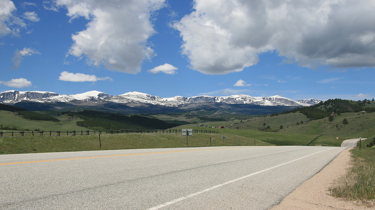
Coming in at 398.1 mi., Section 1 begins in West Yellowstone and strikes eastward across the Yellowstone Plateau. Within the park, the route passes several popular landmarks including Gibbon Falls, the otherworldly Norris Geyser Basin, the towering Lower Falls of the Yellowstone and Fishing Bridge. From the shore of Yellowstone Lake, it embarks upon a steady 1,000 ft. climb to Sylvan Pass before descending to the North Fork Shoshone River and the stunning Wapiti Valley. From here, expect to get friendly with miles of riverine mountain views and vast sagebrush basins often supporting more pronghorn herds than passing cars. East of Ten Sleep, lushly-irrigated river roads bring riders into the cliffy maw of Ten Sleep Canyon and the surmounting of the immense Bighorn Range ensues— a climb of nearly 5,000 ft over roughly 30 miles.
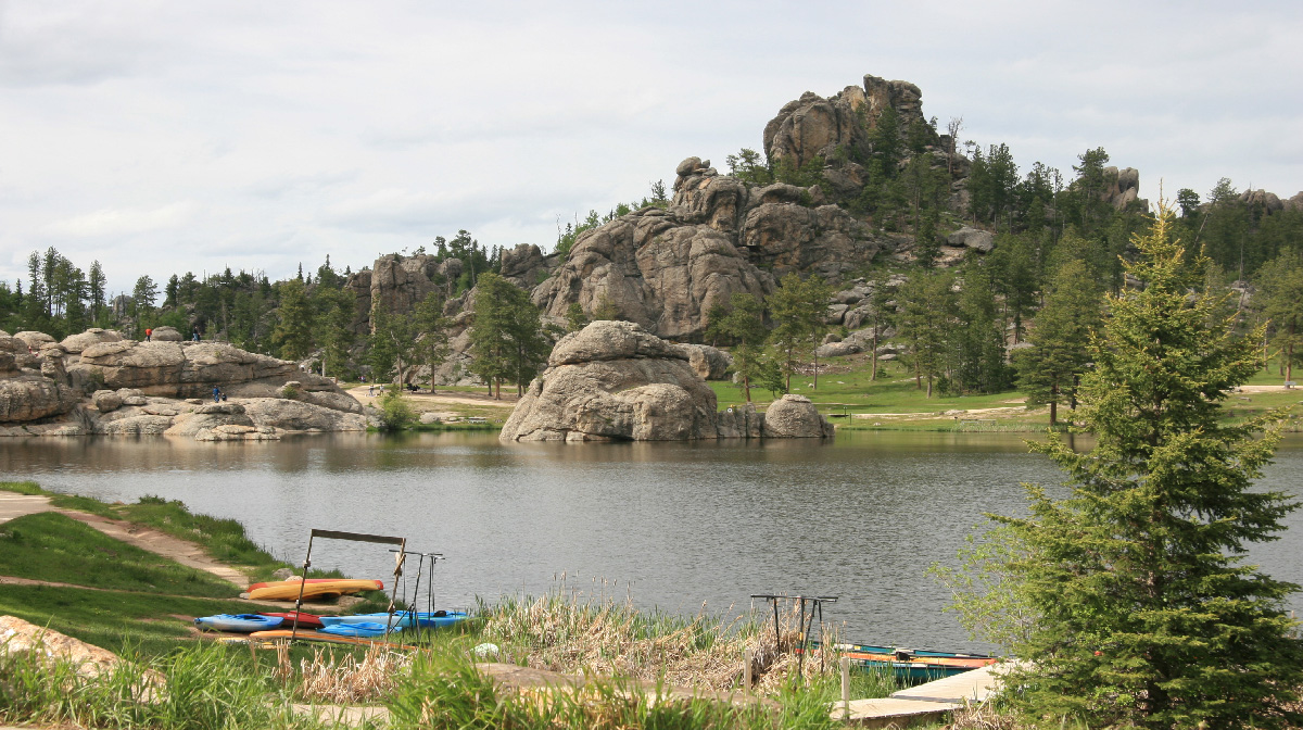
Section 2 includes 379.7 miles along a stretch of routing that is destined to become a cyclo-touring classic. Within 50 miles of the route start in Gillette the sharp pinnacle of Devils Tower is seen thrust over the horizon, and then the hits just keep coming: Spearfish Canyon, The Black Hills, George S. Mickelson Trail, Mt. Rushmore, the Needles Highway, Rapid City, The Badlands and Wall Drug. Riding conditions and landscapes are also richly varied— one can be cruising an unpaved, flat straightaway on a separated converted railbed along a creek in the morning, and grunting up a 10% grade on immaculate pavement along a road-crest through exposed mountains in the evening. Services and scenery are generally ample although a call ahead is recommended during summer months, especially in August when the Sturgis Motorcycle Rally occurs in the region.
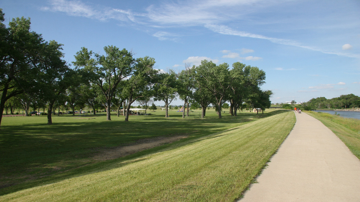
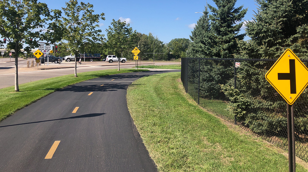
Section 3 of PPP makes valid the use of the word “prairies” in the route name, as almost 510 miles pass through this green and grassy ecosystem. This long section begins in small-town Midland, SD and contours through more forgiving terrain than the previous two route sections. The way follows mostly quiet secondary roads and soon becomes a showcase for more small prairie towns, most of them lost either to history or the interstate highway. Around the Minnesota state line, the surrounding grasslands begin to gradual fill with small pocket lakes, as indicated by the honking, squawking, and quarrelling of many water bird species. Camping is available at several lake parks, and services generally increase toward the Twin Cities. Undoubtedly, a great feature of this section greets eastbound cyclists in Hutchinson, MN where the route hops onto the Luce Line State Trail— the first of seven separated, level, often paved bike paths that put a memorable bow on the final 74 miles into Minneapolis and the end of an epic connection.
Maps and GPX Data are available at our online store or purchase the route on the Bicycle Route Navigator app. For a comprehensive route overview, be sure to check out ACA’s PPP route page with detail maps, planning resources, elevation stats and additional information.
Minneapolis/St. Paul International Airport is bikeable from the route terminus at Fort Snelling State Park, and West Yellowstone boasts a domestic airport. For those seeking to stay in contact with the ground, the route is a 10-mile ride on paved, signed Mississippi River bikepaths from the Amtrak Station in St. Paul, which offers checked bike service.
The Adventure Cycling cartographers and everyone on staff at Adventure Cycling are pleased to share this exciting new route. If you are a Twitter user and want to share or learn from others via tweet, please include the hashtag #acaPPP.