Oh, Canada!
When I first developed my desire for bicycle travel, my home country of Canada was the last place on my mind. It didn’t feel like much of a “destination” when I was already there. Places like Mongolia, Tajikistan, Pakistan, and Australia beckoned me the most. I wanted to experience the unfamiliar — vast deserts, steppes, high Himalayan villages. After almost two years of cycling around Asia, Australia, and New Zealand, I returned home, fearful of a return to the familiar that I had longed to escape from.
But when I returned, I found myself growing finely tuned to all the subtleties that defined Canadians. I had missed hearing Canadian accents on the radio. I fell in love with the scenery and the small Northern British Columbia towns. I felt like I was learning a new culture again, even though it was my own that I had lived with for 32 years of my life. Still buzzing with the desire to travel by bike, I hatched a new plan. I would ride the entirety of the Great Divide Mountain Bike Route, starting from my home in Dawson Creek, BC, Canada.
A few things delayed my expedition — a new romance and a knee injury ended the ride in 2018 in Canmore, Alberta. The following year, fully rehabilitated, I set out to continue my journey from the same driveway of my Warmshowers hosts where it had ended the previous year. I altered my plans slightly. Bikepacking Roots had just released the Western Wildlands route, which passed through Montana, Idaho, Utah, and Arizona. It was a great dream of mine to visit the deserts of the American southwest, so I decided to take the Great Divide route to the Canada/U.S. border before linking it to the Western Wildlands route.
I was ready to experience Canada as a bikepacker. The Great Divide route was a love letter from my home country, and I invited her in with open arms.
![]()
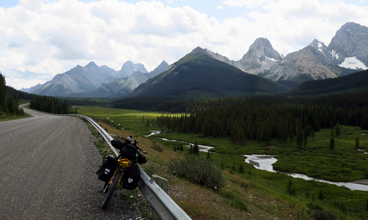
The Goat Creek trail near Canmore, Alberta, carved a wide path through tall conifers like an untamed version of a hedge maze. I was completely alone, riding blissful doubletrack with glimpses of the Rockies poking through the mist. It had rained heavily the previous night while I hid out in the home of Warmshowers hosts in Canmore. That morning, the thick air felt heavy on my skin, clinging like a film that I wanted to peel off. Everything was hydrated, fresh, and oozing with life. Eventually, the trail widened into a clear-cut for power lines and headed to the Spray Lakes Road.
Entering Kananaskis country, the mountains seemed to swell in size. The surrounding lakes copied their perfection in calm reflections. Often, the dirt road skimmed right along the edges. The feeling of isolation started to disappear with an increase of summer tourists in vehicles. After passing through some busier campgrounds, I followed a section of paved bike path that eventually turned to rougher dirt. It was nearly the end of my first day on the road, and I began the search for a place to wild camp. It was tricky with the dense woods, but I eventually settled on a spot by a creek, though a bit cramped in the trees.
I have camped many hundreds of nights solo, but I admit that I have never fully overcome the fear of bear country, in particular, grizzly country. I took all the precautions — hanging my food, not cooking near my tent. Luckily, fatigue overtook my nerves, and I was able to sleep soundly in a darkness that fell over me like a heavy cloak.
The following morning, bears were still on my mind. With over 15 years of experience in the forestry industry, I was well used to existing alongside them and always tried to notify them of my presence. When I left my campsite that morning, I got into my routine of yelling out occasionally to let them know I was around.
To begin the day, I rode uphill along a power line trail and got into a rhythm of heavy breathing. Mind focused, I forgot about bears and stopped conversing with them. As I crested the top of the hill, my Zen climbing state was immediately broken. A grizzly sow and two cubs rambled maybe 50 meters away.
Sh*t, sh*t, sh*t … don’t panic …
Luckily, mama didn’t seem phased. I got off my bike and talked in low tones.
“It’s okay, bear … it’s okay … ” I said in my best, deepest baritone impression.
I continued to walk backward slowly with the bike until I was quite a good distance away. She wasn’t following me, so I went back the way I came, all the way down the hill I had just spent almost an hour climbing. There was no way I was riding past them! I found another mountain bike trail that would scoot around the original power line route and eventually reconnect to it at Elk Pass, where I was headed.
Along the alternate trail, my body felt tight the whole time. I hoped that she wasn’t moving in my direction. The trail became very steep and rejoined the power line trail at the pass. I emerged from the trail very cautiously, looking left and right. No sign of them. For dealing with hours of crushing anxiety, I was rewarded with a spectacular descent. The seemingly endless shelter of trees drew back its curtains to reveal a sky dominated by giants of rock and ice. After a ridiculously fun and bumpy rip downhill, I landed on one of the most stunning sections of road I have ever ridden.
The fierce figures of the Rockies dominated the skyline. On my descent to Elk Lakes Forest Service road, they seemed so close that I felt like I would crash right into them. This view went on for miles. Sadly, the illusion of untouched wilderness eventually disappeared and proud stands of conifers were replaced by clear-cuts. The patchwork hillsides resembled a wounded animal with chunks of its hide torn apart by predators. Then, after many hours of seeing no vehicles and no humans, a man in a white pickup pulled up beside me. He had a long, scraggly white beard and a raspy voice.
“Are you headed to New Mexico?” he asked.
“Arizona … Mexican border,” I said.
“There was an Irish guy on a bike that passed by earlier today and he was headed to New Mexico. Pretty far!” he laughed.
Although it was brief, it was the only conversation I had with anyone over the last few days. As a result of many years travelling solo, spontaneous conversations with strangers never seem to get old.
Not long after, I spotted another grizzly cub on the side of the road. Luckily, another pickup passed me and scared the bear off. I hoped and hoped that mama wouldn’t show her face. One encounter was enough excitement for the week.
With little traffic the rest of the day, it was just me alone in the shade of the trees, broken apart by the odd section of clear-cut. I reached Round Prairie, barely a settlement with only a few houses. This was the start of the singletrack section that I was a bit apprehensive about. My Thorn Nomad was a heavy brute of a bike, better suited to dirt roads and ATV trails. I ended up managing better than I thought and began to enjoy the challenge of it. I loved the winding bits through the woods, the foliage catching the sun’s rays and dispersing them in golden strands. The trail descended into Elkford, where I beelined it to the gas station for its offerings of salt, sugar, and calories. I settled for some late-morning instant noodles, eating them at a picnic bench outside with a crew of colorful local characters — some retired, some just avoiding work. I told them my grizzly story, and they followed with some bear stories of their own. Apparently, there were a few “locals” around town that were spotted often. They even had names for some of the bears and complained about them like surly neighbors.
I left Elkford on some more singletrack toward Sparwood, BC, mainly passing through more clear-cuts. I wondered how long the area had remained forested after the route was created. The ride highlighted the duality of Canada’s wilderness. We are a natural resource economy, and it is reflected in the landscape. Just because you can’t always see it, you can’t deny its existence.
In Sparwood, I met up with friends who took me to their home near Frank, Alberta, in the Crowsnest Pass. I spent a day canoeing on a scenic lake, a refreshing change from the bike saddle. After waiting out a day of rain, I got a lift to Corbin Road so I could skip a section of highway from Sparwood.
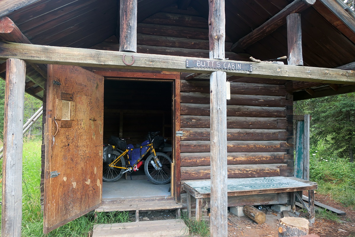
After watching my friends’ pickup disappear, I looked ahead of me with a bit of a clenched stomach. This was the gateway to the Flathead Valley, one of the remotest sections of the entire Great Divide route. This area is nicknamed “Grizzly Alley” and the “Serengeti of North America” due to its high concentration of wildlife. It was recommended to avoid tenting if possible so I had planned to sleep in the two wilderness cabins open to travelers along the route. Butts Patrol Cabin was a little over 50 miles away. Normally, this distance wouldn’t be an issue, but I had heard about the especially rough road conditions of the Flathead Valley. I really hoped I could make it.
The start of the Flathead Forest Service Road was a muddy mess, created by the heavy rain from the previous day. The ATV was the steed of choice here with engines revving as they whipped past me in groups. The road started to improve as it dried out and I moved along at a good speed. Aside from the odd ATV parade about once per hour, I had this wonderful place to myself. The dense forests of the valley inched up the mountainsides. This was a truly wild landscape, free of the scars of clear cuts and seismic lines. Unfortunately, the smooth dirt didn’t last long. The road became increasingly rutted and rocky. It degraded to a trail and then a full-on creek bed. The stream and the “road” became one. This brought to mind one place I’d ridden in the Indian Himalaya in 2015. My Himalaya By Bike guidebook highlighted this particular section of road that locals described as “so bad that even the goats won’t walk on it.” If there were goats in the Flathead Valley, I am sure they would have used similar discretion.
I spent the next hour or so pushing and carrying the bike through shallow water rushing over rocks. My feet were soaked, and I took care in my cleated shoes. One couple was insane enough to attempt the trip in a Jeep. Many times, I thought the vehicle would bound off of the rocks and onto its side. I was amazed when they made it across. A motorcyclist told me that he saw someone attempt to go through with a camper. I saw various remnants of vehicle parts along the way, scattered about like bones from a kill. Then there was a section of the camper, sinking, defeated into the ground. The water rushed around it, forging a path through the man-made trash as if it were millennia-old rock.
Fortunately, I hit smooth dirt again. I was able to reach Butts Cabin much faster than predicted and lucky to have it all to myself. It was spartan, dirty, but housed stories of thousands of bicycle travelers over the years. I was so tired that I probably could have passed out peacefully in a ditch, undeterred by my surroundings.
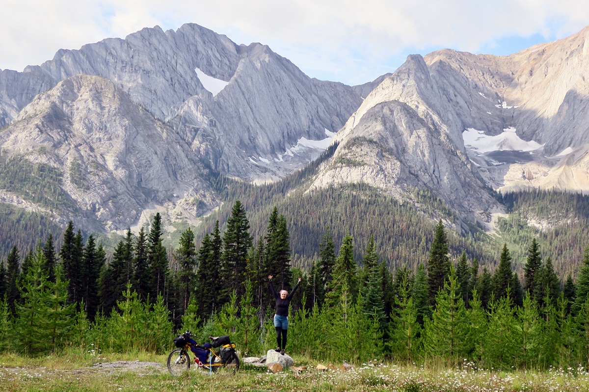
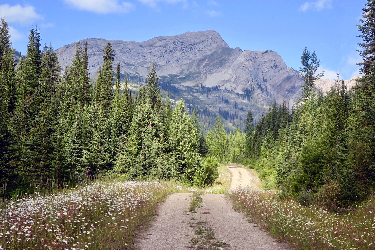
I woke up the following morning unaware of what I was in for. I will never forget that day because it is one of the best I have ever had on a bike: perfect solitude on a lonely doubletrack climbing steadily toward Cabin Pass. The wind moved with the flickering of light across the grass, gently rippling like an ocean. Purple, white, and yellow wildflowers lined the path, softly illuminated by the sunlight. Drifting clouds created shadows that shifted on the high peaks, defining its contours. The light breeze was just enough just to tickle my face and not hinder my forward progression. I had my eyes locked on a track that I felt like I could ride on forever.
Bliss on a bicycle — this was it.
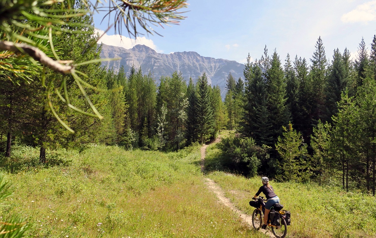
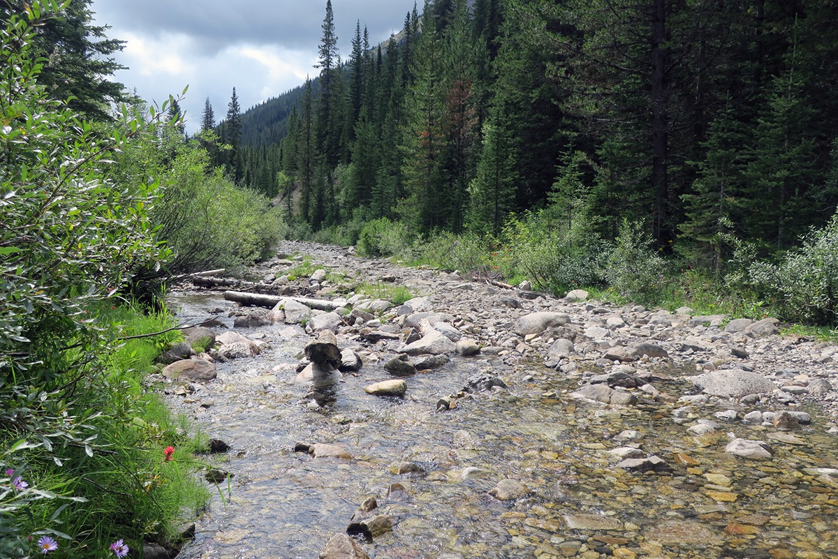
The descent from the pass to Wigwam River Road was rocky and jarring. I passed one parked government vehicle, the only sign of human existence I had seen for about half a day. Wigwam River Road was closed to motorized vehicles. It was another lonely and beautiful stretch of smoother doubletrack riding. I stopped to fill my water bottles in a stream. Afterward, I sat beside the creek, listening. In those slow minutes, I was suddenly not a cyclist on a quest but an observer, an audience member listening to a chorus in song. The flow of water, the shuffle of leaves in the wind, the cracking of branches.
![]()
I saw two figures approaching in the distance. It was a pair of French cyclists, riding from Whitefish, Montana, to Banff. We didn’t chat for long, as they had a goal to make it to Butts Cabin, which was still a significant distance away with a hefty climb. I was so caught up in the thrill of the day that I completely forgot about one significant hurdle ahead: the infamous “wall.” I should have asked those cyclists about it. The “wall” as I read in various Great Divide tales is a crazy steep and grueling section of hiking trail, where carrying the bike is necessary. I felt overconfident.
I turned off the doubletrack onto a stretch of singletrack that I pedaled awkwardly or walked. It snaked through the woods and eventually followed the edge of the river. I grew tired of it after a few miles, missing the smoother dirt track. Then, I saw the beast — the “wall!” The track turned sharply away from the river and shot up at a crazy steep pitch. This looked worse than I had anticipated. There was no way I could push the bike up fully loaded, so I started by removing my small rear panniers. I did my best to psyche myself up. Here we go.
My calves burned and burned as I pushed and heaved the bike upward. I was only able to make it halfway without taking a break, and then I could only move in intervals of a few feet at a time before squeezing the brakes hard and fighting the pull to fall backward. When I made it to the top, I went limp and collapsed against a tree. I sat there for a few minutes mustering up the energy to return to the bottom for the panniers. It was still uphill from there, but luckily only a gentle push on more singletrack after which I could finally see a dirt road as the denser forest opened up to an immature pine stand. The goal for the day was Trappers Cabin, only about six miles away, which at the time felt like 600.
With useless blobs for legs, I soon came to a pile of wood planks on the side of the road, which looked like an old cabin that had been destroyed. Nooo! Exhausted and disheartened, just as I was about to ride on, I decided to look at my Adventure Cycling Great Divide route map. The map showed the cabin about a quarter of a mile down a side road at the junction where I was standing. I turned left, crossed a small stream, and climbed a bit of a hill. Sure enough, there was the cabin. Phew! It was tiny and dusty, similar to Butts Patrol Cabin, and I was the only occupant for the night. Another rustic mini haven away from the grizzlies. I was too tired to think, almost too tired to cook. The “wall” had beaten me down. Just before bed, I took some time to read some of the messages carved into the walls from previous cyclists, and I decided to add my own little piece of history. And what a day in history it was. Spectacular, enlightening, grueling — I’ll never forget it.
Daylight warmed the chilly interior of the cabin. I made my usual lackluster breakfast of peanut butter on pita bread and prepared for my last day in Canada. I still had some climbing to reach Dalton Pass, followed by a steep and rough descent to the U.S. border at Roosville, Montana.The descent was just as challenging as the climb, with my hands going numb from all the braking. The forest began to change as I dropped in elevation. White spruce thinned out and made way for large stands of ponderosa pines. The land felt drier. I thought of the thousands of miles ahead to the great deserts of Utah and Arizona.
![]()
The customs officer wished me well on my journey ahead. I could feel the forward pull of America, but not without acknowledging the enormity of what I was leaving behind.
I had always chased the lure of the unknown, ignorant of what was on offer in my own land. The Canadian section of the Great Divide Mountain Bike Route was, without a doubt, one of the best routes I have ridden in the world out of the 21 countries I have cycled. The weather was eerily perfect — a blessing in a mountain environment. I felt strong and incredibly motivated. I developed a love for my homeland like I had never felt before. But, like any love, it is a complicated one. In between great tracts of wilderness is scarring evidence of Canada’s (and the world’s) hunger for resources. I relished the beauty of what remains in the Western Canadian wilderness.
On a bicycle, the world unfolds slowly before our eyes. Here was my Canada, opening a backdoor and letting me in on her greatest secrets.
This time, I listened.
