Log Driver’s Waltz Bikepacking Route
The city of Ottawa conjures up images of the majestic parliament perched upon the tall cliffs overlooking the Ottawa River juxtaposed with the glass-domed National Art Gallery and the Rideau Canal locks, a UNESCO world heritage site. Positioned at the intersection of three river systems (the Ottawa, Rideau, and Gatineau Rivers), Ottawa was the perfect location for loggers to float their freshly cut lumber down the rivers to be milled in the lumber yards that have since disappeared. To support the thriving logging industry, villages and roads were built for hundreds of kilometers around Ottawa enabling travel and commerce. Today Ottawa is a bustling metropolis with over one million inhabitants.
Winding through the lands of the Anishinaabe (Algonquin Peoples), the Log Driver’s Waltz bicycle route is a 797-kilometer bikepacking journey around the Ottawa Valley that displays the bounty of this First Nations territory and follows the paths of the pioneers and log drivers who created the forestry industry. The route explores the old log drivers’ villages and roads on the Ontario and Quebec sides of the Ottawa River Watershed.
The Creation of a Route
Adventurers Jen Adams and Eric Betteridge completed the Butter Tart 700 bikepacking route in southwestern Ontario in 2019 and felt compelled to create an equally challenging and inspiring route around their home of Ottawa. They reached out to the Butter Tart 700 creator, Matthew Kadey, who proved to be a willing mentor. Over the winter of 2019–2020, Eric and Jen pieced together a journey that guides cyclists through the beautiful natural and cultural landscapes the area has to offer, not in a straight line from beginning to end but following the most scenic roads and trails. Named after a song called the Log Driver’s Waltz, Eric and Jen felt the name best represents the region’s history.
Jen and Eric first designed the route on paper along with help from the Backroad Mapbook. Soon they had a draft version of the route on RideWithGPS. Then, every weekend in the spring of 2020, they would ride different segments of the route to select the roads and trails that would provide the kind of gravel, singletrack, and doubletrack adventure they desired. They often rode two or three optional routes before deciding on a final segment, ensuring routes were not private lanes or flooded at various points of the year. With Matthew’s assistance, Points of Interest, or POIs, such as campsites, hotels, shops, and other service information were logged into RideWithGPS, enabling easy planning for future riders.
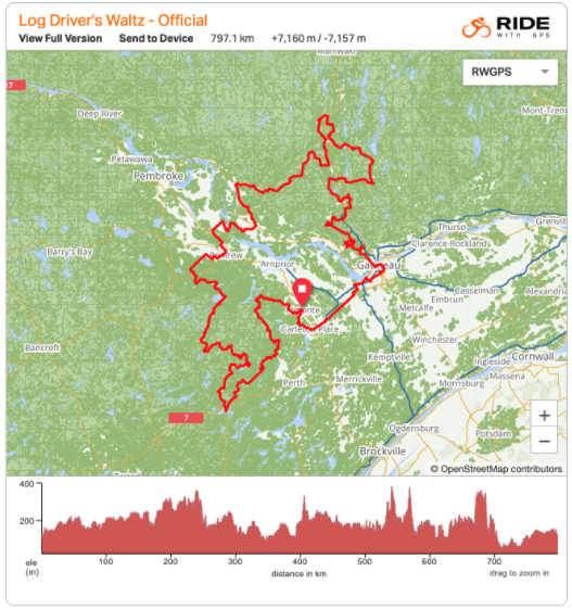
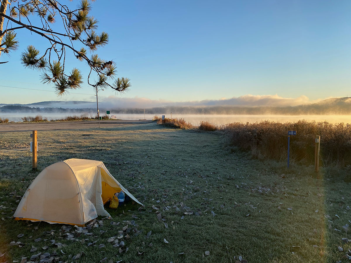
Overall, the route has 7,160 meters of climbing with tarmac, gravel, and single- and doubletrack surfaces. Once on the route, you quickly find yourself on quiet roads with deer, bear, coyote, and abundant rodent sightings. You will also find yourself in areas with no cell phone coverage for several hours, yet the route itself is never more than 120km from the city. As the route has attracted more and more riders, B&Bs, hotels, campgrounds, and farms are now catering to the cyclists. One cottage owner wants to become a “trail angel” and is planning to build an outdoor shower and tent platform for bikepackers to use.
Route Details
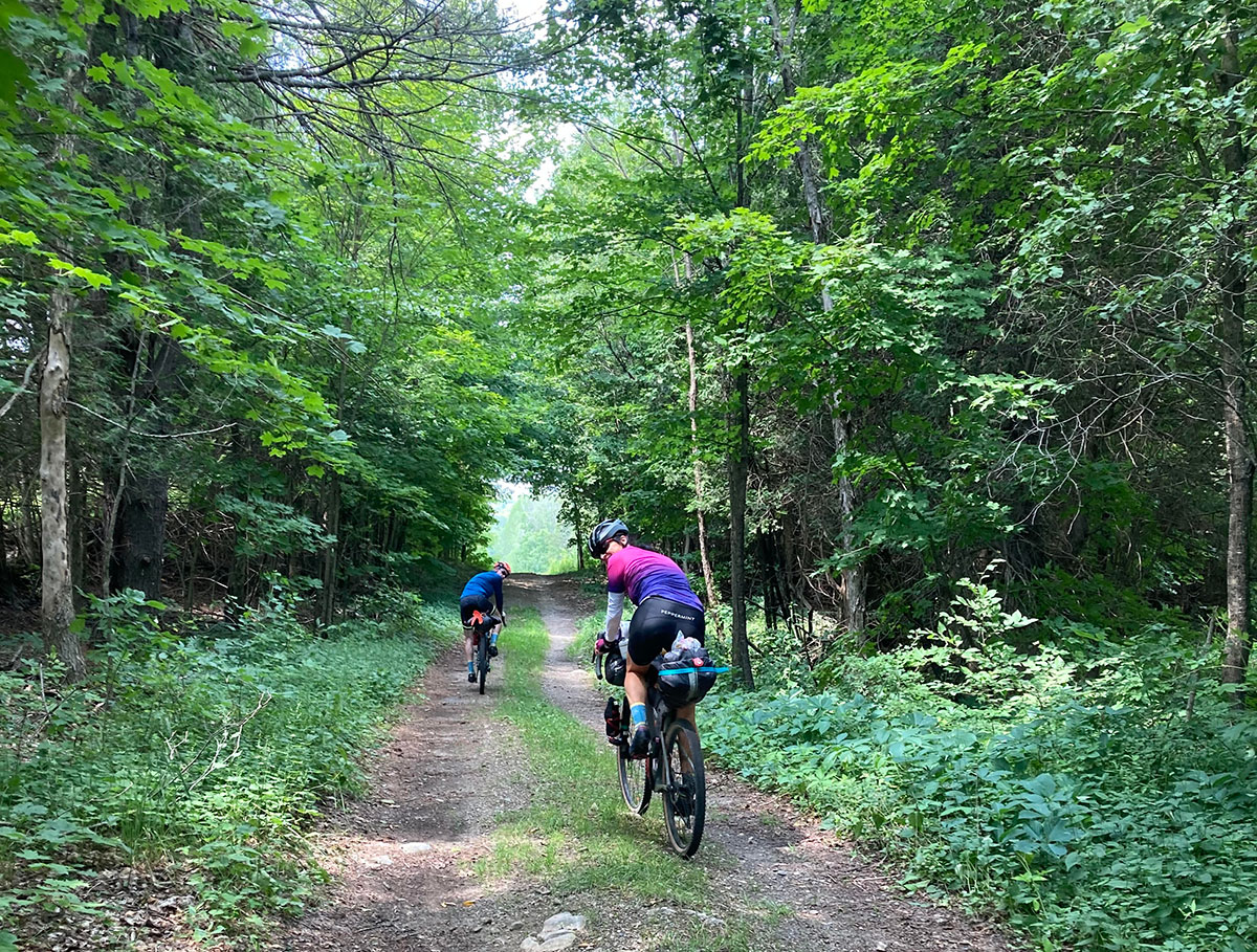
The official start of the route is in Almonte, Ontario, a beautiful village with old stone buildings on the Mississippi River (no relation to the river of the same name in the U.S.). However, you can start anywhere along the route. From Almonte, the route heads north and then meanders along old gravel roads toward the south to Sharbot Lake. There are two extraordinary segments along this part of the route. One is the California Road Trail, an old bush road that provides plenty of shade and rolling gravel and dirt during hot summer months. The other is the Bathurst Line Trail, closer to Sharbot Lake, which is barely a road and should be classified more as an ATV track or snowmachine trail, as it’s a very technical 25km section that gradually climbs 50 meters. The Line itself is rich with the history of old stone walls and wooden fences buried beneath second- and third-growth forests.
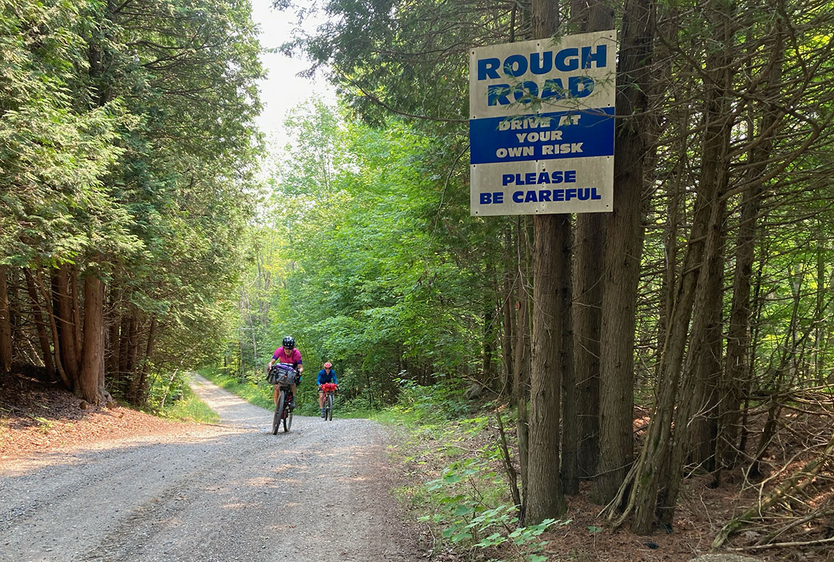
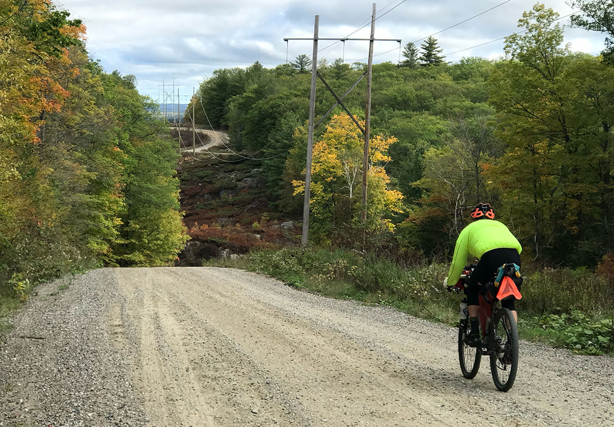
Another challenging and epic section of the route without cell phone coverage is the Arcol Road through the Frontenac Highlands. It is a bush road with a never-ending series of steep rollers and singletrack trails connecting different sections. At one point, we found a paved section and thought we were in the clear, but it was only paved briefly as the grade approached 20 percent. We figured the local township wanted to avoid the road washing away in the rain. I recommend bringing plenty of water and food before entering this segment — it was the slowest part of the route.
After the Frontenac Highlands, you explore a series of villages in the Ottawa Valley such as Calabogie and Renfrew. Beyond the Renfrew Swinging Bridge, you follow old farm roads to the Ottawa River and the Chenaux Dam where it crosses to Portage du Fort into Québec. Once in Québec, the route zigzags to Shawville and then north along the PPJ trail to Campbell’s Bay before starting the long and gradual climb into the Gatineau Hills.
Once over the top of the Gatineau Hills, the route takes you north on the Véloroute des Draveurs trail (Draveur is the French word for Log Driver) to the most northerly point, Gracefield, where you cross the Gatineau River for the first time out of four crossings. From there, you head southeast along some of the most challenging climbs of the adventure, through Mont Sainte-Marie, a popular ski and mountain bike resort, then on to remote cottage roads that eventually bring you west again to cross the Gatineau River at the Paugan Dam.
From Low, the village next to the Paugan Dam, you meander along farm roads until you eventually cross the Gatineau River two more times including the historic covered bridge in Wakefield.
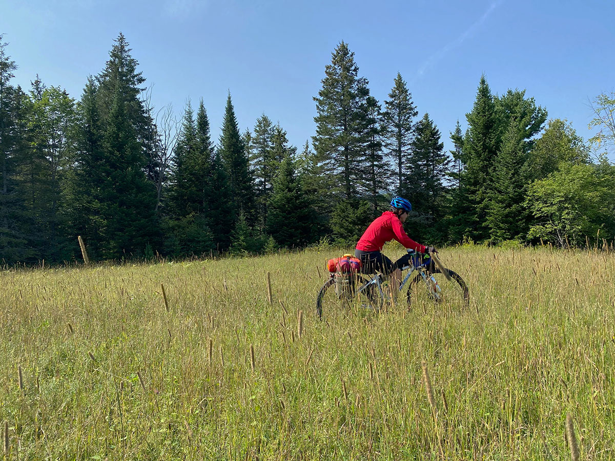
From Wakefield, you climb a singletrack trail into the Gatineau Park, the national capital conservation region. From my perspective, this is the best segment of the route. For the next 80km, you follow singletrack and doubletrack trails through one of the most majestic conservation areas in Canada. The trails in this section are tough with many hike-a-bike sections — all worth it due to the incredible scenery and beautiful lakes such as Taylor, Philippe, and Meech Lakes.
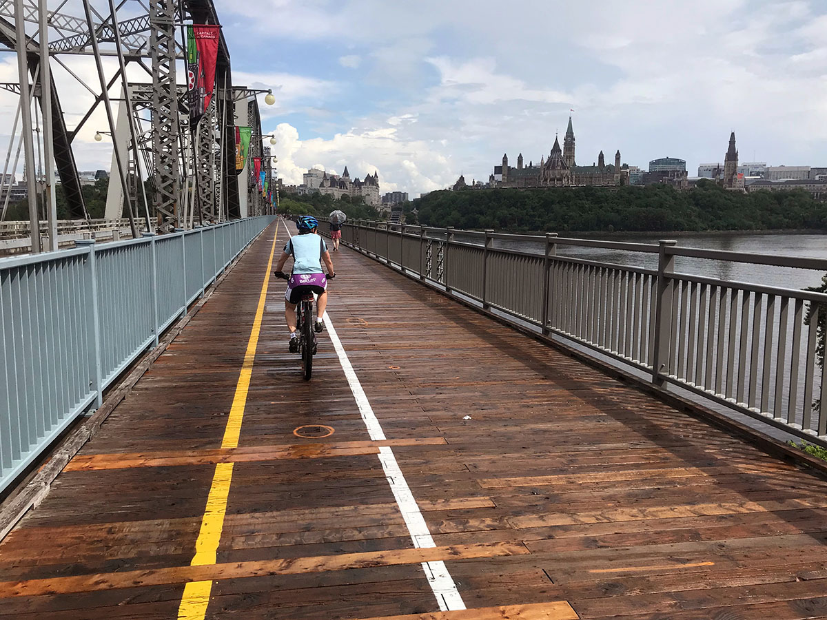
Once you pop out of the Gatineau Park, you follow bicycle paths along the Ottawa River past some of the most impressive architecture in Ottawa — the Museum of Civilization, the National Art Gallery, Parliament, the National Arts Centre — and you ride along the Rideau Canal, a protected World Heritage Site. From Ottawa, you follow the Trans-Canada gravel trail, a straight line to Carleton Place, and then ride quiet roads back to the start in Almonte.
At present, Thom Unrau holds the fastest known time of two days, seven hours, and 10 minutes. Most people, however, plan five to eight days to complete the route. In August, Jen and Eric have a Grand Départ, with registration numbers expected to grow. There are two routes to choose from: the LDW Full at 800km and the L’EGGS at 350km.
If you want remote roads, deep forest escapes, challenging climbs, beautiful vistas, and hospitable French and English hosts on your bikepacking journey, then add the Log Driver’s Waltz to your bucket list.
