In the Shadow of Mount Shasta
Every year in the weeks leading up to Thanksgiving, I waffle on whether to host a meal with friends or take off on an adventure. I’ve done both and enjoyed both immensely, but somehow, every year I seesaw on what to do with my all-too-precious days off work.
Back in 2016, I had another set of days off, this time in the summer. I emphatically decided I would take my then-boyfriend Tom on his first-ever bike tour. He had ridden and raced road bikes and mountain bikes for years but had never traveled by bike. To top it off, he was about to turn 50 years old, and he said it was something he had always wanted to do. I helped him pack and decided I would oversee food. I would ride my classic four-pannier setup on a Surly Long-Haul Trucker, and he insisted on pulling a BOB trailer with suspension behind an aluminum touring bike he had just bought.
We came up with a loose route on a paper map, covering about 180 miles in five days. Still ignorant of the ease of digital maps, our AAA map left a lot of detail to be desired and was about 10 years out of date. Instead of finding a better map, I focused on cleaning out the fridge to bring everything that might go bad while we were gone. I packed more food and more produce than usual, and it would be a fortuitous decision.
Waking up at dawn, we loaded quickly and drove four hours from our house on the North Coast of California to Mount Shasta, an idyllic mountain town at the base of its namesake. We parked my hatchback at a friend’s house and took off on our kidney-bean shaped loop to the east, through the ancestral lands of the Shasta Tribe, toward the ancestral lands of the Modoc and Achomawi Tribes. Bumbling our way out of town, we ended up on Highway 89, the only road that connected. Its high-speed traffic was terrifying, but I saw no other option. I could tell Tom was nervous. I shakily promised him it wouldn’t always be like this. But in truth, I had no idea what the road conditions would be like. Gravel? Paved? Dirt?
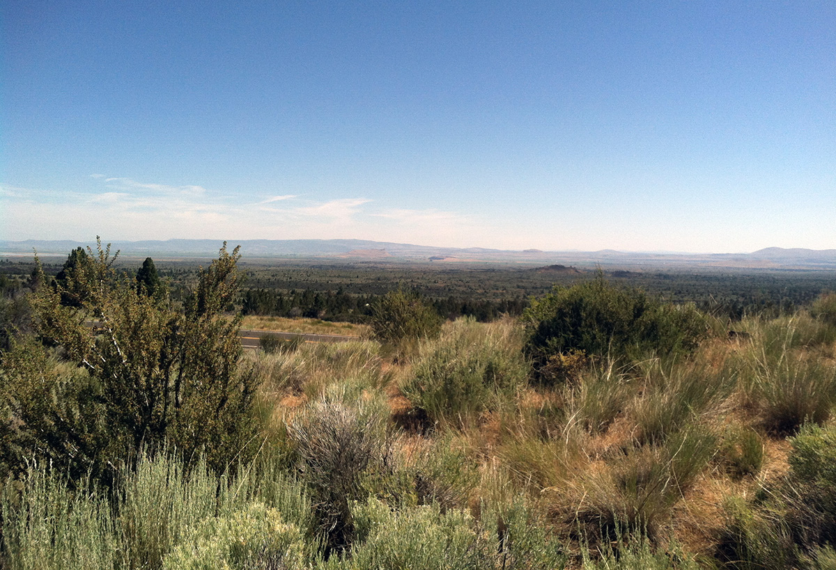
From Highway 89, we went north on a road labeled Modoc Volcanic Scenic Byway. Scenic meant fewer cars. Fewer cars meant fabulous. Over the next four days, the route would weave east and around, across several large and small watersheds and through multiple ecosystems to bring us back to where we had started.
As we pedaled on the scenic road, the familiar butterscotch smell of Jeffrey pine trees welcomed us, and the whole landscape seemed to sigh with relief. The curious deer faces replaced the stressful shhhhhhhh vrroooshhhh of the traffic, and our shoulders relaxed from their hunched, tense positions. Turkey vultures soared above us. That first night, we camped at the edge of a picturesque meadow within the Shasta-Trinity National Forest. Mount Shasta was to the west now, and after a long day full of logistics, we felt like we had made progress and found a rhythm.
The second morning, long hard climbs on pavement through rows of pines led us up to Medicine Lake Volcano, which sits just under 7,000 feet. Medicine Lake at the top is a caldera, a bowl-like depression that formed after many volcanic eruptions. I tried to imagine the hidden magma chambers below me emptying, and the surrounding rock slowly caving in over the years. The volcano has been active for over 500,000 years, plenty of time to enlarge Medicine Lake with many small eruptions. As it sits now, the lake is about four miles across and seven and a half miles lengthwise.
Sweaty from the long climb, I immediately stripped and dove into the clear water, just as a dark rain cloud and cold wind capped the lake and surrounding peaks like a lid. My hands immediately went numb, and I felt foolish, barely able to feed myself the lunch we had been greatly anticipating: a smorgasbord of berries, cucumbers, sardines, and cheese and crackers. In the meantime, Tom struggled with a flat tire caused by a defective rim strip. The sun came out, Tom improvised a fix, and we were off.
From the high lake, a long descent went by all too quickly. Expansive, sweeping views stretched from one ridge to the next as the ecosystem changed from high elevation pines to woody shrubs and rock. The gray-green sagebrush was clumped between swathes of black volcanic rubble, and we went through the edge of the Modoc National Forest. Tionesta was a tiny, semi-abandoned town reminiscent of Wild West movies, with a prefabricated shed as a store. However, the “store” catered to the nearby campground and sold mainly marshmallows and pancake mix, of which I stubbornly declined to buy.
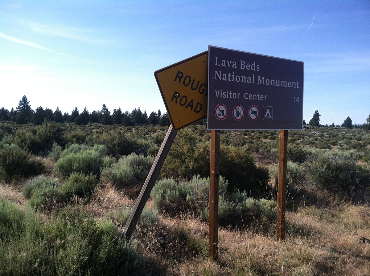
I was still getting to know my new travel companion and readily accepted his overly optimistic reassurances. “There has to be another store on the route!” he said. Swept up in his false optimism, I thought, Sure, I bet we will find some canned goods somewhere. That night we rode until near sunset and set up camp just outside Lava Beds National Monument. Dehydrated beans with peppers made for a good-enough dinner for us, while bats swooped around us for their dinner of insects. Small hares frolicked between bushes, and I checked our food inventory. I tend to overpack food for trips, and since I had cleaned out the fridge, this time was extra extra. However, I had not planned on being gone for five days with no resupply. I calculated that we had enough for another two days. But I didn’t say anything.
The morning spread soft sunlight on the scrubby desert plants surrounding our tent. Sagebrush, bitterbrush, rabbitbrush, and juniper scratched at our calves as we packed up and started to sweat in the dry summer morning. Around noon, just as the day started to become unbearably hot, we stumbled upon the underground lava tubes the area is known for. We descended into the cool dark — nature’s air conditioning and a welcome relief from the harsh heat outside. There were several spots lit up with informational signs, and we learned that the lava tubes are part of an expansive, connected network.
Local knowledge of this web was key to the Modoc Tribe’s ability to evade and hold off the U.S. Army during the Modoc War in the 1870s, when a band of tribe members returned to their ancestral lands after being forced onto a reservation in Oregon. A band of 60 Modoc warriors fought for over a year for their right to remain in the Lost River area, holding off up to 600 U.S. troops. However, their request for a reservation on their homeland was denied and defeat came cruelly, as with so many other tribal histories.
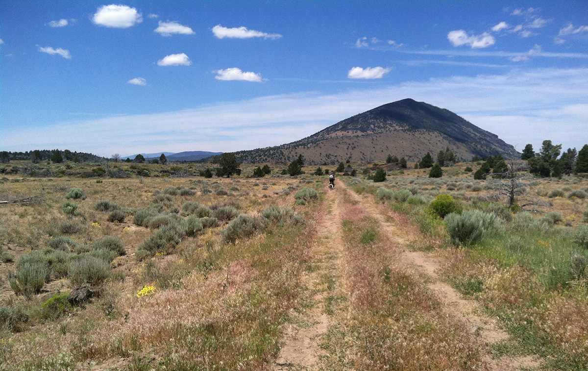
Continuing north on our loop, we realized we would return to the car “too early,” because our original route was “too easy,” continuing on paved and possibly high-traffic roads. Together, we studied the map for alternatives. There were dotted lines representing roads that seemed to connect and take us deeper into the wilderness. Let’s do it, we agreed. Three huge bucks suddenly appeared out of the brush, surely a good omen.
The dotted lines turned out to represent not roads but barely there sandy tracks. It was a full-on adventure now. For hours, we crossed what we now know as the land of the Modoc and the Achomawi. Up and over low hills we pedaled, matted grass slowly replacing the sagebrush and rock. Gravediggers Pass, an encouraging name, came and went. We perched on the side of a cowpie-covered dirt road, studying the map, unsure of our exact location. Cell service was zilch. We smiled and laughed and grunted when we had to walk. Occasionally we fell off our bikes into the sand.
After the novelty of our new route wore off, my mind got stuck on the idea of a cold Coca Cola, and I just stared at the grassy, untraveled road beneath my front wheel. When the remote road intersected a paved road without cars, we could solidly orient ourselves on the map. Joyous to know where we were again, I did a little dance in my spandex. The town of Tennant lay 15 more miles down the road, and we were sure they would have a store.
Tennant is an abandoned logging town where the only store had either just closed or closed a long time ago; it was hard to tell. It had a somewhat creepy vibe to it, but we camped by the creek anyway, now rationing lentils and sardines. From Tennant, gravel Forest Service roads led us around, up, and over the eastern flanks of Mount Shasta. A thick fog rolled in and socked in what I had thought would be great views. By late afternoon, I was riding ahead of Tom when I came to a recently installed Road Closed sign. Our last fork in the road (i.e., possible detour), had been about 15 miles before this sign.
Thirty feet beyond the sign, there was a gaping hole where the road was supposed to cross the muddy, deep, and fast-flowing water.
We later learned that the road had been swept away by a massive debris flow in 2014, when the tip of a glacier on Mount Shasta broke off. Our options were limited. For half an hour, we paced up and down the stream, trying to find a safe place to cross. I pointed out the small waterfall downstream that was obviously dangerous if either of us fell. We decided to take the bags off the bikes and portage the gear, then ourselves. I would portage gear to the middle of the raging creek, then Tom would take it to the far bank. Adrenaline was high, the water was freezing, and the current was fast. We worked out an emergency rescue plan for one or the other, like we had been thinking it up all along. I put my hiking sandals on, and we did it, heart racing, mind alert for any hazards floating towards us.
We sprawled out on the far side when our mini mission was complete, relieved. A few more miles past the debris flow, we set up camp on a patch of U.S. Forest Service land, in an area where ownership lies in a checkerboard pattern, interspersed with a private timber company. The drizzle continued, and we set up camp too near to a ground-nesting bird. She feigned injury to try and lure us away from her nest, so we calmly moved our cooking setup away from her. She still chirped and stared at us, but eventually relaxed and fed her young as we prepared our dinner. For our last supper, we rationed the last of our dried lentils, supplemented by spoonfuls of peanut butter. We talked about how we could imagine bike touring for a long time and were not ready to go home yet, though we were ready for a decent meal. We had one more granola bar each and several spoonfuls of peanut butter for our final ride the next day. As Tom and I rode into town, we connected to the community forest trails and ran into people walking their poodles, abruptly welcoming us back to modernity. We asked directions to a diner, sat down, and ordered two entrees each.
If you do choose to use the upcoming holiday as an opportunity for adventure, I recommend overpacking food, especially given the nature of Thanksgiving and the nature of bicycle travel. Also, given the nature of Thanksgiving, I recommend taking the time to research the ancestral lands that you travel through. Get to know the history and make a donation. You can read more about the Modoc Tribe’s history here, more about the Achomawi Tribe here, and more about the Shasta Tribe here.
Nuts and Bolts
While I would in no way recommend following it exactly, here is a Ride with GPS map of our approximate route that I put together after the trip.
The area we visited is in north-central and northeast California, east of Mount Shasta and north of Redding. The area is best accessed from the north or south on Interstate 5. Parts of the region are within the Shasta-Trinity National Forest, which stretches from the Inner Coastal Mountains to the southeastern Klamath Mountains. There is interesting geology, challenging terrain, and open landscapes throughout the approximate two million acres of the National Forest, which includes several wilderness areas (where bikes are not allowed on trails). Many bike routes could be created through this area! There are a variety of recreation opportunities like boating, fishing, climbing, and mountain biking, in case you want to incorporate other modes of exploration into your bike adventure.
Camping
Dispersed camping is allowed outside of developed sites unless otherwise posted. You can see more details here. The Lava Beds Visitor Center is closed as of November 6, 2022, due to a lack of water. For up-to-date information about Lava Beds National Monument, visit their National Park Service page.
Weather
Weather and temperatures can vary greatly throughout the months, even more so with elevation. At lower elevations, winters are somewhat mild, ranging from 30°F to 40–50°F, and summers can be hot, getting in the high 90s and sometimes 100°F in the day, and cooling off to the 70s at night. Rain or snow occurs more in the winter (November–March), and the summers stay dry (May–October). The higher elevations are much cooler in all seasons, just like most places. High elevation can get cold and wet even in summer, so come prepared!
For a more detailed weather forecast within the region, click here.
When to Go
The ideal time to camp is May to October, before winter storms start. There are campgrounds that accept reservations, and others are first come, first served. Most campgrounds fill quickly during summer holiday weekends. To see a listing of campgrounds across the forest and their locations on a map, click here and scroll to the bottom.
Trail and road conditions change depending on the season, and a few places get sticky with mud after spring rains. As always, be mindful of hunting season, prescribed burns, and wildfires in late summer. For up-to-date information, call or check the USFS website. Happy cycling!
