Gravel Road to Damascus
This story originally appeared in the October/November 2020 issue of Adventure Cyclist magazine.
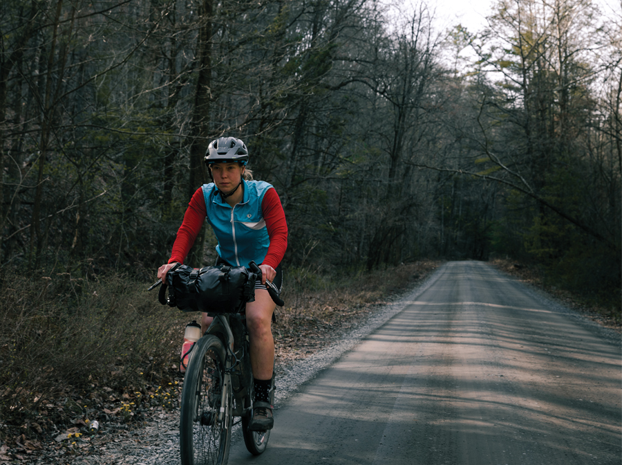
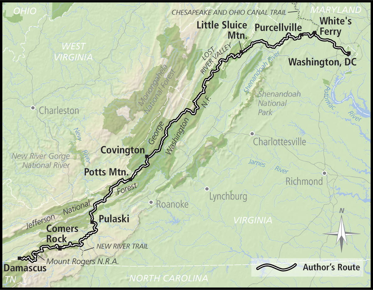
“Dude, your lips are blue.” Lindsey eyed me with motherly concern. Behind her, the fluorescent yellow Dollar General sign beamed brightly against the cloudy sky. The morning’s rain had stopped, but the air hung heavy with the cool dampness of fall. We were seven days into our journey along the TransVirginia Bike Route, a 550-mile mostly gravel route that begins in Washington, DC, and ends in Damascus, Virginia.
“I wish Dollar General served coffee,” I said, my teeth chattering. I sized up Lindsey’s grocery bag. She pulled out a pack of fruit cups. “Is that all you got?” I asked.
“Yeah, it’s fine, fruit cups are great,” she said.
Whether she was feigning enthusiasm, I couldn’t be sure. Lindsey doesn’t eat gluten, soy, corn, nuts, or dairy, the five main food groups of bikepacking. Having climbed over 37,000 feet so far, how she kept pedaling without a steady drip of candy bars was a mystery to me.
The Dollar General in Pulaski was 30 miles into what we had dubbed “the Big Day,” a 97-mile push from our previous night’s camp along the New River to the campground at Comers Rock high up on Iron Mountain. In reality, it was just a slightly bigger day in a string of big days. The day before, we’d climbed a punishing 9,000 feet in just 75 miles. Fatigue pulled heavy on my legs, but if we reached Comers Rock that night, we could finish the route the next day.

Hot, hot heat
A week ago, I dreamed of being cold enough to warrant blue lips. Day One of TransVirginia dawned hot and humid. It was a late September morning, and though we were officially on the precipice of autumn, summer was still holding its ruthless grasp.
Lindsey and I rolled early from my brother’s house near downtown Washington, DC, in search of coffee. Outside a café, we sipped our overpriced cups of piping hot pour-over, sweating in the fading shade of an umbrella. By 8:00 am, the temperature had already spiked above 80°F. Throngs of suit-clad businessmen and women swarmed the sidewalks, marching purposefully to their nine-to-fives. Eventually we peeled our sticky legs from the metal chairs and pedaled to the Lincoln Memorial, the TransVirginia’s official starting point. Weaving our loaded bikes through the morning commute felt a little like skipping school. Handlebars pointed west, we left the weekday hustle behind, giddy with anticipation.
The first 36 miles of the route steered us away from the capital’s busy streets to the Chesapeake & Ohio Canal Trail. Within minutes of leaving the Lincoln Memorial, concrete jungle gave way to verdant forest. The mostly flat, crushed-gravel path should have rolled fast, but in the soaring heat, it felt like a slog. Dense stands of tulip poplar and oak trees wrapped us in a green embrace, shading us from the sun but trapping the soupy air beneath their boughs.
It was afternoon by the time we arrived at White’s Ferry. Inside the White’s Ferry Store & Grill, we settled into a booth. The air conditioning and ice-cold drinks felt indulgent, like we hadn’t yet ridden far enough to justify the luxury, but we splurged all the same.
White’s Ferry is the only operating cable ferry on the Potomac River. Used daily by commuters crossing between Virginia and Maryland, the ferry was mostly empty when Lindsey and I rolled our bikes down the ramp. The novelty of the crossing wore off quickly; as the ferry inched across the stagnant river, we baked under the cloudless sky.
We dodged traffic for the next 10 miles until reaching another rail trail, the Washington & Old Dominion Trail. It’s paved and straight, and we made quick work of the miles. At the trail’s end in Purcellville, a sign in front of the local bank crawled with heat advisories and safety reminders for pets. The temperature reading was 100°F.
With 24 miles to go before we reached the sole campground — at Mile 80 — in a sea of private land, I began to despair. Every stroke of the pedal felt too hard. Every hill was impossibly long. Dry mouth, aching head, cramping legs. No, it wasn’t despair I was feeling — it was dehydration.
“Are we going right or left up here?” Lindsey asked.
I looked down at my phone and zoomed in on the route. We were approaching a lefthand turn onto Yellow Schoolhouse Road.
“Yellow,” I stammered. Lindsey peered back curiously over her shoulder. “I mean left,” I said.
We pulled off beneath the shade of a sprawling oak tree. Lindsey poured electrolyte drink mix into my water bottle, which I promptly chugged. Within minutes, I could feel myself emerge from the red zone, thankful for the second wind.
As we crawled up the final climb of the day, we could hear the din of westbound traffic roaring ahead. The northern Virginia chaos we had left behind in DC was now zooming 60 mph down the mountain on Route 7, the very road we would have to ride for a few hairy miles. Fortunately, there was a sizable shoulder for us. We merged into single file, taking care to avoid broken shards of glass and hardware that could put holes in our tires or, worse, shred their sidewalls.
When we finally crossed the four-lane highway and were safely back on country roads, our relief was palpable. Pavement turned to gravel. We rolled along the banks of the Shenandoah River through familiar-to-me territory; this river was literally my childhood backyard. At camp, my parents — who still live in the area — treated us to burritos and cold sparkling water. Neither of us slept much that night. The stifling heat had hardly dissipated, but no matter: at long last, the adventure had begun.

Touring in a time of drought
Click. Click. Click. Click. By the end of Day Two, my bottom bracket creaked incessantly. Gone were the meditative moments of quiet pedaling that I relished on bike tours.
Click. Click. Click. Click.
The rhythmic ticking mocked me with every turn of the cranks. For hours, I obsessed over it, feeling annoyed both at the bike and myself. I had ridden this bike — a 2017 Salsa Fargo — thousands of miles down the Great Divide Mountain Bike Route and on countless shorter tours in the intervening years. Of course, this trip would be the one that finally put my bottom bracket over the edge.
After 50 miles, we crossed into the George Washington National Forest. Straddling the border between Virginia and West Virginia, the combined George Washington and Jefferson national forests are home to over 1.8 million acres of rugged terrain. Steep, rocky climbs awaited us in the days to come, so we made camp early in the shadow of Little Sluice Mountain.
Though the insufferable heat from the day before had abated, the humidity remained relentless. Our chamois and shirts were soaked with sweat. We walked down to the creek behind our campsite to rinse the crusted salt and dust from our legs. To our surprise, the creek was bone dry.
In general, Virginia is blessed with ample surface water and piped springs, even in the heat of summer. But in the past 10 weeks, over half of Virginia had fallen into a moderate drought, or worse. Fortunately, we remembered crossing a trickling tributary about a mile up the road from camp. At the very least, we had water for the night.
On Day Three, we were climbing right away. Doubletrack strewn with large rocks turned to washed-out singletrack. Fallen trees slowed our speed, forcing us to hike-a-bike on sections we might have otherwise been able to ride. Eventually, the trail dumped us out onto well-maintained gravel Forest Service roads. Up and up we climbed, the grade stiffening so much that even spinning in the granny gear felt hard.
As we neared the summit of Devils Hole Mountain, a misty fog shrouded us in obscurity. Pops of red and yellow in the canopy signaled the change of seasons. In three days, it would be autumn. Despite the moisture in the air, the land was still parched. We passed yet another normally reliable spring that was completely dry.
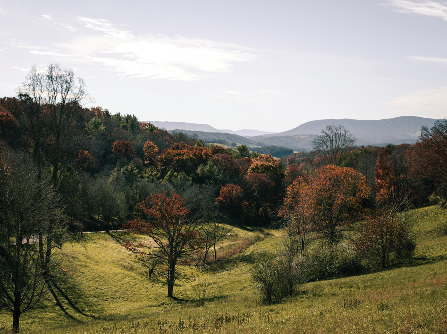
Just when I thought I could climb no more, we started to descend out of the clouds. In five miles, we dropped over 1,400 feet in elevation. Before us, the rolling hills of the Lost River Valley glistened in the golden light. Tucked somewhere beyond those ridges was our next climb of the day: German River Road.
Having climbed some 3,500 feet that morning alone, we steeled ourselves mentally for the remaining 5,000 feet of climbing ahead. The grind up German River Road began innocently enough, first on pavement, then dirt, then grassy doubletrack. But the more elevation we gained, the more the road devolved.
Our pace slowed from 13 mph to 10, then 8, then 5. We picked our way slowly up the rock-studded jeep trail, crawling alongside a scorched German River. We rationed our remaining water, knowing full well that, if anything, the ridge we were gaining would be drier than the holler.
Just as we crested the ridge, thunder rumbled overhead. Within minutes, the sky opened up and unleashed a heavy curtain of rain. We hastily took cover and huddled beneath a scrawny tree, but no sooner had it started than the storm passed.
Though the day’s climbing was mostly behind us, the next 10 miles of overgrown doubletrack hardly came easy. Stinging nettle and thorny briars ripped at our skin. Freshly downed branches littered what little of the track we could see and threatened to rip the derailers from our bikes.
Soaked, scratched, and a little bloodied, we emerged from the woods just as the sun was starting to set. We tucked into a mini-peloton for the final pavement rip down to Switzer Lake where we hoped to find water. We were in luck. Out of the many feeder creeks that dumped into the reservoir, only one remained flowing.
By Day Six, we had fully assimilated to life on tour, our new normal. Riding bikes became our job. There was freedom in the simplicity of only needing to eat, ride, and find water. I’d made peace with the creaking of my bottom bracket and the fact that, although water was seemingly scarce on this route, the climbing was mercilessly plentiful.
This section in particular — from Covington to our planned campsite along the New River — was stacked with 2,000-foot climb after 2,000-foot climb. But there were joys too: the sight of a black bear scrambling down a tree, the rush of flying down mountains side by side with one of your closest friends. Even the ritual morning cup of instant coffee tasted better than that gucci pour-over we had back in DC. We were both experiencing parts of our home state that neither of us had seen before, all on our own power, on our own terms. And that in and of itself made all of the hard moments worth it.
“I’m in a slight food coma right now,” Lindsey said, staring vacantly down the road.
“You’ll have that,” I muttered between mouthfuls of PayDay. The midafternoon sluggishness had slowly been creeping over me too.
Sunlight burned through the canopy in blistering patches. Though it was now officially fall, it didn’t feel like it. We trudged up Potts Mountain on a road that was chunky and punchy and little used. Cobwebs crisscrossed the track and clung to our sweaty skin. We swapped leads off and on to give each other a break from the near-constant onslaught of spiderwebs to the face.
Finally, after 10 hours of mind-numbingly slow pedaling, the New River appeared on the horizon like a mirage. It took every last ounce of energy to set up the tent and cook my packet of Knorr rice. I forgot to brush my teeth entirely. Exhausted from the day’s 9,000 feet of climbing, we hardly noticed the trains that rumbled past that night.

The end and the beginning
My knee brushed the overstuffed contour of my framebag as we pedaled away from the Dollar General. Sufficiently stocked with enough snacks to fuel us for the final 130 miles, we picked up the New River Trail outside of town and settled into a steady pace. We had just over 30 miles of rail trail we needed to knock out by lunchtime if we wanted to finish our 97-mile “Big Day” before dark.
Lindsey pulled ahead first and I rode her wheel. We hammered hard for what felt like an eternity. Despite the fact that the trail was flat and hardpacked, the monotonous miles almost felt more challenging than the thousands of feet we had climbed in the days before.
Two hours later, we left the New River for good and climbed up into Mount Rogers National Recreation Area. The route plunged into a vortex of Forest Service roads. Beneath the canopy it was dark and eerily still. We encountered a road closure but decided to take our chances in lieu of rerouting. Two massive bulldozers barricaded the road. We wasted almost an hour bushwhacking through thick tendrils of rhododendron to get around.
We climbed for another three hours without seeing a single person. As we inched higher in elevation, the temperature continued to drop. Fog hung heavy over the road. By now, we had both run completely out of water. Our only hope was the Comers Rock campground.
At long last, we began the descent to Comers Rock. I was hardly off my bike before I collapsed onto the first campsite I saw, delusional from a combination of hunger, thirst, and fatigue. We stumbled over to the water spigot with our bottles. In the fading light, I could barely make out a sign hanging on the spigot: OUT OF ORDER.
I was about to crack. I was too shelled to ride farther in search of water but too thirsty to go without. On the verge of tears, I suddenly heard a voice. A man shouted at us from the only other occupied campsite.
“Hey! Come over here!”
Lindsey was understandably wary about waltzing over to a stranger’s campsite in the dark, but I was desperate and our options were limited. I could barely discern the outlines of three people standing around a campfire. A woman and two men introduced themselves, and at once I was relieved. One of the men was the campground host.
Like a guardian angel, he retrieved a gallon of water from his truck. The woman shoved a $5 bill in my palm to pay for our campsite. Humbled but hungry, we walked back to our site to cook dinner, speechless with gratitude.
Our eighth and final day on the TransVirginia was piercingly cold. We donned every warm piece of clothing we had and set out at first light. Soon, a stiff 15 percent grade rose before us, and our blood was pumping in no time.
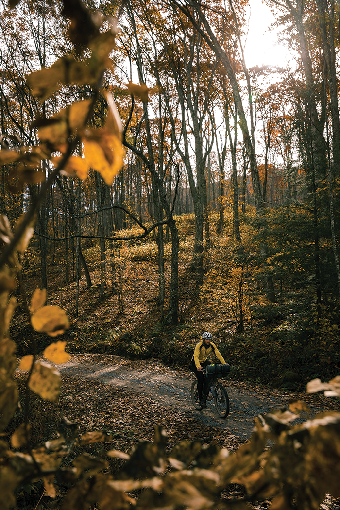
I savored every moment of that last day: the weariness in my legs, the brisk wind on my cheeks, the fall foliage rimmed in rose-gold light. When we began the 17-mile descent along the Virginia Creeper Trail, the end felt bittersweet — having finally settled into the rhythm of a bikepacking tour, I wasn’t ready for it to be over. But at the red caboose in Damascus, the official southern terminus of the TransVirginia, I realized that the route itself might have been over, but the next bikepacking adventure was just waiting to begin.

Nuts & Bolts: TransVirginia
When to go
Because of Virginia’s mild year-round weather, this route can be ridden during much of the year. However, campgrounds are typically closed in the winter, which may affect your itinerary. Mid-April through October is the recommended window for touring the TransVirginia. It’s not uncommon for snowfall and freezing temperatures to linger at elevations above 4,000 feet, even in April, so come prepared to experience a range of temperatures.
How long it will take
With over 45,000 feet of climbing over the course of 550 miles, this route packs a solid punch. Most riders will take anywhere from nine to 15 days to complete the TransVirginia, which averages out to be between 36 and 61 miles per day.
What bike to bring
Any rigid gravel or hardtail mountain bike will be sufficient for this route. Front suspension is certainly not necessary, though wider tires are. Riders can get away with 45mm gravel tires, but 2.0in. tires are recommended. Many of the Forest Service roads are rough and chunky, so if you run a skinnier tire, come prepared with a solid repair kit.
How much food and water to carry
Most riders will only need to carry a maximum of two days’ worth of food. Riders will pass by gas stations or country stores at least every 50 to 60 miles. The longest stretch without stores is 85 miles. Natural surface water is accessible throughout the route, but plan accordingly during the late summer months when droughts are common.
Level of difficulty
About 60 percent of the route is unpaved: 35 percent on gravel/dirt roads, 17 percent on rail trails, 5 percent on doubletrack, and 0.5 percent on singletrack. The climbing can be very demanding, especially if you are attempting to ride 60 miles or more per day. Earlier this year, the route developers created an alternate called the Valley TransVirginia, which follows the same north–south trajectory but reduces the overall climbing by 15,000 feet.
More information
TransVirginia Bike Route: transvirginia.org

