Back into View
This article first appeared in the June 2022 issue of Adventure Cyclist magazine.
We banked a fast curve on the gravel road, breathing in the fragrance of the balsam fir, watching closely for surprised moose, when suddenly it’s before us — the “Greatest Mountain,” looming in the sky, its craggy summit engulfed in clouds. Mount Katahdin’s precipitous slopes and massive cliffs rise abruptly from the Maine woods with no foothills to detract from its solitary dignity. We pulled our mountain bikes over at a viewpoint on the Katahdin Loop Road and indulged in some snacks and a stare at the peak, hypnotized by the dissipating clouds. It had been two years of COVID quarantine since we’ve gifted ourselves an extensive travel trip; we have been looking forward to this like the sun after a long storm.
A weeklong adventure in Maine’s North Woods, mountain biking the historic tote roads east of Mount Katahdin in central Maine lay ahead. The North Woods are mostly an unbroken carpet of pine and hardwood trees that is the largest contiguous forest block east of the Mississippi River. The vast chunk of Maine woods that we would explore is the newest in our national park system: the Katahdin Woods and Waters National Monument, and its showcase is Mount Katahdin.
Spectacular Katahdin, a 5,269-foot monolith in Piscataquis County, is the highest peak in the state of Maine. It was considered by the ancient Native Americans to be the home of the spirits of the wind, storm, and thunder. Located in Baxter State Park, which butts up to the monument on its west side, it is a mecca for hikers. On the summit is the northern terminus of the wildly popular 2,100-mile Appalachian Trail (AT). The native Penobscot Tribe call the peak “Ktaten,” meaning the “Greatest Mountain.” As one could imagine, that title attracted hordes of nature lovers and outdoor enthusiasts, so much so that you’d want to avoid a visit to Mount Katahdin in the state park.
That changed in 2016 when, thanks to Roxanne Quimby, founder of Burt’s Bees, the U.S. gained the Katahdin Woods and Waters National Monument — 87,563 acres of protected lands, mountains, trails, campsites, and unpaved woods roads, giving mountain bikers a wild, unique place to recreate. Quimby moved to Maine in her 20s and began selling beeswax candles at local farmer’s markets, which evolved into the huge Burt’s Bees natural cosmetics company. She later moved away from business and into philanthropy. She began buying land across Maine, purchased at market prices from willing sellers, with her sights set on creating a new national park. Quimby’s gift of land included $40 million to help fund the initial operations of the monument. You can now view the rugged profile of Mount Katahdin without the competition and the crowds.
The monument is divided into north and south connected sections, and stretches about 25 miles top to bottom. The south entrance is via Swift Brook Road, 20 miles north of Medway. The north end/Matagamon’s entrance is via Route 11 and Highway 159. A smaller, separate eastern section offers additional cycling.
The only mountain biker I heard of who did a long ride through the monument did so on the logging roads and the park road that travels through Baxter State Park, making a loop. This route forces you to share the road with the fast-driving and often dangerous logging trucks, which held no appeal to us. We longed to get into the heart of this wild area and explore the little-visited places via the historic old tote roads. I reached out to Ranger Jason Gablaski, one who personally cares for the land and knows the monument intimately, for advice.
The monument has deep, dark forests with bogs and wetlands, and three watercourses surging through it: the East Branch of the Penobscot, the Wassataquoik Stream, and the Seboeis River. Exploring the monument via canoe is a great way, but Gablaski believed a combination of cycling, hiking, and mountain climbing would give us the most intimate experience with the new monument. He shared his favorite routes to mountain bike, shelters to camp at, spots to swim, mountains to climb, trails to hike, and views to soak in. My husband Todd Gladfelter and I were hikers before becoming bicycle travelers, summiting Katahdin as end-to-enders in 1979 and 1980. In the past few decades, however, we do way more cycling so combining these two enjoyable sports, hiking and cycling, while exploring the monument sounded intriguing. We stopped by the ranger station in Millinocket so Gablaski could highlight these special spots on our map and mark the roads to avoid, which haven’t been cleared of blowdown from the hard Maine winter.
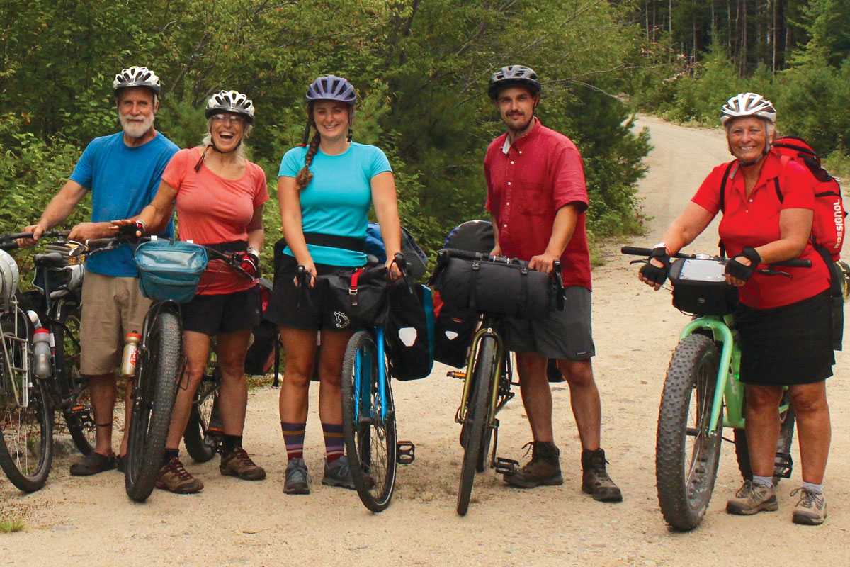
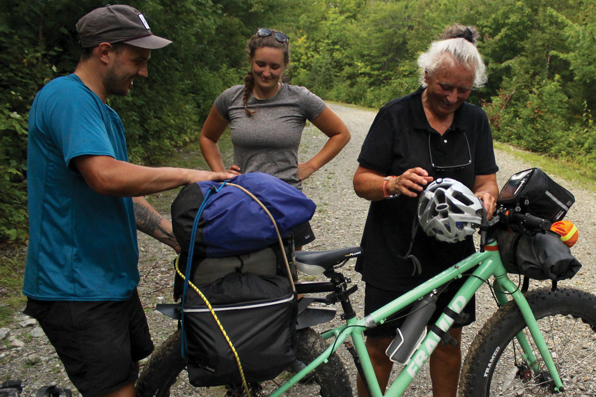
We used our mountain bikes as both a means of transportation and also on recreational day rides, which was the best way for us to get the most of the park, as bikes aren’t allowed on all trails. We bikepacked into wilderness camps with three-sided, Adirondack-style log lean-tos. The route took us through some great mountain bike day rides on historic logging tote roads, some grassy doubletrack deep in the wilderness, and others on gravel roads. Meanwhile, the hikes often ran alongside rivers with thundering waterfalls with a climb up a mountain or two with spectacular views.
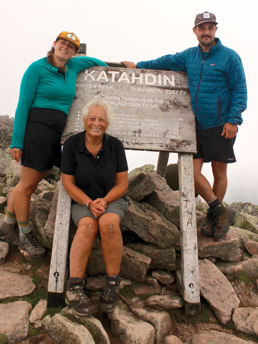
Besides being curious about the new monument, Todd and I also longed to return to Mount Katahdin to make an anniversary climb with some of our long-distance hiking cronies. After a week of cycling and viewing the Greatest Mountain, we were looking forward to celebrating with a reserved cabin at Cathedral Pond in Baxter and a summit climb.
The International Appalachian Trail (IAT) begins right off the Katahdin Loop Road on which we started our first day, extending 1,580 miles into Québec on the Gaspé Peninsula. There are IAT miles both in the south and north ends of the monument that we could cycle on (unlike the Appalachian Trail, which does not allow bikes). The IAT can be connected to the Appalachian Trail and then connect to the Florida Trail, which extends all the way to Key West. It’s fun to think how this trail can be followed for a total distance of 4,400 miles, called the Eastern Continental Trail. As long-distance hikers and cyclists, we naturally daydream about epic adventures like these, but for now, we are content merely exploring this new monument.
The East Branch of the Penobscot River flows through the monument for 25 miles north to south, with two tributaries, the Wassataquoik and the Seboeis feeding it, hence the name “Woods and Waters.” In the East Branch’s first 10 miles, it drops over 200 feet over dramatic waterfalls, including Stair Falls, Haskell Rock Pitch, Pond Pitch, and Grand Pitch. Our route often took us along the scenic riverbanks as well as the Wassataquoik Stream.
South End
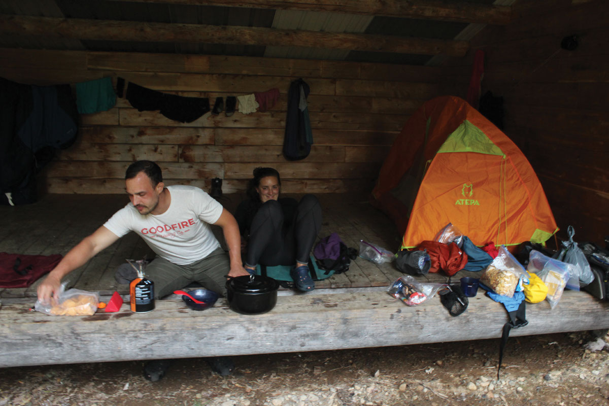
After packing up our panniers with fresh food and treats, we cycled a short distance to the Wassataquoik Lean-to and set up camp for the next few days. We rode into Orin Falls on Wassataquoik Stream to indulge in a late afternoon swim. The old roads were once used by loggers who cut the massive white pines and spruce back in the 1800s, and before that as paths by the Wabanaki Nations for over 11,000 years. These lands inspired writers, artists, and conservationists for generations, including Henry David Thoreau, John Audubon, Frederic Church, and a young Theodore Roosevelt. The most famous visitor of all in those early years was Henry David Thoreau, who followed ancient canoe routes through this vast, primitive wilderness. During his first trip in 1846, he climbed Mount Katahdin, traveling by way of the Penobscot and West Branch of the Penobscot River. When Roosevelt climbed, he forded Wassataquoik Creek and lost his boot and had to climb Katahdin in a leather moccasin. The monster boulders planted in the river stopped the loggers in their tracks — they are as big as houses and cars. The river bottom is sandy and the water cool and inviting.
On our first full day, we rode straight from camp down Orin Falls Road to the 17-mile circuit Katahdin Loop Road with mileage markers. We made a stop at Lynx Pond and, to our astonishment, saw a beaver cruising the surface. He came closer and closer to the observation deck on which we stood until he was mere inches away. Completely apathetic about our presence, he glided by with a green branch clamped in his mouth, his webbed feet paddling, his tail balanced. Later on, a young moose trotted across the road in front of our bikes. To our delight, we saw more wild animals than humans. One could also ride the more rustic offshoot, Rocky Pond Road (or do a circuit), but don’t miss the best view of Mount Katahdin between Milepost 6 and 7.
When we arrived at Milepost 12, we cycled down the IAT (dirt road) to the Katahdin Brook Lean-to where we locked our bikes, then hiked north to the side trail climbing east to Barnard Mountain (1,558 feet). You could cycle to this point, but we wanted to stretch our legs and walk. On the summit is a picnic table (it must have been air lifted!) surrounded by large, smooth boulders to stretch out on and take in the glorious view. Ranger Gablaski said this is one of his favorite views in the entire monument as the boreal forest spreads wide, Katahdin Lake shimmers in the sunlight, and the mountain rises in all its glory. Historically, this is the direction from which folks approached and summited Katahdin. As we came to expect, we had the view all to ourselves. The next day was a short cycle southeast on the IAT to a wide, shallow ford on Wassataquoik Stream. After scoping out trail conditions on the far bank, we decided to hike up to Deasey Mountain as the treadway grew considerably more technical very quickly. The boreal forest is displayed in all its glory on this climb: dark, cool fir and spruce trees, and prolific mushrooms in all the colors of the rainbow popped up in the thick, mossy forest bed. Moose droppings littered the trail, for the wild creatures use the cleared path for easy navigation too. With so much evidence of these massive creatures among us, we stepped lightly and stayed hushed, hoping for a surprise sighting. Partway up the climb were the remains of a fire warden cabin. We poked around, trying to surmise what life was like not too long ago for this solitary forest steward. He had to make this final steep push to the summit every day “to go to work,” keeping these wild Maine woods fire-free. On the summit was the unmanned Deasey Mountain Fire Lookout. We stepped inside the wood-frame building and found the Osborn Fire Finder still in place.
North End
The north end of the monument at Matagamon Gate is an hour and a half away by car. We drove down gravel Messer Pond Road to park at the Haskill Gate, loaded up the bikes, and rode five miles on the IAT to the Grand Pitch Lean-to.
There are a lot of good rides based out of here: the IAT, Messer Pond Road, Oxbow Road, Old River Road, and Keyhole Road. There are offshoot rides to falls, river lookouts, portage trails, and short walks to hidden ponds where you can attempt to sneak up on a moose or see a bald eagle fishing. It’s highly advisable to check with the rangers in Millinocket for up-to-the-minute data on the trail clearing crews before you set off. The winter blowdown can be severe and a big load for the small staff to handle.
We only spent one night at Grand Pitch before packing up and heading to the Haskill Deadwater Lean-to for our last night. Gablaski advised us to overnight here if the night is a clear one because of the wide view of the sky above the still water. The East Branch of the Penobscot River backs up here and forms a type of lake. Stargazing is another unique recreation at the monument as these are the darkest skies east of the Mississippi. In 2020, the International Dark Sky Association designated the national monument as the first International Dark Sky Sanctuary on the eastern seaboard. We took our foam pads and a cup of tea down to the lakeside and settled in for the evening. It takes about 20 to 30 minutes for your eyes to adjust to the darkness, so we succumbed to patience. Loons called around us. Then shooting stars began to fall right into the water.
Our last ride in the monument was on the Katahdin View Loop in the east, which we drove to on our way out. Not a single vehicle disturbed our wild experience, just a young moose high-tailing it across the road as we approached.
A stop in the town of Patten on our way back to Millinocket was in order — the famous Craig’s Clam Shop delivered a great lunch after a week of adventuring, paired with a tour of the Lumberman’s Museum to round out our education about logging these North Woods. Nine buildings house the vast collection of tools and equipment that reflects every aspect of the woodsman’s life in the 1800s and the first three decades of the 20th century. Horse-drawn logging sleds, wagons, tractors, primitive snowmobiles, an 1820 logging camp, a blacksmith shop, and more occupied us for hours. Thousands of woodsmen have passed with their horses and supplies to cut and haul or drive the millions of board-feet of pine and spruce. The forest lands through which we rode are incredibly quiet now in the Katahdin Woods and Waters National Monument compared to when it rang out with the whine of a saw. We liked it better this way, but the locals were not originally convinced of the value of creating this national monument. They were previously free to visit the lands on ATVs and snowmobiles, which are now regulated and confined to designated areas. Motorized travel must now be exchanged for transportation like the mountain bike, which gets you closer to the heart of this magnificent place.
You can add another day of cycling by stopping at Penobscot River Trails located off of Route 11 southeast of the monument at Grindstone, Maine. The creation of this nature preserve is another philanthropic story like the national monument, as it was built through the generosity of one Maine family that privately owns it and shares it with the public. There are over 15 miles of crushed-stone carriage trails to ride, as well as cross-country skiing with two warming huts.
After a week of exploring the monument, we celebrated with a climb up the Greatest Mountain in Baxter State Park. We based from the comfort of a rented cabin at Chimney Pond, nestled in a deep col at the base of Katahdin. As easy as it is to access the Katahdin Woods and Waters National Monument, it is the exact opposite to secure a spot in Baxter State Park, but well worth it. Eleven months out to the day is when you can attempt to reserve the cabin or a lean-to.
We successfully summited Katahdin with lifelong friends, many of whom are previous 2,100-mile thru-hikers. The Greatest Mountain enriched our lives decades ago and now again on this mountain bike adventure through Katahdin Woods and Waters.
Nuts & Bolts
Tips
Bicycles are allowed on park roads and routes designated for bicycle use. Bicycles and Class 1 eBikes are only allowed on doubletrack roads, not singletrack trails. Class 2 and 3 eBikes are allowed on public roads where public motor vehicles are allowed.
Permits are required for parking, camping, and campfires and are available at recreation.gov or by calling the numbers below.
Tents are not needed if you’re able to attain a lean-to, which will have to be reserved (free of charge) through the same website; if you are unable to reserve a lean-to, you will need to bring your own shelter.
All water in the monument must be treated, so bring a filtration device.
The best time to visit is any time after black fly season, which typically ends about mid-June.
Resources
Katahdin Woods and Waters waterproof trail map: mapadventures.com
Overnight permits: email the National Park Service or call 207.456.6001
Campfire permits: call the Northern Regional Office of the Maine Fire Service at 207.435.7963
Millinocket Contact Station offers monument maps and publications along with trip planning assistance: 207.456.6001
nationalparks.org/connect/explore-parks/katahdin-woods-and-waters-national-monument
