Lake Erie Connector
Farm roads, a three-legged bridge, and a breezy run along Lake Erie's sandy Canadian bluffs, stitched between two of the network's big northern routes.
- Distance
- 244 miles
- Surface
- 100% paved
- 3 days–1 week
- Route Type
- Point to Point
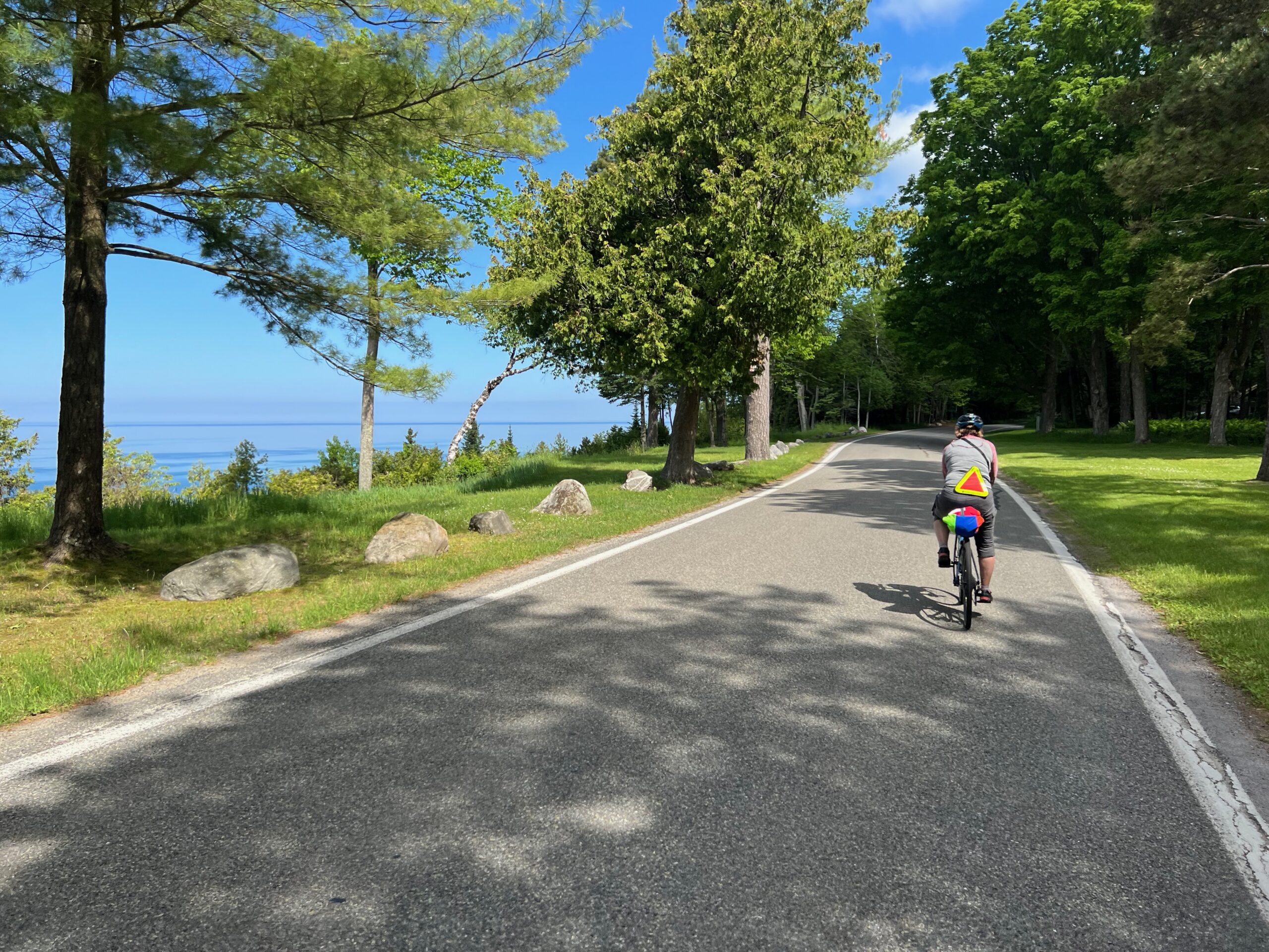
Ride the Lake Erie Connector
This route runs from Wolf Lake, Michigan to Fort Erie, Ontario, c Michigan farmland and a rail trail before entering Canada and following Lake Erie’s northern shore east, so every rider needs a passport or other approved travel document. Three ferry alternates via Pelee Island offer connections across the lake to the Northern Tier in Sandusky, Ohio.
What to Expect
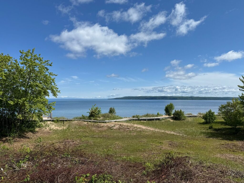
This route offers an easy, mostly flat ride through rural Michigan farmland before crossing into Ontario for a scenic run along Lake Erie’s northern shore. High sand bluffs, cooling south breezes, and small port towns define the lakeshore stretch, and services are never far off. The only real challenge is wind, which can help or hinder depending on the day.
Riders cross the three-legged Tridge in Midland, Michigan, where the Tittabawassee and Chippewa Rivers meet, and pass through Michigan’s tomato-growing region and Canada’s tobacco belt, both worth timing around harvest season. Along Lake Erie, Port Stanley’s arts community and the small port towns strung along the sandy bluffs make easy stops, and the ride finishes on the Niagara River in Fort Erie, a short hop from Niagara Falls.
This route stays largely flat, crossing rural Michigan farmland and the sandy bluffs of Lake Erie’s Canadian shore, with the only real elevation changes where it dips down to rivers and small towns. Expect open fields, woodlots, and long views across the lake. The full route includes detailed riding conditions and field notes for the entire ride.
This is a populated corridor rather than a remote one, with services plentiful through Michigan and bike shops in several larger towns. Services thin out along the Canadian shore, where many lakeside communities are small. U.S. riders should check international roaming or pick up a Canadian SIM card before crossing the border, and download their Ride with GPS route for offline use.
Ride this route from late spring through early fall, when ferries are running and lakeshore campgrounds are open. Summers are warm but moderated by Lake Erie, while spring and fall bring cooler days and changeable weather. Wind can shift quickly along the open shore.

Route Sections
Main Route, Wolf Lake, MI to Fort Erie, ON, 506.7 miles
From Wolf Lake, the route crosses sparsely populated rural Michigan farmland to Clare, then follows 30 miles of the paved Pere Marquette Rail-Trail into Midland, crossing the three-legged Tridge. From there, it continues across Michigan and into Ontario, then follows the Lake Erie shore east through Canada’s tobacco belt and small port towns to Fort Erie. The full route includes turn-by-turn directions, service information, and field notes for the entire route.
Alternates:
- Ferry Alternate A, 46.2 miles. One of three options connecting the Ontario shore to Ohio via the Pelee Island ferry.
Lake Erie Connector Photos
Plan Your Ride
This shortcut works well for linking longer trips, but plan around the ferry schedule if you’re using it, and pack a passport, since the route crosses into Canada.
Trip Planning & Logistics
Wolf Lake, Michigan, connects directly to the North Lakes route, and Fort Erie sits across the Niagara River from Buffalo, New York, where riders can connect to airports and Amtrak. Either direction works well, and the ferry alternates connect to the Northern Tier at Sandusky, Ohio, for loop options. The Pelee Island ferries run seasonally and can fill up, so check schedules and reserve ahead. Most riders plan three to five days, depending on the ferry connections chosen. This route is available in paper and digital formats through Adventure Cycling’s shop and includes routing, detailed service information, riding conditions, and field notes for trip planning.
A standard touring or road-touring bike suits this route well, since it runs almost entirely on pavement and paved rail trail. Bring a passport or other approved travel document for the border crossing, layers for the lakeshore breeze, and a way to pay for ferry crossings if you’re using them.
Campgrounds and B&Bs are plentiful along the Lake Erie shore, including several Ontario provincial parks, though motels are fewer, and reservations are advised, since the lakeshore is a popular vacation destination. Michigan offers steady lodging throughout the farmland stretch. Some campgrounds charge solo cyclists the same as a full tent or RV site, though hiker/biker rates are sometimes available, and Warmshowers hosts are an option on both sides of the border.
Services are plentiful and evenly spaced through Michigan, but grocery stores are scarce along the Canadian Lake Erie shore, so stock up before entering that stretch and rely on the small port towns for basic resupply. Carry some Canadian currency or a card that works internationally. Check your digital route in Ride with GPS for service phone numbers, and call ahead for anything outside peak season.
Traffic is generally light on the rural roads in both countries, but wear bright clothing and use lights on busier stretches near towns. Some international bridges and tunnels in the region don’t allow bicycles, so follow the route’s designated border crossing. Winds off Lake Erie can pick up suddenly along the open shore.
Always check Adventure Cycling Route Updates and Corrections before you go.
Routes change. Bridges wash out, businesses close, and construction pops up overnight. We strive to keep routes updated as those things happen. When we learn about a change, we reroute around sections that have become dangerous or are temporarily closed for road work, bridge outages, or construction, and we update service information as businesses open, close, or move. Digital routes are updated as soon as we’ve reviewed a reported issue.
You’re often the first to spot these changes out on the road. Help us keep this route accurate for the next rider by reporting anything you notice with our Route Feedback Form.
This Route Is Part of Something Bigger
It’s one piece of the Adventure Cycling Route Network, began in 1976 and built on a simple mission: to empower people to travel by bike. Our team maps and maintains it; our members and donors make it possible.
-
Explore the Adventure Cycling Route Network
Our premium routes are well researched by our cartographers and well traveled by thousands of cyclists.
Adventure Cycling Route Network -
Support Route Development
Our members are the reason we can offer three route networks tailored for specific experiences and riders.
Become a Member -
Stay Connected
Find your stoke with our newsletter all about routes, gear, stories, and cycling news in your inbox twice a month.
Sign up for Bike Bits
Frequently Asked Questions
It’s our flagship, staff-built route network. The one that started it all 50 years ago with the TransAmerica Trail, the route that launched bicycle touring and bikepacking in America. Every route in it is designed and researched by our own team of cyclists and cartographers: months of research and on-the-ground testing go into each one, so what you get is more than a line on a map. Each Adventure Cycling route has detailed logistics, terrain and elevation info, points of interest, camping and lodging, safety alerts, and history, all in one place. It’s the most in-depth of our three networks, available as digital routes and most as paper maps too. It’s the route network we update most regularly as conditions change.
They’re related, but not the same thing. The Adventure Cycling Route Network is made up of routes we’ve researched, ridden, and mapped ourselves, chosen specifically for a great touring or bikepacking experience. The U.S. Bicycle Route System (USBRS) is a state-by-state national system that we serve as technical experts for, made official through each state’s department of transportation. The two overlap in a lot of places, but an ACRN route carries our own on-the-ground vetting; a USBRS route carries official state recognition.
It depends! If you want a route we’ve personally scouted end to end, with services, camping, and terrain notes built in, start with the Route Network. The ACA Route Network has routes of many different lengths and can be a much easier starting place for someone new to bicycle travel. If you’re an experienced cyclist piecing together an officially designated corridor, or riding somewhere the two systems converge, the interactive USBRS map is a good resource to use.
The Adventure Cycling Route Network is a premium network because of everything that goes into it. Unlike the U.S. Bicycle Route System (built by state DOTs) or Short Routes (submittedby cyclists in their own communities), every Adventure Cycling route is researched, ridden, and vetted end-to-end by our own team. Unlike other routes, Adventure Cycling routes come with extensive information on riding conditions, terrain notes, camping and lodging info, logistics, safety alerts, and points of interest. We also keep it current as roads and services change. The price supports that ongoing research and maintenance work, done by a nonprofit whose whole mission is making sure the route in your hands is one you can trust.
Turn-by-turn directions with a bike icon aren’t the same as a route built for specifically touring or bikepacking. Every mile in the Adventure Cycling Route Network has been researched and ridden by our staff and researchers, chosen to avoid dangerous traffic, and mapped with what a touring cyclist actually needs — food, water, camping, hotels, bike shops — spaced out along the way. The Adventure Cycling Route Network was built for cyclists by cyclists, is regularly updated, and comes with the resources and information needed to plan your ride.
No. The network includes routes for a wide range of experience and difficulty levels, from a first multi-day trip to a cross-country expedition. What every route has in common is that it was chosen with a touring cyclist’s needs in mind, whatever kind of trip you’re planning.
Not at all. Alongside iconic long-distance routes like the TransAmerica Trail, the network includes shorter regional routes, so it works for a weeklong vacation or a two-month journey.
For many years, we focused on paved routes, but today the network includes plenty of unpaved gravel riding for bikepacking. In fact, Adventure Cycling mapped the Great Divide Mountain Bike Route in 1998, arguably the most impactful bikepacking route in the world. The Adventure Cycling Route Network also includes the Golden Gravel Trail, Idaho Hot Springs Mountain Bike Route, Arkansas High Country Route, and more. Some routes are a 50/50 mix of pavement and gravel. Some routes follow paved and unpaved bike paths and rail trails. The Adventure Cycling Route Network has terrain for every cyclist.
We revisit our printed maps every three to five years, and push corrections to our digital route data as we learn about changes on the ground. If you have an Adventure Cycling Route in Ride with GPS that we’ve updated, you’ll get a notification when you open the route to update to the newest version of the route. Updating will ensure you have the latest data, information, and points of interest vital to being on route. For cyclists who have Adventure Cycling paper maps, we keep a list of route- and section-specific updates current on our Map Updates and Corrections page.
Change comes from two directions: our own staff research and reports from the cyclists actually out there riding them. If a bridge washes out, a shoulder disappears, a campground closes for repairs, or a town loses its only grocery store, that’s the kind of thing that triggers an update. You can help us keep our routes accurate; fill out our Route Feedback Form.
Most of our Adventure Cycling Routes come as waterproof print maps and digital Ride with GPS navigational data. Our print maps are the #1 longstanding popular resource for traveling cyclists. They are waterproof, highly detailed and always work. For long trips, many cyclists use a combination of print maps and digital routes.
If you’re already comfortable and familiar with a GPS navigational aid such as Ride with GPS or a Garmin, our digital data packages are an excellent choice. We do not recommend GPX data for beginners since there are a few extra steps to installing and troubleshooting.
Once you purchase a digital route, you’ll get an email with a link to unlock it in the free Ride with GPS app — no separate subscription required for basic navigation. From there you get turn-by-turn voice directions, curated points of interest like campgrounds and bike shops, and field notes on the history, geography, and climate along your route, all available 100% offline. If you’drather use a dedicated GPS device, you can export the route as a GPX file to load onto a Garmin, Wahoo, or similar device.
To export GPX files of your Adventure Cycling digital route, use your laptop or desktop to open the email you received after purchasing your digital route. Click on the link that allows you to access your Digital Route. Finally, click on EXPORT ALL at the bottom of the screen. This is the only way to export files that include the route line, points of interest, and services. Files will be exported as one ZIP file.
Adventure Cycling uses abbreviations across its paper and digital routes to indicate particular services, land or road types, route names, direction of travel, and route type. Please see our key to abbreviations.
If you have questions on how to purchase a digital route or about the route content, please contact Adventure Cycling: cartography@adventurecycling.org or 406-721-1776.
If you have questions on how to use your Digital Route in Ride with GPS, please check the Ride with GPS support page or email them at info@ridewithgps.com.
If you’re new to Ride with GPS, please check out the following resources:
Our print map panels aren’t always oriented northwards for space and layout reasons. Refer to the north arrows to help orient yourself if you’re not sure.
No. The Routes and Mapping Department does not do custom routes for individuals. Check out the routes we’ve already mapped, and use the interactive map to piece our route networks together, forming a route that gets you from a point A to point B of your choice.
It started with a single route. In 1976, we mapped the TransAmerica Trail, and more than 4,000 cyclists crossed the country together for Bikecentennial — the nation’s bicentennial cycling celebration our founders organized. That one route became the seed of a network we’ve spent the decades since expanding. Today it’s more than 58,000 miles of mapped routes across the U.S. and Canada, from classic epics like the TransAmerica Trail, Great Divide Mountain Bike Route, and Pacific Coast, to shorter regional routes.