Great Rivers South
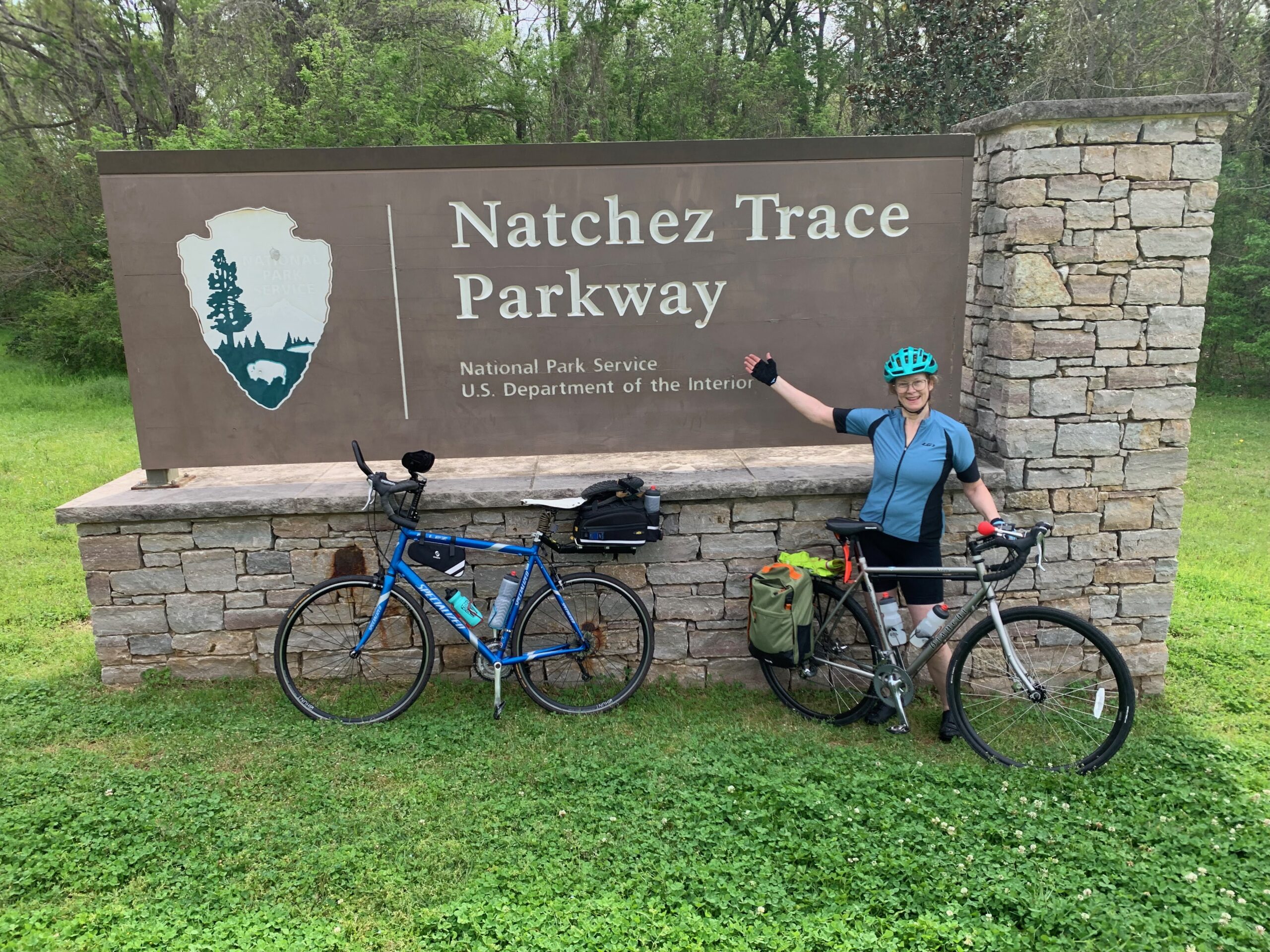
This route runs south from Muscatine, Iowa, to New Orleans, following the Mississippi River before hitting the scenic Natchez Trace Parkway into Louisiana.
- Distance
- 1,385 miles
- Surface
- 95% paved
- 3 weeks–2 months
- Route Type
- Point to Point
Ride the Great Rivers South
This route runs south from Muscatine, Iowa, to New Orleans, following the Mississippi River before hitting the scenic Natchez Trace Parkway into Louisiana.
What to Expect
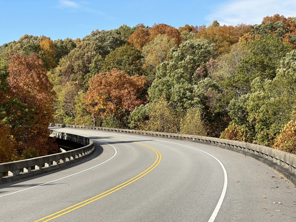
Despite the name, this route crosses more rivers than it follows, running mostly on quiet rural roads and county highways connecting small farming towns. The Natchez Trace Parkway section offers one of the more peaceful long stretches in the network, a two-lane national parkway with no commercial traffic and a strictly enforced 50 MPH speed limit. Expect farm country, Ozark hills, southern history, and hospitality, along with a real workout: the river-bluff hills south of Hannibal and the Ozarks are steep, and the southern heat and humidity add to the effort.
Riders pass through Nauvoo, Illinois, where members of the Church of Jesus Christ of Latter-day Saints built a thriving city before being forced west in 1846, and Hannibal, Missouri, Mark Twain’s boyhood home, complete with the whitewashed fence of Tom Sawyer fame and Mark Twain Cave. Farther south, the route crosses the Land Between the Lakes National Recreation Area on the Woodlands Trace National Scenic Byway before joining the Natchez Trace Parkway, passing the Meriwether Lewis monument, Elvis Presley’s birthplace in Tupelo, and the antebellum homes of Natchez, Mississippi, before finishing in New Orleans.
The route runs flat through the Mississippi floodplain from Muscatine to Hannibal, then turns to steep, roller-coaster river-bluff hills south of Hannibal before settling into Missouri hill country. Kentucky and Tennessee bring moderate to challenging rolling hills until the gentler grades of the Natchez Trace take over through pine and hardwood forest, and the route flattens again between Baton Rouge and New Orleans. The full route includes detailed riding conditions and field notes for every climb and descent.
Services are steady in the small towns the route passes through, but facilities along the Natchez Trace Parkway itself are limited, with most services located in towns just off the route. Bike shops are scarce outside the larger towns, so carry spare tubes and basic tools. Cell coverage is generally good, though it can be spotty in the Ozarks and along stretches of the Parkway.
Ride from spring through fall, roughly April through October, with the southern portion ridable even into winter. Summers bring heat and humidity that increase the farther south you travel, and tornadoes are a risk across much of the route in spring, especially in Illinois and Missouri in May and June. Hurricane season, June through November, can affect the southern end near New Orleans.

Route Sections
Muscatine, IA to Cape Girardeau, MO, 452.7 miles
From Muscatine, the route follows narrow farm-to-market roads along the Mississippi floodplain south into Hannibal, Missouri, then climbs into central Missouri hill country and the Ozark Mountains before dropping back onto the alluvial plains near Cape Girardeau.
Alternates:
- St. Louis Spur, 57.7 mi. Includes 31.1 miles on the Katy Trail and delivers riders into downtown St. Louis and the Gateway Arch; best ridden during daylight hours given the urban traffic.
Cape Girardeau, MO to Tupelo, MS, 451.5 miles
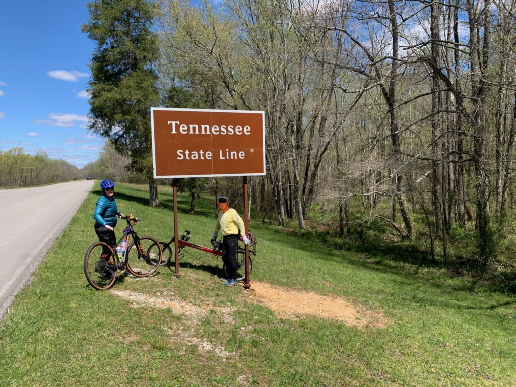
This section crosses into Illinois and Kentucky, including a ferry crossing of the Ohio River at Cave-in-Rock, then continues through the Land Between the Lakes Recreation Area and rolling Tennessee farmland before joining the Natchez Trace Parkway into Mississippi.
The Cave-in-Rock Ferry is indefinitely closed as of July 1, 2026. Check current routing before planning this crossing.
Tupelo, MS to New Orleans, LA, 480.5 miles
The route continues down the Natchez Trace Parkway through Mississippi before finishing the Trace in Natchez, then crosses into Louisiana on rural roads through timberland, finishing along the Mississippi River Levee Path into New Orleans.
Alternates:
- Bike Path Option, 10.7 mi. A separated multi-use path through Ridgeland, Mississippi, that offers a break from riding directly on the Parkway.
Great Rivers South Photos

Plan Your Ride
This route’s long, service-sparse stretch along the Natchez Trace Parkway calls for extra planning around food, water, and overnight stops before departure.
Trip Planning & Logistics
Muscatine is a short drive from regional airports in the Quad Cities area, and New Orleans offers an international airport and Amtrak service at the finish. Amtrak also serves St. Louis, near the end of the St. Louis Spur, though not every station along the route offers bicycle service, so check ahead for both ends of any train connection.
This route is available in paper and digital formats through Adventure Cycling’s shop and includes routing, detailed service information, riding conditions, and field notes for trip planning.
This route runs mostly on paved rural roads, so a standard touring bike suits it well. Riders taking the St. Louis Spur will find a longer stretch of crushed limestone on the Katy Trail that’s easier with slightly wider tires. Pack front and rear lights and bright clothing, plus sunscreen and bug repellent for the humid southern stretches.
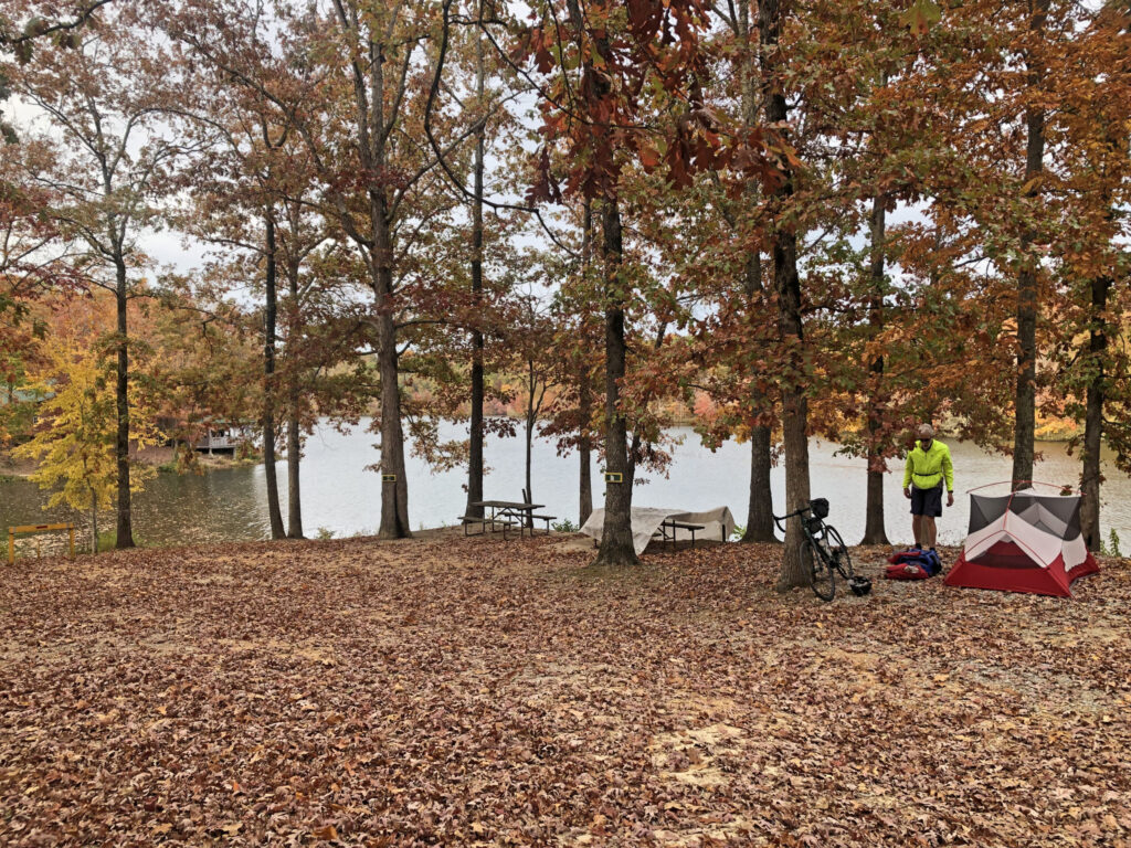
Camping along the Natchez Trace Parkway is limited, though the Parkway has several campsites set aside for cyclists, so plan on a mix of camping and indoor overnights through that stretch. Missouri and Tennessee have no-turn-away policies that guarantee cyclists a campsite at participating state parks, even when they’re full. Campsites in the Land Between the Lakes National Recreation Area are first come, first served and fill quickly on summer weekends. Some campgrounds charge solo cyclists the same as a full tent or RV site, often $10 to $40 per night. Riders chasing fall colors should call ahead, since many campgrounds close after Labor Day.
Services are steady through most of the route’s small towns, but on the Natchez Trace Parkway, food and water are mostly found in towns just off route, so top off before each long stretch. Along the way, expect plenty of southern cooking, and save room for beignets at the finish in New Orleans. Check your digital route in Ride with GPS for service phone numbers, and call ahead for anything outside peak season.
The National Park Service advises avoiding certain Natchez Trace Parkway stretches near Tupelo and between Clinton and Ridgeland during weekday rush hours due to increased traffic, and RV drivers on the Parkway can be inexperienced, so ride visibly. Watch for rumble strips on a few highway stretches in Tennessee, and expect loose dogs on rural Missouri roads; here’s how to deal with loose dogs. In spring, keep an eye on the forecast for severe storms and tornadoes, and in summer, carry plenty of water and ride early to avoid the worst heat.
The Cave-in-Rock Ferry over the Ohio River is currently closed, so confirm the latest routing, and plan ahead for the Parkway, where most services are in towns just off route.
Always check Adventure Cycling Route Updates and Corrections before you go.
- No-Turn-Away Bike Camping Policies (Missouri and Tennessee)
- Katy Trail State Park (Missouri)
- Amtrak bike service info
- How to Deal with Loose Dogs
- Land Between the Lakes National Recreation Area (Kentucky)
- Natchez Trace Parkway (Tennessee, Alabama, Mississippi)
- Mississippi River Levee Path status (Louisiana)
Routes change. Bridges wash out, businesses close, and construction pops up overnight. We strive to keep routes updated as those things happen. When we learn about a change, we reroute around sections that have become dangerous or are temporarily closed for road work, bridge outages, or construction, and we update service information as businesses open, close, or move. Digital routes are updated as soon as we’ve reviewed a reported issue.
You’re often the first to spot these changes out on the road. Help us keep this route accurate for the next rider by reporting anything you notice with our Route Feedback Form.
This Route Is Part of Something Bigger
It’s one piece of the Adventure Cycling Route Network, began in 1976 and built on a simple mission: to empower people to travel by bike. Our team maps and maintains it; our members and donors make it possible.
-

Explore the Adventure Cycling Route Network
Our premium routes are well researched by our cartographers and well traveled by thousands of cyclists.
Adventure Cycling Route Network -
Support Route Development
Our members are the reason we can offer three route networks tailored for specific experiences and riders.
Become a Member -

Stay Connected
Find your stoke with our newsletter all about routes, gear, stories, and cycling news in your inbox twice a month.
Sign up for Bike Bits
Frequently Asked Questions
It’s our flagship, staff-built route network. The one that started it all 50 years ago with the TransAmerica Trail, the route that launched bicycle touring and bikepacking in America. Every route in it is designed and researched by our own team of cyclists and cartographers: months of research and on-the-ground testing go into each one, so what you get is more than a line on a map. Each Adventure Cycling route has detailed logistics, terrain and elevation info, points of interest, camping and lodging, safety alerts, and history, all in one place. It’s the most in-depth of our three networks, available as digital routes and most as paper maps too. It’s the route network we update most regularly as conditions change.
They’re related, but not the same thing. The Adventure Cycling Route Network is made up of routes we’ve researched, ridden, and mapped ourselves, chosen specifically for a great touring or bikepacking experience. The U.S. Bicycle Route System (USBRS) is a state-by-state national system that we serve as technical experts for, made official through each state’s department of transportation. The two overlap in a lot of places, but an ACRN route carries our own on-the-ground vetting; a USBRS route carries official state recognition.
It depends! If you want a route we’ve personally scouted end to end, with services, camping, and terrain notes built in, start with the Route Network. The ACA Route Network has routes of many different lengths and can be a much easier starting place for someone new to bicycle travel. If you’re an experienced cyclist piecing together an officially designated corridor, or riding somewhere the two systems converge, the interactive USBRS map is a good resource to use.
The Adventure Cycling Route Network is a premium network because of everything that goes into it. Unlike the U.S. Bicycle Route System (built by state DOTs) or Short Routes (submittedby cyclists in their own communities), every Adventure Cycling route is researched, ridden, and vetted end-to-end by our own team. Unlike other routes, Adventure Cycling routes come with extensive information on riding conditions, terrain notes, camping and lodging info, logistics, safety alerts, and points of interest. We also keep it current as roads and services change. The price supports that ongoing research and maintenance work, done by a nonprofit whose whole mission is making sure the route in your hands is one you can trust.
Turn-by-turn directions with a bike icon aren’t the same as a route built for specifically touring or bikepacking. Every mile in the Adventure Cycling Route Network has been researched and ridden by our staff and researchers, chosen to avoid dangerous traffic, and mapped with what a touring cyclist actually needs — food, water, camping, hotels, bike shops — spaced out along the way. The Adventure Cycling Route Network was built for cyclists by cyclists, is regularly updated, and comes with the resources and information needed to plan your ride.
No. The network includes routes for a wide range of experience and difficulty levels, from a first multi-day trip to a cross-country expedition. What every route has in common is that it was chosen with a touring cyclist’s needs in mind, whatever kind of trip you’re planning.
Not at all. Alongside iconic long-distance routes like the TransAmerica Trail, the network includes shorter regional routes, so it works for a weeklong vacation or a two-month journey.
For many years, we focused on paved routes, but today the network includes plenty of unpaved gravel riding for bikepacking. In fact, Adventure Cycling mapped the Great Divide Mountain Bike Route in 1998, arguably the most impactful bikepacking route in the world. The Adventure Cycling Route Network also includes the Golden Gravel Trail, Idaho Hot Springs Mountain Bike Route, Arkansas High Country Route, and more. Some routes are a 50/50 mix of pavement and gravel. Some routes follow paved and unpaved bike paths and rail trails. The Adventure Cycling Route Network has terrain for every cyclist.
We revisit our printed maps every three to five years, and push corrections to our digital route data as we learn about changes on the ground. If you have an Adventure Cycling Route in Ride with GPS that we’ve updated, you’ll get a notification when you open the route to update to the newest version of the route. Updating will ensure you have the latest data, information, and points of interest vital to being on route. For cyclists who have Adventure Cycling paper maps, we keep a list of route- and section-specific updates current on our Map Updates and Corrections page.
Change comes from two directions: our own staff research and reports from the cyclists actually out there riding them. If a bridge washes out, a shoulder disappears, a campground closes for repairs, or a town loses its only grocery store, that’s the kind of thing that triggers an update. You can help us keep our routes accurate; fill out our Route Feedback Form.
Most of our Adventure Cycling Routes come as waterproof print maps and digital Ride with GPS navigational data. Our print maps are the #1 longstanding popular resource for traveling cyclists. They are waterproof, highly detailed and always work. For long trips, many cyclists use a combination of print maps and digital routes.
If you’re already comfortable and familiar with a GPS navigational aid such as Ride with GPS or a Garmin, our digital data packages are an excellent choice. We do not recommend GPX data for beginners since there are a few extra steps to installing and troubleshooting.
Once you purchase a digital route, you’ll get an email with a link to unlock it in the free Ride with GPS app — no separate subscription required for basic navigation. From there you get turn-by-turn voice directions, curated points of interest like campgrounds and bike shops, and field notes on the history, geography, and climate along your route, all available 100% offline. If you’drather use a dedicated GPS device, you can export the route as a GPX file to load onto a Garmin, Wahoo, or similar device.
To export GPX files of your Adventure Cycling digital route, use your laptop or desktop to open the email you received after purchasing your digital route. Click on the link that allows you to access your Digital Route. Finally, click on EXPORT ALL at the bottom of the screen. This is the only way to export files that include the route line, points of interest, and services. Files will be exported as one ZIP file.
Adventure Cycling uses abbreviations across its paper and digital routes to indicate particular services, land or road types, route names, direction of travel, and route type. Please see our key to abbreviations.
If you have questions on how to purchase a digital route or about the route content, please contact Adventure Cycling: cartography@adventurecycling.org or 406-721-1776.
If you have questions on how to use your Digital Route in Ride with GPS, please check the Ride with GPS support page or email them at info@ridewithgps.com.
If you’re new to Ride with GPS, please check out the following resources:
Our print map panels aren’t always oriented northwards for space and layout reasons. Refer to the north arrows to help orient yourself if you’re not sure.
No. The Routes and Mapping Department does not do custom routes for individuals. Check out the routes we’ve already mapped, and use the interactive map to piece our route networks together, forming a route that gets you from a point A to point B of your choice.
It started with a single route. In 1976, we mapped the TransAmerica Trail, and more than 4,000 cyclists crossed the country together for Bikecentennial — the nation’s bicentennial cycling celebration our founders organized. That one route became the seed of a network we’ve spent the decades since expanding. Today it’s more than 58,000 miles of mapped routes across the U.S. and Canada, from classic epics like the TransAmerica Trail, Great Divide Mountain Bike Route, and Pacific Coast, to shorter regional routes.