Great Divide Mountain Bike Route
- Epic Ride
- Staff Favorite
The world’s premier bikepacking route, crisscrossing the Continental Divide from the Canadian Rockies to the Mexican border through some of the most remote and spectacular mountain country on the continent.
- Distance
- 3,086.4 miles
- Surface
- 30% paved
- 2+ months
- Route Type
- Point to Point
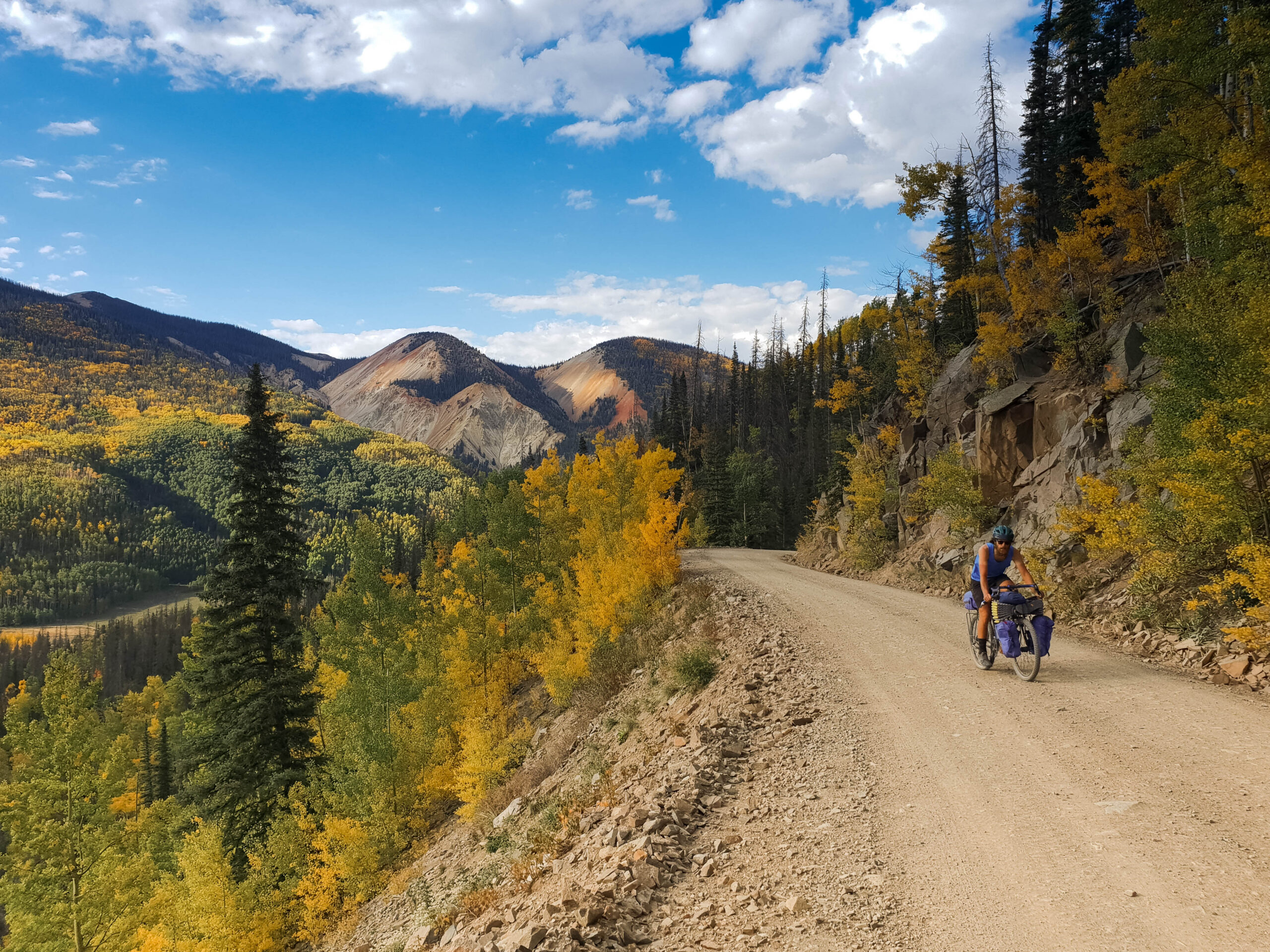
Ride the Great Divide Mountain Bike Route
Running from Jasper, Canada, to New Mexico, this route crosses the Continental Divide roughly 30 times, with most of its miles on dirt roads and mountain passes.
What to Expect
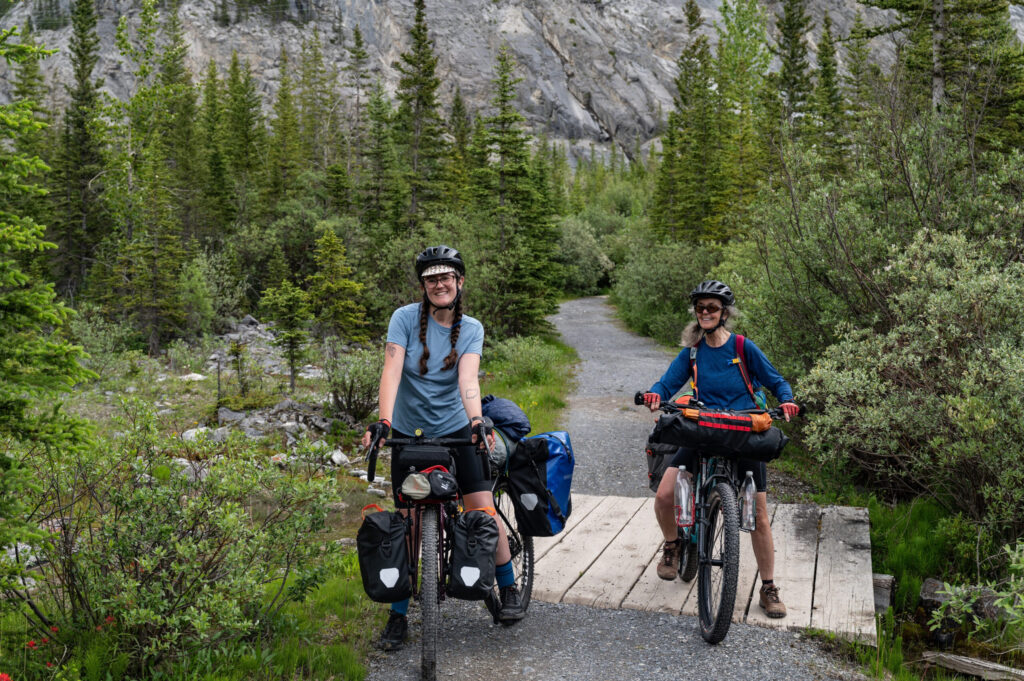
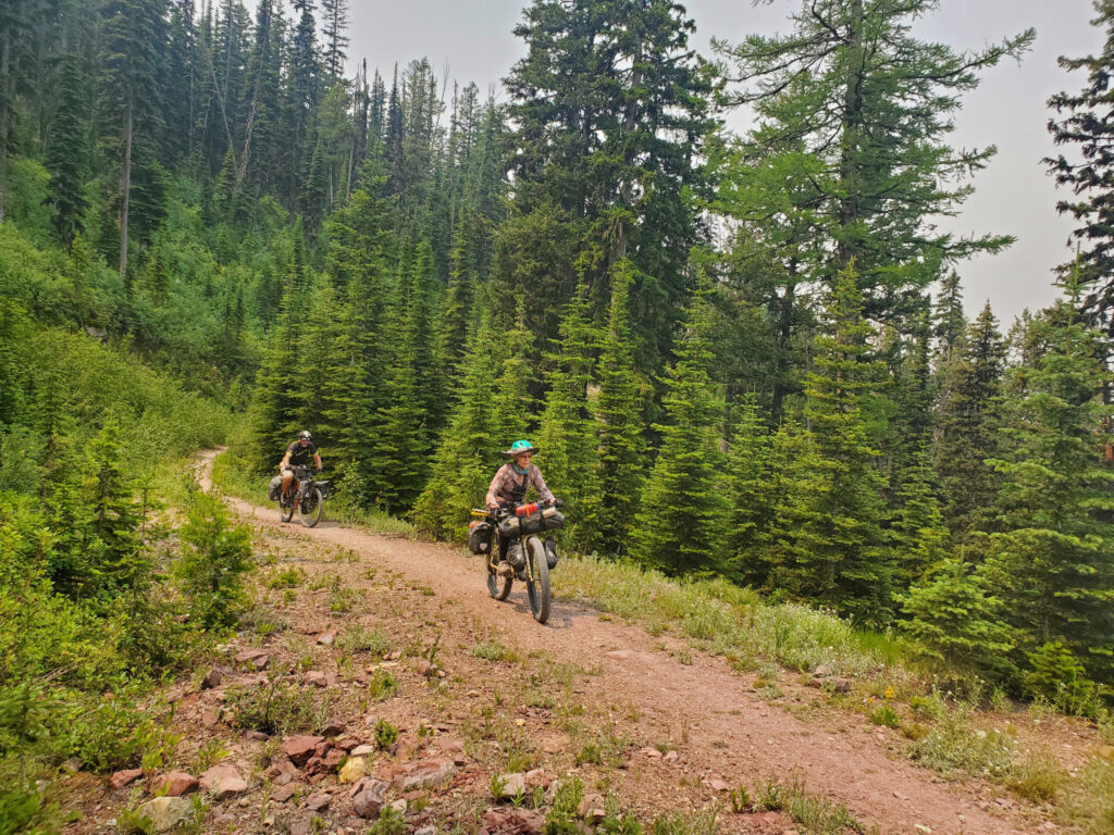
This route offers something different every day, whether it’s riding conditions, scenery, or wildlife, across five geographically distinct regions, from the glaciers and dense forests of the Canadian Rockies to the sagebrush of Wyoming and the piñon, juniper, and adobe villages of New Mexico. Road surfaces range from smooth gravel to washboarded four-wheel-drive tracks and singletrack, and riders should expect to be either climbing or descending nearly the entire way, aside from the flatter Great Divide Basin in Wyoming. It’s a serious undertaking that rewards strong fitness, mechanical self-sufficiency, and comfort with long, remote days far from help.
The ride opens in the Canadian Rockies near Banff, then passes near Glacier National Park and the Bob Marshall Wilderness, between Yellowstone and Grand Teton National Parks, and along the edge of Wyoming’s Wind River Range. Riders cross notorious Fleecer Ridge in Montana, Boreas Pass in Colorado, and the route’s highest point at Indiana Pass, at nearly 12,000 feet, before reaching New Mexico’s ghost towns, abandoned mines, old Spanish land grants, and Pie Town, famous for exactly what its name suggests. Wildlife sightings are common and include bears, elk, moose, pronghorn, wild horses, and a wide range of birds. The route finishes through the Gila National Forest and a final stretch of desert to the tiny border crossing at Antelope Wells.
Elevations start relatively low through the Canadian Rockies, climb to the route’s highest passes in Colorado, topping out near 12,000 feet at Indiana Pass, and taper back down through New Mexico. Some of the toughest climbs come in Montana and New Mexico, though, due to steep grades and rough road surfaces. The scenery shifts from glacier-carved valleys and dense conifer forest to open sagebrush basins, alpine ski country, and finally high desert mesas. The full route includes detailed riding conditions and field notes for every climb and descent.
This is one of the most remote routes in the network, with very limited cell coverage and towns spaced every two to three days along most stretches. About a third of overnight stops are undeveloped backcountry sites, and food sources are often limited to small convenience stores rather than full grocery stores. Bike shops are few and far between, so carry the tools and spares to handle most repairs yourself, and download your Ride with GPS route for offline use.
Ride from late June through mid-October. Late June or early July is the earliest safe start in the northern Rockies due to lingering snowpack, and riders should plan to be off the route by mid-October. Pack rain gear and cold-weather clothing regardless of timing, since snow, hail, or cold rain is possible at higher elevations any day of the season, and afternoon thunderstorms are common, so an early start each day helps avoid the worst weather. New Mexico’s late-summer monsoon rains, roughly July through September, can turn some roads to impassable mud, so build flexibility into the southern end of your itinerary.

Route Sections
Jasper, AB to Roosville, MT, 585.1 miles
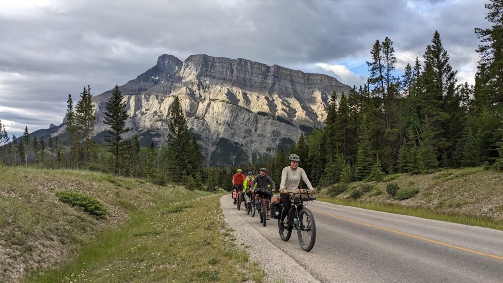
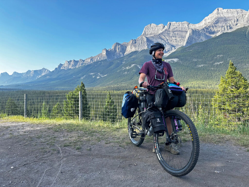
From Jasper, the route heads north before turning south through Hinton, Canmore, and Banff, crossing a string of national and provincial parks on the way to the U.S. border. Riders climb over Elk Pass on a powerline route and follow the Elk Valley Trail through the ski town of Fernie before reaching the border crossing near Grasmere.
Alternates:
- Flathead Alternate. A wilder, extremely remote option through a valley known locally as “Grizzly Bear Highway” for its dense bear population.
- Cadomin Alternate, 48 mi. Bypasses Hinton and its services while passing the historic coal mining town of Cadomin.
- Canmore Cutoff, 6.9 mi. A shortcut from Canmore to Goat Creek that skips the town of Banff.
- High Rockies Alternate, 31.2 mi. A singletrack option that parallels the main route with numerous connection points to mix and match the two.
Roosville, MT to Helena, MT, 371.1 miles
This section runs through heavily timbered mountains and historic mining country near Glacier National Park and the Bob Marshall Wilderness, crossing four national forests before reaching the Montana capital.
Alternates:
- Missoula Spur, 65.4 mi. A very challenging route to Missoula through steep terrain on overgrown logging roads and singletrack.
- Rimini Alternate, 12 mi. Shorter and bypasses Helena, though services are very limited.
Helena, MT to Colter Bay, WY, 453.3 miles
The route continues through Montana’s ranchland and historic mining regions, briefly crosses into Idaho on a converted rail-trail, and threads between Yellowstone and Grand Teton National Parks on the Reclamation Road.
Alternates:
- Boulder Alternate, 33.4 mi. Longer, follows I-15, and avoids some of the route’s most challenging terrain.
- Divide Alternate, 18.3 mi. Shorter and entirely paved, avoiding the technical Fleecer Ridge.
- Fish Creek Alternate, 42.7 mi. Slightly longer but avoids the extremely soft volcanic soils of the Yellowstone Branch Line Trail. No water available.
Colter Bay, WY to Rawlins, WY, 365.5 miles
This section crosses two high Continental Divide passes before skirting the Wind River Range and dropping into the Great Basin, one of the driest, most exposed stretches on the entire route, on the way to Rawlins.
Alternates:
- Jackson Spur, 40.8 mi. A scenic detour along the base of the Tetons into the town of Jackson.
- Wind River Alternate, 13.3 mi. Shorter with some pavement, useful for reaching services in Dubois.
Rawlins, WY to Salida, CO, 377.8 miles
The route climbs from Wyoming’s high desert into Colorado’s ski country, passing through Steamboat Springs and Breckenridge before crossing the Continental Divide again at Boreas Pass and descending into the high valley town of Salida.
Alternates:
- Columbine Alternate, 35.6 mi. Slightly shorter on a wider, potentially dustier road with similar traffic.
Salida, CO to Grants, NM, 539.2 miles
This section crosses the route’s highest point at Indiana Pass before descending into New Mexico’s high desert, passing through small villages, the Jemez Mountains, and the badlands near Chaco Mesa on the way to Grants.
Alternates:
- Chaco Alternate, 117.4 mi. Fully paved and provides access to Chaco Culture National Historical Park, useful during monsoon season when the main route’s dirt roads can turn to mud.
Grants, NM to Antelope Wells, NM, 405.3 miles
The final section passes El Malpais National Monument and the town of Pie Town before climbing across the rugged Gila National Forest into Silver City, then finishing across true desert to the Mexican border at Antelope Wells.
Alternates:
- El Malpais Alternate, 38.4 mi. Shorter and fully paved, useful in wet conditions.
- CDT Alternate, 11.4 mi. Shorter, using a technical stretch of the Continental Divide Trail that requires solid technical riding skills.
- Columbus Alternate, 47 mi. Ends instead at the border town of Columbus, home to Pancho Villa State Park and full services.
- Tres Hermanas Alternate (digital-only), 59.2 mi. A remote, unpaved option added in 2024 on rugged, unsigned doubletrack.
- Big Hatchet Alternate (digital-only), 61 mi. Another remote 2024 addition south of Hachita, with some washed-out sections that require hiking your bike.
Great Divide Mountain Bike Route Photos
Plan Your Ride
Given this route’s length, remoteness, and international border crossing, most riders spend serious time planning logistics, travel documents, and gear well before setting out.
Trip Planning & Logistics
This route crosses the U.S.–Canada border at Roosville, so U.S. citizens need a passport, passport card, enhanced driver’s license, or NEXUS card, and travelers from other countries should check visa and travel authorization requirements for both countries. Riders have traditionally ridden north to south for the best weather window, though the route works in both directions. Given how remote both ends are, Adventure Cycling maintains a list of shuttle options to help riders get to and from Jasper and Antelope Wells. This route is available in paper and digital formats through Adventure Cycling’s shop and includes routing, detailed service information, riding conditions, and field notes for trip planning. Riders are also encouraged to pick up the companion guidebook, Cycling the Great Divide, for added history and context along the way.
A high-quality water filter is essential, one per rider if traveling in a group, and from Salida, Colorado, south, protect your tires against goathead thorns, an invasive plant with puncture-prone spines, using sealant-filled tubes, tubeless setups with sealant, or tire liners. Pack a well-ventilated three-season tent, a sleeping bag rated below 20 degrees Fahrenheit, reliable rain gear for the many cold, wet nights at high elevation, and bear spray where you can reach it quickly.
Camping is abundant along the route on U.S. Forest Service, Bureau of Land Management, and provincial land, ranging from reservable sites with hookups to free dispersed sites where legal. In Canada, dispersed camping rules differ, and it’s generally not permitted in the national parks, so check regulations before heading into the backcountry. Forest Service campgrounds are usually inexpensive, though some campgrounds charge solo cyclists the same as a full tent or RV site. The Forest Service and Bureau of Land Management also rent cabins and lookout towers in some areas, though these book up months in advance, and motels and inns are available in most towns along the way.
Food sources are generally small-town cafes, convenience stores, and campground stores with limited supplies, so flexibility in meal planning matters here. And yes, Pie Town in New Mexico really does serve pie. Water can run scarce for long stretches, particularly between Pinedale and Rawlins, Wyoming, and through parts of New Mexico, where riders should carry 3 to 4 gallons at a time in the driest sections. Check your digital route in Ride with GPS for service phone numbers, and call ahead for anything outside peak season.
This route runs through grizzly and black bear country north of Pinedale, Wyoming, and black bear country south of there, so carry bear spray and store food properly away from camp; read Biking with Bears and How to Be Bear Aware When Bike Camping. Cell coverage is very limited, so a satellite communication device is worth carrying, along with a minimum group size of three. Afternoon thunderstorms bring lightning on exposed passes, so plan to be down from high ground by midday. Expect cattle, cattle guards, and ranch dogs on open-range roads, and wear blaze orange during fall hunting season. Wildfire has closed portions of this route in every state and province it passes through at one time or another, so check current conditions regularly before and during your trip. Always check Adventure Cycling Route Updates and Corrections before you go.
- Practical Advice for Riding the Great Divide Mountain Bike Route
- Biking with Bears
- How to Be Bear Aware When Bike Camping
- IMBA Rules of the Trail
- Roosville/Grasmere border crossing info
- U.S./Canada visa requirements
- Dispersed Camping Guidelines
- National Interagency Fire Center
- Great Divide Shuttle Options
- Antelope Wells and Columbus, New Mexico border crossings
Routes change. Bridges wash out, businesses close, and construction pops up overnight. We strive to keep routes updated as those things happen. When we learn about a change, we reroute around sections that have become dangerous or are temporarily closed for road work, bridge outages, or construction, and we update service information as businesses open, close, or move. Digital routes are updated as soon as we’ve reviewed a reported issue.
You’re often the first to spot these changes out on the road. Help us keep this route accurate for the next rider by reporting anything you notice with our Route Feedback Form.
This Route Is Part of Something Bigger
It’s one piece of the Adventure Cycling Route Network, began in 1976 and built on a simple mission: to empower people to travel by bike. Our team maps and maintains it; our members and donors make it possible.
-
Explore the Adventure Cycling Route Network
Our premium routes are well researched by our cartographers and well traveled by thousands of cyclists.
Adventure Cycling Route Network -
Support Route Development
Our members are the reason we can offer three route networks tailored for specific experiences and riders.
Become a Member -
Stay Connected
Find your stoke with our newsletter all about routes, gear, stories, and cycling news in your inbox twice a month.
Sign up for Bike Bits
Frequently Asked Questions
It’s our flagship, staff-built route network. The one that started it all 50 years ago with the TransAmerica Trail, the route that launched bicycle touring and bikepacking in America. Every route in it is designed and researched by our own team of cyclists and cartographers: months of research and on-the-ground testing go into each one, so what you get is more than a line on a map. Each Adventure Cycling route has detailed logistics, terrain and elevation info, points of interest, camping and lodging, safety alerts, and history, all in one place. It’s the most in-depth of our three networks, available as digital routes and most as paper maps too. It’s the route network we update most regularly as conditions change.
They’re related, but not the same thing. The Adventure Cycling Route Network is made up of routes we’ve researched, ridden, and mapped ourselves, chosen specifically for a great touring or bikepacking experience. The U.S. Bicycle Route System (USBRS) is a state-by-state national system that we serve as technical experts for, made official through each state’s department of transportation. The two overlap in a lot of places, but an ACRN route carries our own on-the-ground vetting; a USBRS route carries official state recognition.
It depends! If you want a route we’ve personally scouted end to end, with services, camping, and terrain notes built in, start with the Route Network. The ACA Route Network has routes of many different lengths and can be a much easier starting place for someone new to bicycle travel. If you’re an experienced cyclist piecing together an officially designated corridor, or riding somewhere the two systems converge, the interactive USBRS map is a good resource to use.
The Adventure Cycling Route Network is a premium network because of everything that goes into it. Unlike the U.S. Bicycle Route System (built by state DOTs) or Short Routes (submittedby cyclists in their own communities), every Adventure Cycling route is researched, ridden, and vetted end-to-end by our own team. Unlike other routes, Adventure Cycling routes come with extensive information on riding conditions, terrain notes, camping and lodging info, logistics, safety alerts, and points of interest. We also keep it current as roads and services change. The price supports that ongoing research and maintenance work, done by a nonprofit whose whole mission is making sure the route in your hands is one you can trust.
Turn-by-turn directions with a bike icon aren’t the same as a route built for specifically touring or bikepacking. Every mile in the Adventure Cycling Route Network has been researched and ridden by our staff and researchers, chosen to avoid dangerous traffic, and mapped with what a touring cyclist actually needs — food, water, camping, hotels, bike shops — spaced out along the way. The Adventure Cycling Route Network was built for cyclists by cyclists, is regularly updated, and comes with the resources and information needed to plan your ride.
No. The network includes routes for a wide range of experience and difficulty levels, from a first multi-day trip to a cross-country expedition. What every route has in common is that it was chosen with a touring cyclist’s needs in mind, whatever kind of trip you’re planning.
Not at all. Alongside iconic long-distance routes like the TransAmerica Trail, the network includes shorter regional routes, so it works for a weeklong vacation or a two-month journey.
For many years, we focused on paved routes, but today the network includes plenty of unpaved gravel riding for bikepacking. In fact, Adventure Cycling mapped the Great Divide Mountain Bike Route in 1998, arguably the most impactful bikepacking route in the world. The Adventure Cycling Route Network also includes the Golden Gravel Trail, Idaho Hot Springs Mountain Bike Route, Arkansas High Country Route, and more. Some routes are a 50/50 mix of pavement and gravel. Some routes follow paved and unpaved bike paths and rail trails. The Adventure Cycling Route Network has terrain for every cyclist.
We revisit our printed maps every three to five years, and push corrections to our digital route data as we learn about changes on the ground. If you have an Adventure Cycling Route in Ride with GPS that we’ve updated, you’ll get a notification when you open the route to update to the newest version of the route. Updating will ensure you have the latest data, information, and points of interest vital to being on route. For cyclists who have Adventure Cycling paper maps, we keep a list of route- and section-specific updates current on our Map Updates and Corrections page.
Change comes from two directions: our own staff research and reports from the cyclists actually out there riding them. If a bridge washes out, a shoulder disappears, a campground closes for repairs, or a town loses its only grocery store, that’s the kind of thing that triggers an update. You can help us keep our routes accurate; fill out our Route Feedback Form.
Most of our Adventure Cycling Routes come as waterproof print maps and digital Ride with GPS navigational data. Our print maps are the #1 longstanding popular resource for traveling cyclists. They are waterproof, highly detailed and always work. For long trips, many cyclists use a combination of print maps and digital routes.
If you’re already comfortable and familiar with a GPS navigational aid such as Ride with GPS or a Garmin, our digital data packages are an excellent choice. We do not recommend GPX data for beginners since there are a few extra steps to installing and troubleshooting.
Once you purchase a digital route, you’ll get an email with a link to unlock it in the free Ride with GPS app — no separate subscription required for basic navigation. From there you get turn-by-turn voice directions, curated points of interest like campgrounds and bike shops, and field notes on the history, geography, and climate along your route, all available 100% offline. If you’drather use a dedicated GPS device, you can export the route as a GPX file to load onto a Garmin, Wahoo, or similar device.
To export GPX files of your Adventure Cycling digital route, use your laptop or desktop to open the email you received after purchasing your digital route. Click on the link that allows you to access your Digital Route. Finally, click on EXPORT ALL at the bottom of the screen. This is the only way to export files that include the route line, points of interest, and services. Files will be exported as one ZIP file.
Adventure Cycling uses abbreviations across its paper and digital routes to indicate particular services, land or road types, route names, direction of travel, and route type. Please see our key to abbreviations.
If you have questions on how to purchase a digital route or about the route content, please contact Adventure Cycling: cartography@adventurecycling.org or 406-721-1776.
If you have questions on how to use your Digital Route in Ride with GPS, please check the Ride with GPS support page or email them at info@ridewithgps.com.
If you’re new to Ride with GPS, please check out the following resources:
Our print map panels aren’t always oriented northwards for space and layout reasons. Refer to the north arrows to help orient yourself if you’re not sure.
No. The Routes and Mapping Department does not do custom routes for individuals. Check out the routes we’ve already mapped, and use the interactive map to piece our route networks together, forming a route that gets you from a point A to point B of your choice.
It started with a single route. In 1976, we mapped the TransAmerica Trail, and more than 4,000 cyclists crossed the country together for Bikecentennial — the nation’s bicentennial cycling celebration our founders organized. That one route became the seed of a network we’ve spent the decades since expanding. Today it’s more than 58,000 miles of mapped routes across the U.S. and Canada, from classic epics like the TransAmerica Trail, Great Divide Mountain Bike Route, and Pacific Coast, to shorter regional routes.