Ask an Adventure Cycling Tour Leader: What Should I Do If I Get Lost?

I’ve recently gotten into bike touring, but I’ve never been great with maps and directions. Is it common to get lost on a tour, and how should I handle it if I do?
Dear Directionally Challenged,
Thanks for your honesty about something you find difficult. And great job not letting this stop you from getting out there. Whether it’s a route we researched ourselves or one that’s been curated by Adventure Cycling’s cartography team, the potential for losing your way is always there.
If you feel like something’s not right, the first step is to simply pull over as soon as you can safely do so. The next step is to not panic. Just because you’re off course doesn’t mean you’re actually lost. A little detour can be fun, and it can add to the adventure. (Significant bonus miles, however, can be less appealing.)
If you’re riding in a city, it’s easy to miss a turn in a high-traffic area. Keep your wits about you and make sure you’re not compromising safety to return to your intended route. For any tricky intersection, it’s okay to become a pedestrian. Hop off your bike and use those crosswalks rather than attempt to cross multiple lanes in traffic while pedaling a loaded rig.
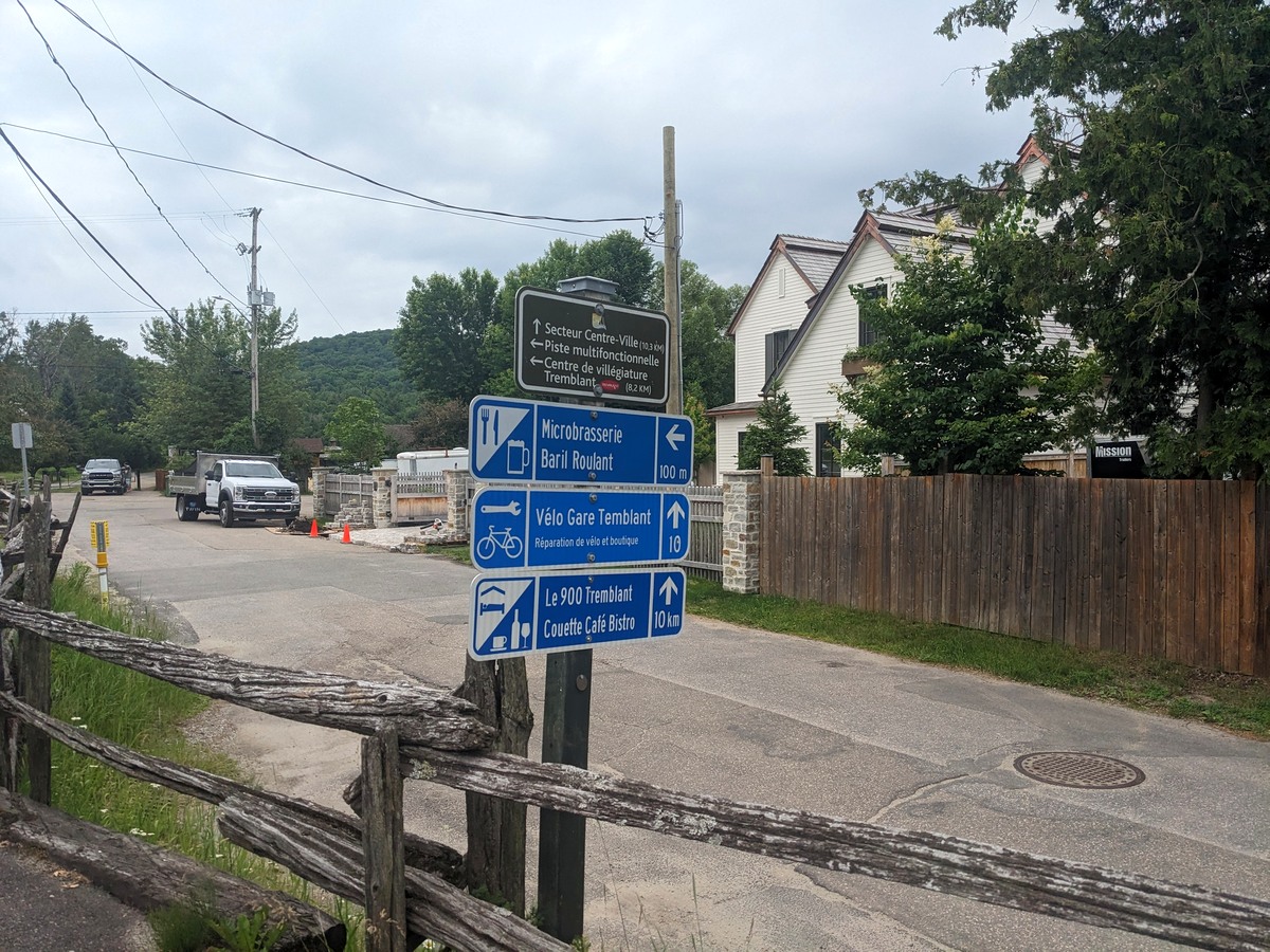
Speaking of cities, urban bike trails tend to be my personal navigational downfall. Some networks are well marked. Others have multiple spurs with unclear signage, if they have any signage at all. And while underpasses and overpasses are great for keeping us away from cars, they sometimes confuse my bike computer. This is often when I find myself going back and forth trying to determine if I am on the route or not.
Which brings me to the topic of digital navigation versus paper. I love poring over paper maps to get a big-picture idea of things, but when it comes to navigating in the moment, I gravitate toward digital tools.

Ride with GPS hosts all of Adventure Cycling’s free and paid digital maps, but whichever digital navigation tool you decide on, practice helps. Before setting out, tackle a few shorter routes close to home to get comfortable with the user interface. Then go off course on purpose to see what happens. For example, I opted to turn off the setting on my Wahoo bike computer that “reroutes to course” automatically because its supposedly helpful reroute often added to my confusion. Now if I’m off course, it simply blinks red and shows me both how far I’ve strayed and what opportunities I have for getting back on course. And be sure to test how all of your digital tools work in airplane mode because that will greatly extend your battery life on the road.
It’s also helpful to validate where you are through multiple methods, paper backup included. If you’re navigating using a bike computer and things aren’t making sense, get out your phone and see what Google Maps has to say. Simply seeing where your blue dot is in relation to where you thought you were and where your bike computer says you are is a good step one.
Another nice use of technology is sharing your location with your riding partners at the start of each day. Even if you plan to stick together, it’s nice to know that, if you spread out at some point, you’ll be able to keep track of each other.
Once you figure out where you are and where you want to go, you have a decision to make. Backtracking to where you got off course might be the best way to alleviate your anxiety about being lost. If it’s a significant distance, however, you may want to look ahead to see if there’s any feasible way to rejoin your intended route down the road. When I was leading the Alaska Golden Circle tour, one of our participants missed the turnoff from the Alaska Highway to a local access road. It was several miles before he realized he’d gone too far. Fortunately, that same access road met up with the Alaska Highway again, and he was able to turnoff there and backtrack to our overnight spot.
It’s not always so simple, and there will be times when leaving a vetted route risks making you more lost. Even with — maybe especially with — the apps we rely on today, sometimes the route we see on a map doesn’t match reality. I’ve seen sensible-looking roads show up as a “County Road” on Google Maps only to find an overgrown, impassable path in front of me instead.
Finally, there is more to plan for regarding getting lost than simply how to find your way again. First, underestimate the daily mileage you can reasonably tackle on a loaded bike. If a 60- to 70-mile day sounds good on paper, think about how that day might look if you have 10 to 15 bonus miles. Not nearly as fun. And even if the added mileage is modest, just stopping to recalibrate or reassess takes time. So, unless you really have to cover a significant distance due to services, planning for 40- to 50-mile days will give you a reasonable buffer for when things go wrong.
This is why it’s also necessary to have some backup food, backup power for your phone or navigational device, and plenty of water. Towns with services, especially in the West, can be a good distance apart, so a spare liter tucked in one of your panniers is essential if you’re in between these resupply places longer than intended. Be prepared to take care of yourself, but don’t be shy about flagging down a motorist. They’re usually more than willing to help.
Many of us tour because we crave an element of adventure, so getting off course for a bit shouldn’t be a bad thing. As long as we’ve prepared properly and can keep our wits about us, the occasional unintended detour can be one of the most memorable parts of the journey. Happy pedaling!