Allegheny Mountains Loop
Quiet hollows, ridgetop climbs, and a telescope that listens to the stars, all stitched together by steep Appalachian ridges.
- Distance
- 409.6 miles
- Surface
- 40% paved
- 1 week–3 weeks
- Route Type
- Loop

Ride the Allegheny Mountains Loop
Starting and ending in Blacksburg, Virginia, this loop crosses through remote valleys, over steep mountain ridges, and along a long-distance rail trail.
What to Expect
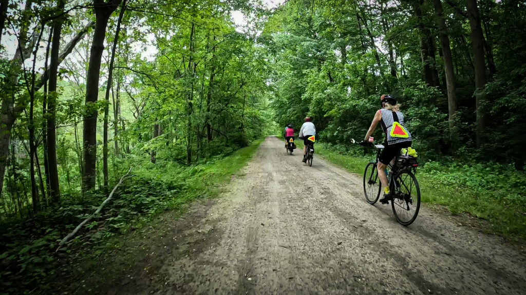
This loop packs a lot of variety into one route: pavement and gravel, gentle river valleys and steep, muscle-burning climbs, and a car-free rail trail. Expect hardwood forests, rushing rivers, and quiet farm valleys, with long stretches where you’ll see few cars and fewer towns. The Greenbrier River Trail offers a long, nearly flat stretch of packed gravel, but the ridge crossings between valleys bring grades of 6 to 10 percent, occasionally as steep as 18 percent.
The Green Bank Observatory is the showstopper: its telescope is the largest fully steerable radio telescope in the world, set inside the National Radio Quiet Zone, where cell phones and wifi are restricted. In Cass, the Cass Scenic Railroad State Park runs historic steam locomotives up to Bald Knob, one of the highest summits in West Virginia, and nearby Durbin has its own excursion railroad. Along the way, look for Virginia’s historic Humpback Bridge, Droop Mountain Battlefield State Park, and the Pearl S. Buck Birthplace. Riders taking the Mountain Lake Cutoff pass Mountain Lake Lodge, the filming location for Dirty Dancing.
Valley roads run flat to rolling with occasional hills, while roads climbing over ridges turn steep and winding. The Greenbrier River Trail, a converted rail line, offers close to 80 miles of nearly flat riding on packed gravel with a short paved stretch near Marlinton.
This route runs through some of the most remote country in the Adventure Cycling Route Network. The gravel U.S. Forest Service roads through the Monongahela National Forest see minimal traffic and few services, and cell service is spotty to nonexistent across much of the West Virginia stretch, especially inside the National Radio Quiet Zone around Green Bank. Download your Ride with GPS route for offline use, and carry tools and spares for the gravel sections.
Ride from spring through early fall, roughly April through mid-September. Summers in the Allegheny Mountains run hot and humid, with frequent afternoon showers and weather that can shift quickly between valleys and ridges. Fall brings spectacular foliage, but some campgrounds close after Labor Day, so call ahead if you’re riding late in the season.

Route Sections
Blacksburg, VA to Blacksburg, VA, 409.6 miles
From Blacksburg, the route rolls along the New River before entering the first of several remote valleys in Virginia. Riders head northeast through quiet valleys and over ridges on lightly trafficked, partly gravel county roads before crossing into West Virginia near Mountain Grove. From there, gravel Forest Service roads lead through the Monongahela National Forest to the Greenbrier River Trail near Cass, and the route follows the trail’s full length before returning on remote county roads, crossing back into Virginia near Waiteville to close the loop in Blacksburg. The full Adventure Cycling route includes turn-by-turn directions, service information, and field notes for the entire loop.
Alternates:
- Mountain Lake Cutoff, 24 mi. Shortens the main loop and passes Mountain Lake Lodge. Recommended south to north when returning to Blacksburg, since it’s shorter and includes a paved downhill in that direction.
- Dunmore Cutoff, 24.5 mi. Cuts the main route by 73.5 miles and heads directly to Cass over a major ridge into West Virginia.
- Durbin Cutoff, 2 mi. Cuts the main route by 50.8 miles and ends just north of Durbin, West Virginia.
Allegheny Mountains Loop Photos



Plan Your Ride
This loop’s remote forest roads and limited services call for extra planning around food, water, and camping, especially through the Monongahela National Forest stretch.
Trip Planning & Logistics
Blacksburg sits in southwest Virginia near the TransAmerica Trail, with Roanoke about 40 miles away for a larger airport and services. Ride between late spring and late fall for the best conditions, and consider calling ahead if planning an autumn trip, since some campgrounds close after Labor Day. Riders choose a clockwise or counterclockwise direction and can shorten the route with one of three cutoff options along the way.
As a digital-only route, this loop is available through Adventure Cycling’s shop as a Ride with GPS experience, which includes routing, detailed service information, riding conditions, and field notes for trip planning.
Portions of the route run on gravel county roads and Forest Service roads, so a bike with wider tires is recommended over a standard road setup. A gravel or touring bike suits most of the route well, while riders sticking to the paved alternates could get by with narrower tires.
Front and rear lights and bright, visible clothing are worth packing for the mountain highway sections, which run narrow and winding with little to no shoulder and short sight lines on climbs and descents. Pack layers for temperature swings between valley floors and ridge tops, and bring extra water capacity for the long stretch through the Monongahela National Forest.
You can camp or find lodging along most of the loop, with campgrounds and motels in and near the larger towns. Advance reservations are recommended for both, especially on weekends. Virginia’s no-turn-away policy guarantees cyclists a campsite at participating campgrounds, even when they’re full. Some campgrounds charge solo cyclists the same as a full tent or RV site, often $10 to $30 per night, though hiker/biker rates are sometimes available. The Greenbrier River Trail offers primitive campsites, drinking water, and restrooms along its length, and Cass Scenic Railroad State Park rents restored company-town cottages.
Groceries on route are mostly limited to convenience stores, with fuller services in the larger towns along the loop. Stock up on food and water before the Monongahela National Forest stretch, where services are minimal; the Greenbrier River Trail’s campsites are a reliable water source. Check your digital route in Ride with GPS for service phone numbers, and call ahead for anything outside peak season.
Highway sections in the mountains run narrow and winding with minimal to no shoulder, so bright clothing and caution are important, especially when climbing or descending ridges. Expect more traffic on weekends near the Lake Moomaw and Bolar Mountain Recreation areas. Always check Adventure Cycling Route Updates and Corrections before you go.
- No-Turn-Away Bike Camping Policies (Virginia)
- Greenbrier River Trail (West Virginia State Parks)
- Tangent Outfitters (vehicle overnight location)
- Pocahontas County Convention and Visitors Bureau (West Virginia)
Routes change. Bridges wash out, businesses close, and construction pops up overnight. We strive to keep routes updated as those things happen. When we learn about a change, we reroute around sections that have become dangerous, update service information as businesses open, close, or move, and reroute around temporary road and bridge closures or construction. Digital routes are updated as soon as we’ve reviewed a reported issue.
You’re often the first to spot these changes out on the road. Help us keep this route accurate for the next rider by reporting anything you notice with our Route Feedback Form.
This Route Is Part of Something Bigger
It’s one piece of the Adventure Cycling Route Network, began in 1976 and built on a simple mission: to empower people to travel by bike. Our team maps and maintains it; our members and donors make it possible.
-

Explore the Adventure Cycling Route Network
Our premium routes are well researched by our cartographers and well traveled by thousands of cyclists.
Adventure Cycling Route Network -
Support Route Development
Our members are the reason we can offer three route networks tailored for specific experiences and riders.
Become a Member -

Stay Connected
Find your stoke with our newsletter all about routes, gear, stories, and cycling news in your inbox twice a month.
Sign up for Bike Bits
Frequently Asked Questions
It’s our flagship, staff-built route network. The one that started it all 50 years ago with the TransAmerica Trail, the route that launched bicycle touring and bikepacking in America. Every route in it is designed and researched by our own team of cyclists and cartographers: months of research and on-the-ground testing go into each one, so what you get is more than a line on a map. Each Adventure Cycling route has detailed logistics, terrain and elevation info, points of interest, camping and lodging, safety alerts, and history, all in one place. It’s the most in-depth of our three networks, available as digital routes and most as paper maps too. It’s the route network we update most regularly as conditions change.
They’re related, but not the same thing. The Adventure Cycling Route Network is made up of routes we’ve researched, ridden, and mapped ourselves, chosen specifically for a great touring or bikepacking experience. The U.S. Bicycle Route System (USBRS) is a state-by-state national system that we serve as technical experts for, made official through each state’s department of transportation. The two overlap in a lot of places, but an ACRN route carries our own on-the-ground vetting; a USBRS route carries official state recognition.
It depends! If you want a route we’ve personally scouted end to end, with services, camping, and terrain notes built in, start with the Route Network. The ACA Route Network has routes of many different lengths and can be a much easier starting place for someone new to bicycle travel. If you’re an experienced cyclist piecing together an officially designated corridor, or riding somewhere the two systems converge, the interactive USBRS map is a good resource to use.
The Adventure Cycling Route Network is a premium network because of everything that goes into it. Unlike the U.S. Bicycle Route System (built by state DOTs) or Short Routes (submittedby cyclists in their own communities), every Adventure Cycling route is researched, ridden, and vetted end-to-end by our own team. Unlike other routes, Adventure Cycling routes come with extensive information on riding conditions, terrain notes, camping and lodging info, logistics, safety alerts, and points of interest. We also keep it current as roads and services change. The price supports that ongoing research and maintenance work, done by a nonprofit whose whole mission is making sure the route in your hands is one you can trust.
Turn-by-turn directions with a bike icon aren’t the same as a route built for specifically touring or bikepacking. Every mile in the Adventure Cycling Route Network has been researched and ridden by our staff and researchers, chosen to avoid dangerous traffic, and mapped with what a touring cyclist actually needs — food, water, camping, hotels, bike shops — spaced out along the way. The Adventure Cycling Route Network was built for cyclists by cyclists, is regularly updated, and comes with the resources and information needed to plan your ride.
No. The network includes routes for a wide range of experience and difficulty levels, from a first multi-day trip to a cross-country expedition. What every route has in common is that it was chosen with a touring cyclist’s needs in mind, whatever kind of trip you’re planning.
Not at all. Alongside iconic long-distance routes like the TransAmerica Trail, the network includes shorter regional routes, so it works for a weeklong vacation or a two-month journey.
For many years, we focused on paved routes, but today the network includes plenty of unpaved gravel riding for bikepacking. In fact, Adventure Cycling mapped the Great Divide Mountain Bike Route in 1998, arguably the most impactful bikepacking route in the world. The Adventure Cycling Route Network also includes the Golden Gravel Trail, Idaho Hot Springs Mountain Bike Route, Arkansas High Country Route, and more. Some routes are a 50/50 mix of pavement and gravel. Some routes follow paved and unpaved bike paths and rail trails. The Adventure Cycling Route Network has terrain for every cyclist.
We revisit our printed maps every three to five years, and push corrections to our digital route data as we learn about changes on the ground. If you have an Adventure Cycling Route in Ride with GPS that we’ve updated, you’ll get a notification when you open the route to update to the newest version of the route. Updating will ensure you have the latest data, information, and points of interest vital to being on route. For cyclists who have Adventure Cycling paper maps, we keep a list of route- and section-specific updates current on our Map Updates and Corrections page.
Change comes from two directions: our own staff research and reports from the cyclists actually out there riding them. If a bridge washes out, a shoulder disappears, a campground closes for repairs, or a town loses its only grocery store, that’s the kind of thing that triggers an update. You can help us keep our routes accurate; fill out our Route Feedback Form.
Most of our Adventure Cycling Routes come as waterproof print maps and digital Ride with GPS navigational data. Our print maps are the #1 longstanding popular resource for traveling cyclists. They are waterproof, highly detailed and always work. For long trips, many cyclists use a combination of print maps and digital routes.
If you’re already comfortable and familiar with a GPS navigational aid such as Ride with GPS or a Garmin, our digital data packages are an excellent choice. We do not recommend GPX data for beginners since there are a few extra steps to installing and troubleshooting.
Once you purchase a digital route, you’ll get an email with a link to unlock it in the free Ride with GPS app — no separate subscription required for basic navigation. From there you get turn-by-turn voice directions, curated points of interest like campgrounds and bike shops, and field notes on the history, geography, and climate along your route, all available 100% offline. If you’drather use a dedicated GPS device, you can export the route as a GPX file to load onto a Garmin, Wahoo, or similar device.
To export GPX files of your Adventure Cycling digital route, use your laptop or desktop to open the email you received after purchasing your digital route. Click on the link that allows you to access your Digital Route. Finally, click on EXPORT ALL at the bottom of the screen. This is the only way to export files that include the route line, points of interest, and services. Files will be exported as one ZIP file.
Adventure Cycling uses abbreviations across its paper and digital routes to indicate particular services, land or road types, route names, direction of travel, and route type. Please see our key to abbreviations.
If you have questions on how to purchase a digital route or about the route content, please contact Adventure Cycling: cartography@adventurecycling.org or 406-721-1776.
If you have questions on how to use your Digital Route in Ride with GPS, please check the Ride with GPS support page or email them at info@ridewithgps.com.
If you’re new to Ride with GPS, please check out the following resources:
Our print map panels aren’t always oriented northwards for space and layout reasons. Refer to the north arrows to help orient yourself if you’re not sure.
No. The Routes and Mapping Department does not do custom routes for individuals. Check out the routes we’ve already mapped, and use the interactive map to piece our route networks together, forming a route that gets you from a point A to point B of your choice.
It started with a single route. In 1976, we mapped the TransAmerica Trail, and more than 4,000 cyclists crossed the country together for Bikecentennial — the nation’s bicentennial cycling celebration our founders organized. That one route became the seed of a network we’ve spent the decades since expanding. Today it’s more than 58,000 miles of mapped routes across the U.S. and Canada, from classic epics like the TransAmerica Trail, Great Divide Mountain Bike Route, and Pacific Coast, to shorter regional routes.