U.S. Bicycle Route 20
Three separate slices of the northern U.S., from the Columbia Plateau to Minnesota's lake country to Michigan's Lower Peninsula, each linked by ferry, trail, or rail.
- Distance
- 703 miles
- Surface
- 98% paved
Get the Full Route in Ride with GPS
Access the details and download free digital maps
 Open in Ride with GPS
Ride the U.S. Bicycle Route 20
U.S. Bicycle Route 20 currently has three separate sections: a short, rugged traverse of Washington’s Columbia Plateau, a route across Minnesota, and a crossing of Michigan’s Lower Peninsula.
What to Expect
Minnesota’s trails make for easy, low-stress riding, and Michigan’s section is gently rolling, so the Washington section is by far the most demanding of the three.
In Washington, riders climb through dry wheat country to Alpowa Summit, then descend to the Snake River at Clarkston. Minnesota’s section strings together the Heart of the Lakes Trail, Central Lakes State Trail, and Lake Wobegon Regional Trail through prairie and lake country, then follows the Mississippi River through St. Cloud, the Twin Cities, and Hastings. In Michigan, the route links Ludington, home port of the SS Badger car ferry across Lake Michigan, with Midland, Bay City, and the ferry crossing to Walpole Island in Ontario.
Riders connecting the three sections will need to plan their own routes in between. In Michigan, the seasonal SS Badger ferry links Ludington to Wisconsin, and the Walpole–Algonac Ferry crosses into Ontario, so bring a passport or other approved travel document if you plan to use it.
This route is signed in Michigan. Be aware that signs can be damaged, stolen, or otherwise missing, so you can never rely totally on following signs.
Routes change. Bridges wash out, businesses close, and construction pops up overnight. We strive to keep routes updated as those things happen. When we learn about a change, we reroute around sections that have become dangerous, update service information as businesses open, close, or move, and reroute around temporary road and bridge closures or construction. Digital routes are updated as soon as we’ve reviewed a reported issue.
You’re often the first to spot these changes out on the road. Help us keep this route accurate for the next rider by reporting anything you notice with our Route Feedback Form.

States
Washington’s section begins on U.S. Highway 12 near Lewis and Clark Trail State Park and travels east across the Columbia Plateau to the Idaho border at Clarkston. The route passes through Dayton and Pomeroy while crossing a dry, open landscape of agricultural valleys and rolling hills.
Riders climb gradually toward Alpowa Summit, the section’s high point at 2,785 feet, before descending toward the Snake River and Chief Timothy Park. Designated in 2021, this section is the first completed part of the planned U.S. Bicycle Route 20 corridor across southern Washington.
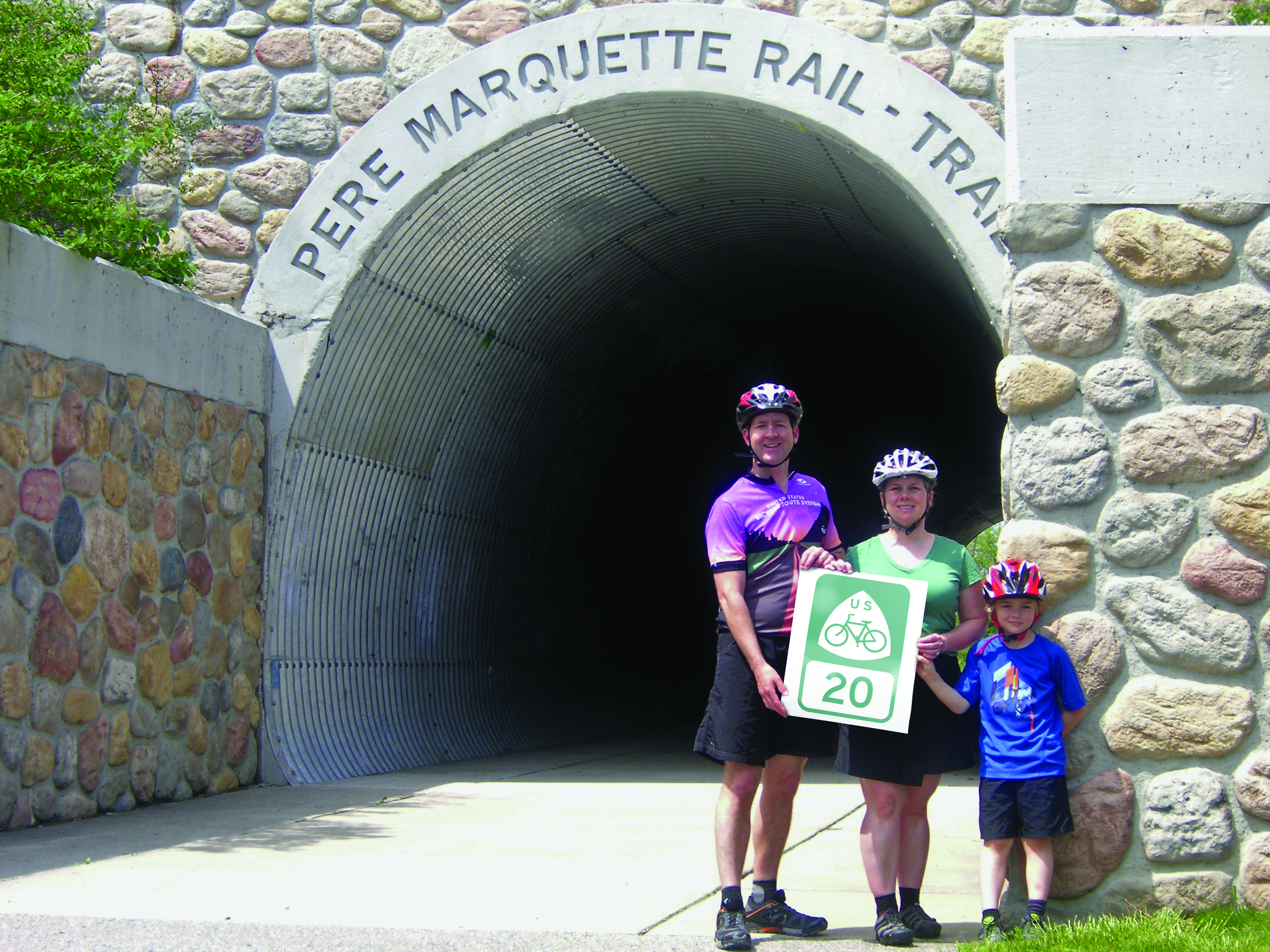
Minnesota’s section begins in Moorhead and travels across the state to the Wisconsin border. More than two-thirds of the route uses off-road trails, connecting prairie, lakes, parks, and small communities before following the Mississippi River through the Twin Cities metropolitan area.
From Moorhead, riders use trails and county roads to reach communities including Barnesville and Pelican Rapids. The route then connects the Heart of the Lakes Trail, Central Lakes State Trail, and Lake Wobegon Regional Trail on its way to St. Cloud. There, it meets U.S. Bicycle Route 45 and follows the same corridor south through the Twin Cities and Hastings before reaching Wisconsin.
Amtrak’s Empire Builder provides additional access through stops in the Fargo–Moorhead area, St. Cloud, and Minneapolis–St. Paul. Bicycle reservations are required.
Michigan’s section crosses the center of the Lower Peninsula between Ludington on Lake Michigan and Algonac on the St. Clair River. Rural roads and paved trails connect forests, farmland, small communities, and cities including Midland and Bay City.
At its western end, the seasonal SS Badger carries travelers across Lake Michigan between Ludington and Manitowoc, Wisconsin. At the eastern end, the Walpole–Algonac Ferry connects Michigan with Walpole Island First Nation in Ontario, so bring a passport or other approved travel document. Portions of the route coincide with Adventure Cycling’s North Lakes route and Lake Erie Connector.
This Route Is Part of a Decades-Long Advocacy Effort
The U.S. Bicycle Route System (USBRS) is a national network Adventure Cycling has helped build since 2003. Shaped by public input from the communities it passes through, and supported by our members and donors, every mile is free to ride.
-

Explore the U.S. Bicycle Route System
Discover what makes this paved interstate system unique, find a route near you, or work with us to advocate for more routes.
Learn more about the Network -
Support Route Development
Our members are the reason we can offer three route networks tailored for specific experiences and riders.
Become a Member -

Stay Connected
Find your stoke with our newsletter all about routes, gear, stories, and cycling news in your inbox twice a month.
Sign up for Bike Bits
Frequently Asked Questions
It’s a national network of officially numbered and signed bicycle routes, built from existing paved roads, paths, and trails chosen specifically for bike travel. Unlike a single bike lane or a state’s own bike map, U.S. Bicycle Routes are approved through the same national body that numbers interstate highways, AASHTO, which is what lets a route carry one consistent number as it crosses state lines.
AASHTO first created the U.S. Bicycle Route System in 1978, and in 1982 it designated the system’s first two routes — USBR 1, running from North Carolina into Virginia, and part of USBR 76, from Illinois through Kentucky into Virginia. Then growth stalled: for almost three decades, those two routes were the entire system. In 2003, AASHTO formed a task force — with Adventure Cycling as the technical partner — to figure out how to actually grow it, and by 2008 AASHTO had approved a national corridor plan to guide expansion state by state. Since then, the system has grown steadily every year, and Adventure Cycling has served as its technical expertand partner to DOTs across the country throughout.
Adventure Cycling isn’t the owner or approver of the U.S. Bicycle Route System. Our role is technical expert and coordinator: since 2003, we’ve been the organization that helps states, regional agencies, and advocacy groups actually get routes designated, offering free technical assistance, planning resources, and coordination across state lines. We’re also the only organization that hosts the entire system in one place, so riders can plan a U.S. Bicycle Route trip from a single map instead of stitching together dozens of separate state resources.
It’s the only bike route network in the country that’s officially sanctioned, numbered, and signed by state departments of transportation and AASHTO, the same organization responsible for the U.S. Interstate Highway System. That official status is what makes it the largest public bike route network in the world. Every mile is free to ride, and a route can carry the same number for hundreds of miles across multiple states, the way I-90 does for cars.
No. A state bike map might show every road that’s technically legal to ride; a bike lane is a single piece of infrastructure. A U.S. Bicycle Route is neither. It’s a complete, continuous corridor stitched together from existing roads, paths, and trails, evaluated end to end, given an official number, and (in some places) marked with on-the-ground signage so riders know they’re on it.
Start by finding the route on Adventure Cycling’s interactive networks map. We’re the only place that hosts the entire U.S. Bicycle Route System in one map, so instead of hunting down individual state DOT websites for every leg of your trip, you can browse, compare, and plan across all 35 states and D.C. from a single screen. From there, you can pull the route’s turn-by-turn digital data into Ride with GPS to navigate as you ride, or look for on-the-ground route signage where a state has installed it. Because on-road conditions vary by corridor, it’s worth checking a route’s specific mileage, road types, and services before you go, the same way you would for any long-distance ride.
Primarily, it’s built with confident, experienced cyclists in mind. Many corridors run on rural roads without separated bike infrastructure, so they suit someone comfortable riding alongside traffic. That said, plenty of sections use separated paths and trails that work well for beginners and families, and because routes are built to connect communities rather than just showcase scenery, the system serves commuters and everyday riders in some corridors just as much as long-distance travelers.
It depends on the corridor. Some sections are shared-use paths suitable for a casual ride; others are rural highways with minimal shoulder, better suited to an experienced touring cyclist. AASHTO doesn’t set a single difficulty standard for the whole system. Each state decides what’sappropriate for its own corridors, so it’s worth checking a specific route’s conditions before you go.
Start by contacting Adventure Cycling at usbrsinfo@adventurecycling.org. We provide free technical assistance to anyone working on a designation, whether that’s a state DOT, a regional planning agency, or a local advocacy group. In practice: a route gets drafted using existing state and local bike maps, gets vetted against the National Corridor Plan (the framework AASHTO approved in 2008), and needs written support — letters, resolutions, or memorandums of understanding — from every road jurisdiction it crosses. Only a state DOT can submit the final application to AASHTO, but the groundwork is very often done by volunteers, coalitions, and consultants working alongside that DOT.
State DOTs propose it, and AASHTO’s Special Committee on Route Numbering approves it. Adventure Cycling isn’t the decision-maker, but the technical coordinator that helps get a proposal into shape and connects the people working on it. A DOT can delegate the legwork to an outside partner, but the DOT’s chief executive has to sign the final application, and every route ultimately becomes public infrastructure once it’s designated.
Yes. This is one of the most common ways new routes get built. State DOTs frequently rely on advocacy groups, regional coalitions, and transportation consultants to draft the route, gather local agreements, and prepare the application, since DOT staff time is limited. Reach out to usbrsinfo@adventurecycling.org and we can point you to the implementation resources, sample selection criteria, and templates other groups have used successfully.
AASHTO’s Special Committee on Route Numbering meets twice a year, in spring and fall, and applications are due five to six weeks before each meeting. Routes are often designated in phases rather than all at once, and the system as a whole adds roughly 1,500 to 2,000 miles annually.Today it spans more than 24,000 miles across 35 states and Washington, D.C., with much more mapped out for the future.
Yes. A realignment — moving a route because a road closed, a better path opened up, or conditions changed — goes through the same state DOT-to-AASHTO approval process as a brand-new designation. U.S. Bicycle Routes on our website always reflect where the route actually is on the ground.