Okanogan-Wenatchee National Forest
Cross the mountains from Winthrop to Chelan on steep forest roads where rough gravel, high ridges, and immense Cascade views set the pace.
- Distance
- 76.6 miles
- Surface
- 50% paved
- 3 days–1 week
- Route Type
- Point to Point
Get the Route in Ride with GPS
Access the details and download free digital maps
 Open in Ride with GPS
Ride the Okanogan-Wenatchee National Forest
From Winthrop, roll down the Methow Valley to Carlton, then climb steep, rugged forest roads past Cooper Mountain and descend to Lake Chelan, finishing in Manson or Chelan.
What to Expect
Remote, strenuous, and deeply rewarding, this trip asks for fitness, self-sufficiency, and confident navigation. Nearly half the route follows rough gravel forest roads that can be loose, steep, and slow.
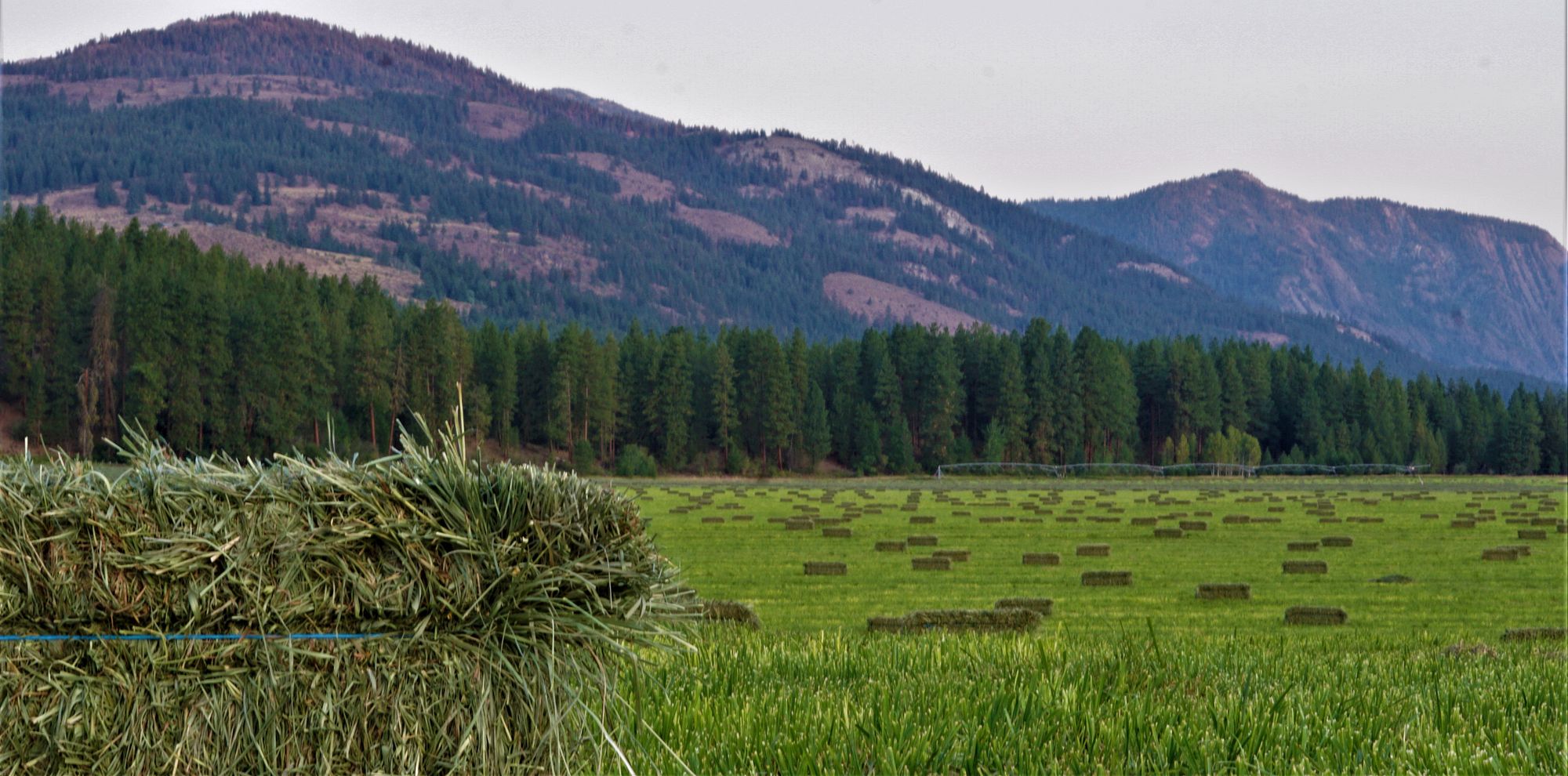
The route crosses the divide between the Methow River and Lake Chelan, moving from the North Cascades gateway town of Winthrop into high forest and then down toward dry-country orchards. Expansive views and the dramatic change between valleys make the crossing unforgettable.
The route covers 76.6 miles with 7,282 feet of climbing, including roughly 37 miles of rough gravel forest road. Expect an approximately even split between paved and unpaved riding, with sustained climbing, high ridges, and a long descent toward Lake Chelan. The scenery shifts from the Methow Valley’s open ranchland to pine and fir forest, then to dry hillsides and orchards above the lake.
Carlton, around mile 20, is the final dependable resupply before the mountain crossing. Road junctions may be unsigned, cell coverage is limited, water becomes scarce on the descent, and mechanical or emergency help can be many hours away.
Late June and early July are recommended for water availability, but snowpack, heat, wildfire smoke, and forest closures vary significantly by year. Check the entire alignment immediately before departure and avoid travel during active fire restrictions or unsafe air quality.

Plan Your Ride
Allow at least two days plus a final morning, ride from Winthrop toward Chelan as the route is designed, and build every day’s mileage around water, rough-road speed, and changing forest conditions.
Trip Planning & Logistics
The north-to-south direction provides more shade and water on the major climb. Return transportation is limited and may require several bus connections, so verify current bicycle capacity and schedules before committing. Download the official Ride with GPS route for offline use, and check Okanogan-Wenatchee National Forest alerts, road status, fire restrictions, and air quality before departure.
A mountain bike or sturdy bikepacking bike with very low gearing, dependable brakes, and high-volume tires is recommended, and front suspension may improve control and comfort. Carry offline navigation, a satellite communicator, water treatment, substantial water capacity, food reserves, warm layers, and robust repair supplies.
Established camping is available around Winthrop and Chelan, while the route uses dispersed sites on national forest land near reliable streams. Use existing sites, follow current dispersed-camping and fire rules, and confirm that the land and roads remain open. Don’t assume water at exposed camps.
Winthrop and Carlton provide the main pre-route supplies, with Carlton the final dependable stop before the mountains. Carry all meals and emergency calories for the forest crossing; Manson and Chelan provide food at the finish.
Very steep grades, rough surfaces, unsigned junctions, limited water, wildfire, smoke, and rapid weather changes make this an advanced route. Never enter a closure area. Share an itinerary, carry emergency communication, treat backcountry water, and be prepared to turn around if road or fire conditions deteriorate.
Routes change. Bridges wash out, businesses close, and construction pops up overnight. We strive to keep routes updated as those things happen. When we learn about a change, we reroute around sections that have become dangerous or are temporarily closed for road work, bridge outages, or construction, and we update service information as businesses open, close, or move. Digital routes are updated as soon as we’ve reviewed a reported issue.
You’re often the first to spot these changes out on the road. Help us keep this route accurate for the next rider by reporting anything you notice with our Route Feedback Form.
This Route Is Part of a Community Effort
Short Routes are cyclist-submitted and Adventure Cycling approved, with the mission of inspiring more adventures from your own backyard. All possible thanks to the dedicated support of our members and donors.
-

Explore the Short Routes Network
Accessible, beginner-friendly, free routes, expanding opportunities for bicycle travel to more riders.
Learn about the Network -
Support Route Development
Our members are the reason we can offer three route networks tailored for specific experiences and riders.
Become a Member -

Stay Connected
Find your stoke with our newsletter all about routes, gear, stories, and cycling news in your inbox twice a month.
Sign up for Bike Bits
Frequently Asked Questions
A collection of free, cyclist-submitted routes built for shorter trips. Each route is designed for a trip of one to five nights, ranging from a quick overnight ride to a longer multi-day adventure. It’s the most accessible of our three route networks: no purchase required, no advanced experience assumed, just a well-vetted route you can ride over a weekend or a week off.
We launched Short Routes in August 2022 with an initial set of 12 routes, created specifically because our epic, long-distance routes don’t work for everyone. Someone with a week of vacation, or someone new to bike touring, needs a different starting point. We developed that first collection in partnership with BIPOC, LGBTQ+, women, and intersex cyclists, with routes centered near major cities like Los Angeles, Seattle, Minneapolis, Austin, Atlanta, Washington, D.C., Philadelphia, and Boston, so people could find a route close to home rather than needing to travel somewhere remote first. Since then, the collection has grown through rider submissions and partnerships with other organizations like East Coast Greenway Alliance.
It’s the only one of our three networks built primarily by the community, for the community. Typically, the route builder is local to the area, providing special knowledge about transportation logistics, services, points of interest, and more. Anyone can submit a route, but every submission goes through a staff review: checked for traffic speeds, shoulder width, surface conditions, and whether services like food, water, and camping are realistically spaced for a loaded touring bike.
Riders who don’t have weeks to spend in the saddle, and riders who’ve never done a multi-day bike trip before. The collection was built with input from locals and includes routes near major cities, so that cyclists who live far from the endless miles of gravel roads or remote bikepacking routes have great routes mapped near them.
No. Many of our Short Routes are built to be beginner-friendly, though all are worth riding no matter your experience level. Because each one runs just one to five nights, it’s a much lower commitment than a cross-country tour, which makes it a good place to start if you’ve never done a multi-day ride.
Anyone can submit. You don’t need any official affiliation with Adventure Cycling. Head to our route submission form, and come prepared with three things: at least 10 photos from the route, a written description covering the highlights, navigation notes, services along the way, seasonal considerations, and a short bio about you as the route’s creator, and a Ride with GPS route that includes automatic cuesheetsand custom points of interest for things like lodging, food, bike shops, and any hazards.
It needs to take a beginner one to five nights, cover 50 to 200 total miles, and be located anywhere in the U.S. or Canada. Beyond that, we’re mainly checking for safety. A route can’t put a fully loaded touring cyclist through excessive hazards, so we look at things like traffic speed, shoulder width, road surface, and whether food, water, and camping are realistically spaced along the way.
It helps if you rode it within the past year or so. Those submissions move through review faster, since conditions on the ground are more likely to still match what you’re describing. Older routes can still be submitted, but they may take longer to review since we may need to double-check that services and conditions haven’t changed.
Review typically takes several weeks. We check every submission for safety and accuracy and reserve the right to edit before publishing. If your route is approved, we’ll follow up with you by email.