What’s So Special About the Arkansas High Country Route?
If you ask me, Arkansas is a really cool place — a destination worthy of any adventure cyclist’s bucket list. While I might kindle a particular fondness for the geology, flora, and fauna that make up the backwoods of my home, others tend toward the beautiful views, small-town vibes, and winding creeks — all of which make Arkansas a perfect place for a bicycle tour.
If you’re thinking about cycling in Arkansas, you could consider going low. That is, to the lowland areas of the south and east parts of the state. Here you’ll find the Coastal Plain, the Delta, and Crowley’s Ridge. The largest hills in these areas are usually the interstate overpasses. Don’t get me wrong, they have their own beauty. The cypress-tupelo swamps feel like a throwback to the Paleozoic, and the beech forests of Crowley’s Ridge are reminiscent of an elf sanctuary. And there are plenty of historic sites to visit like Johnny Cash’s home and the WWII Japanese internment camp at Rohwer.
But, for me, the high country is home.
The Arkansas High Country Bicycle Route
The high country consists of the Ozark Plateau, the Ouachita Mountains (pronounced wah-shî-tah), and the Arkansas River valley, each unique in its geology, ecology, and beauty. In getting the opportunity to work with Adventure Cycling to create a cycling route in my favorite state, I knew I wanted to showcase the natural features and the beautiful human environments of these highlands. And that’s exactly what I did with the Arkansas High Country Route.
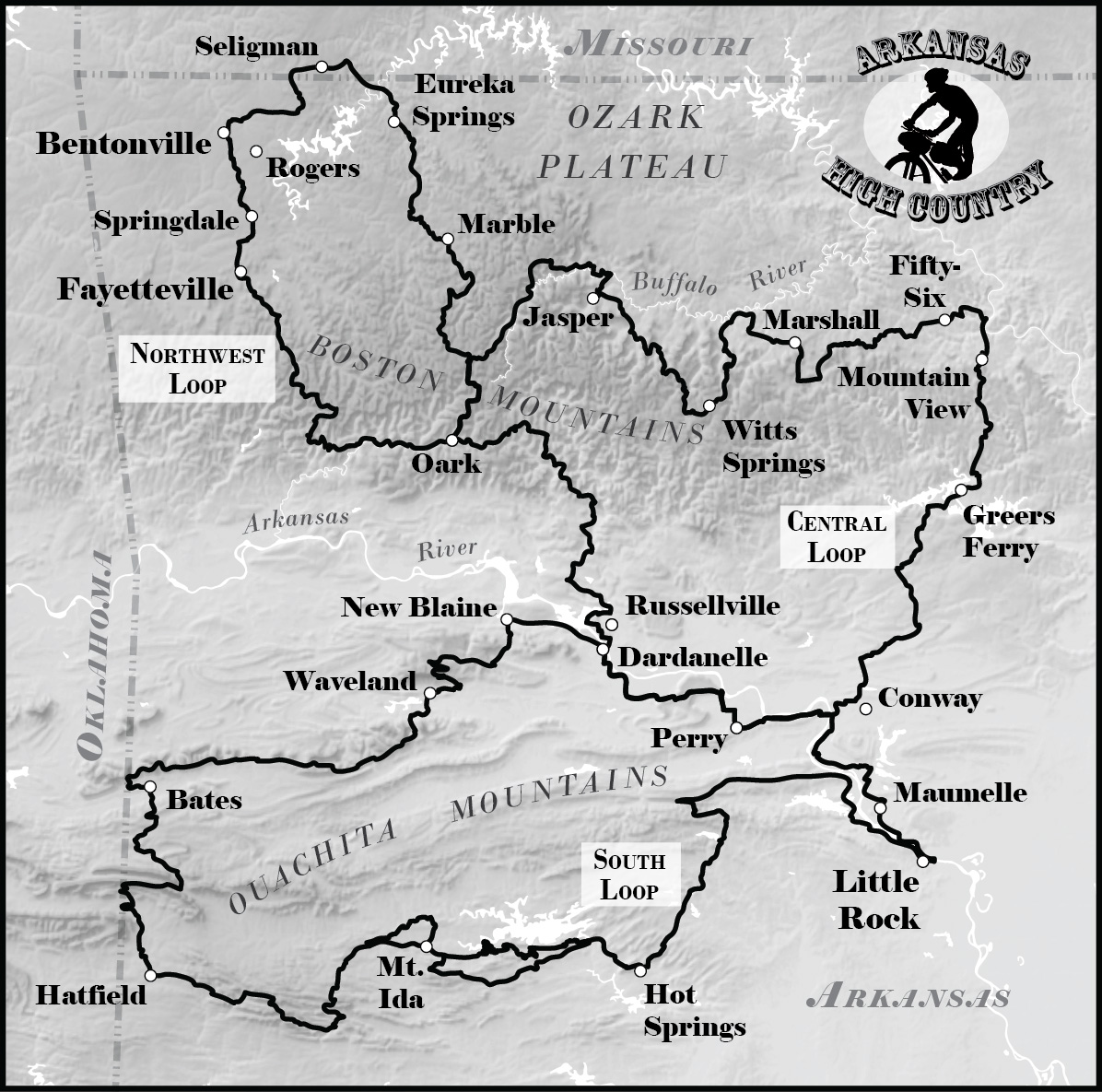
The Arkansas High Country Route starts where the highlands begin. Literally. At a town accurately named Little Rock.
As early explorers made their way up the Arkansas River, they noted a “little rock” rising out of the flood plain, a beacon in an area washed clean of all other surface rocks. The Arkansas High Country Route follows bike trails on the south shore of the river, passing by that very rock. On the return route, re-entering Little Rock, the route lies on the north shore of the river under the shadow of the “big rock” of Fort Roots Mountain.
I think Little Rock is the best place to enter the high country by bike. Situated nicely in the center of the state with a national airport, Little Rock is not only the capital, but it also claims some of Arkansas’s best urban bike paths.
Climbing Through the Ouachitas
The South Loop of the Arkansas High Country Route could be easily be named the “Ouachita Loop.” The range’s east-to-west ridges make for interesting cycling terrain.
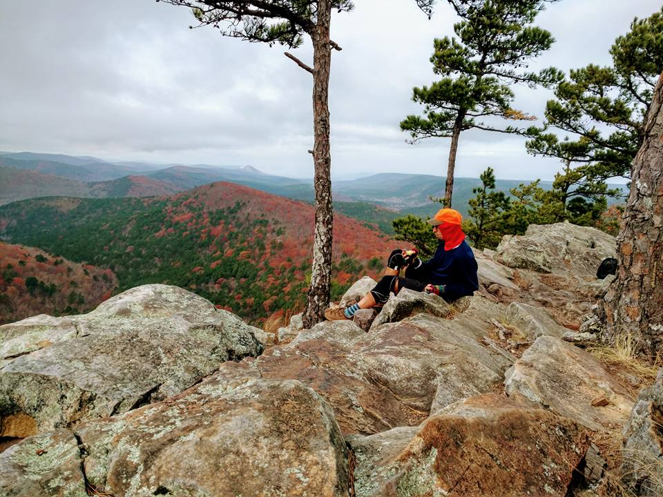
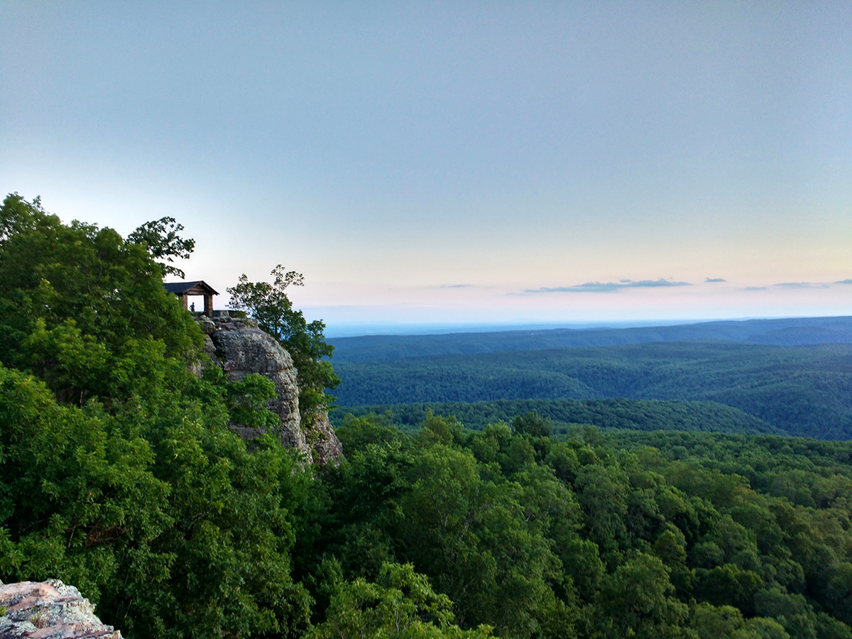
Early on in this loop, you’ll run into Pinnacle Mountain, first named “Maumelle” or “breast” by French explorers, either for the mountain’s conical shape or for the explorers’ *cough* unclean thoughts. There are in fact a number of these pinnacles in the eastern Ouachitas that formed because their super hard rock resisted weathering better than the surrounding ridges. I can hardly resist stopping my bike and walking through the shortleaf pines to the top of each pinnacle to take in the stunning views.
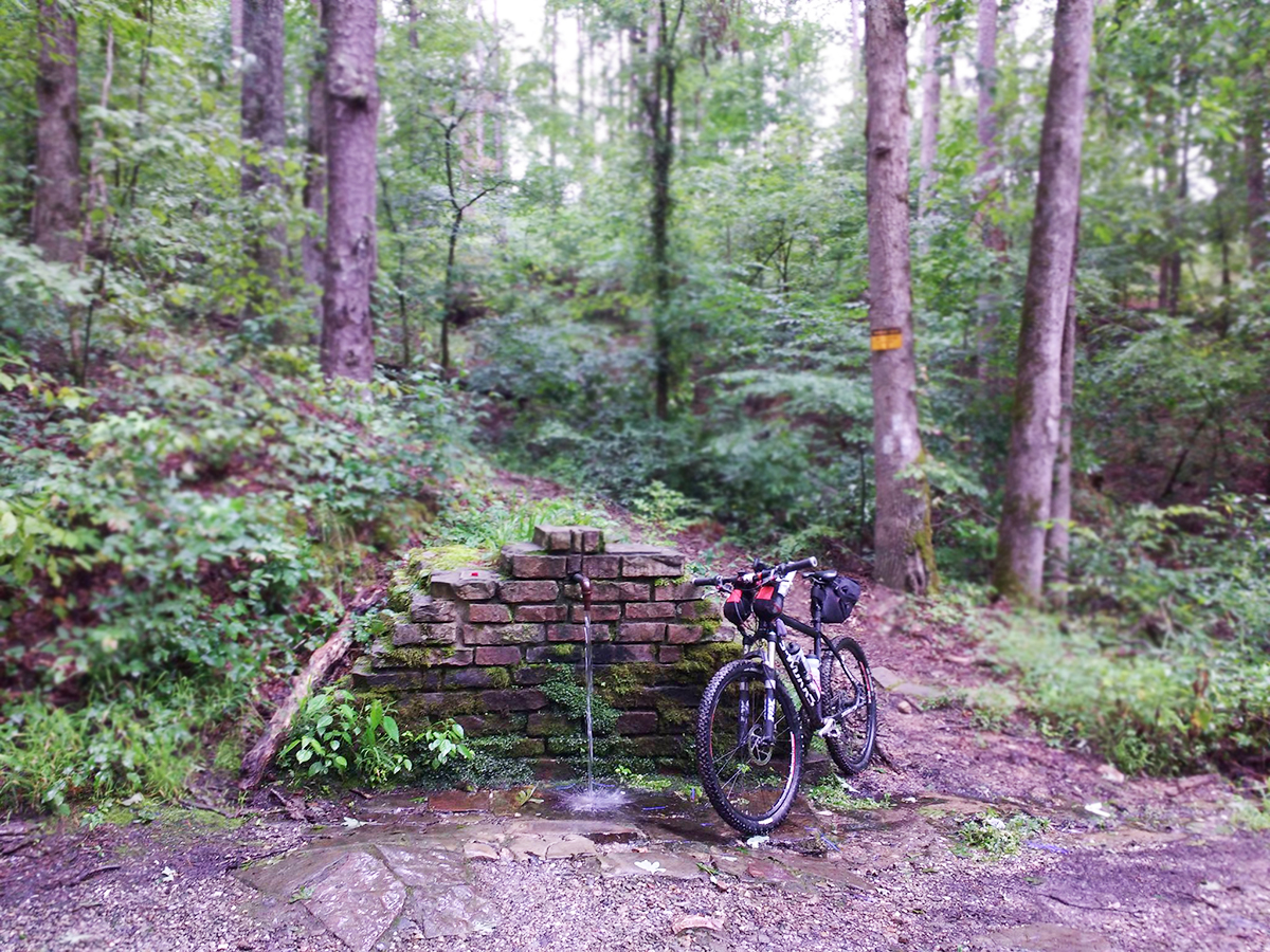
The valleys of the Ouachitas offer cold water and beautiful, thick forests. If you’re in the area, keep an eye out for some of my favorite plants that thrive in these wet alluvial zones: umbrella magnolia, wild azalea, cinnamon fern, and lady’s slipper orchids.
And heed my advice that there is nothing better than soaking in one of the spring-fed creeks on a hot summer day. In the winter, be sure to soak in the healing waters at Hot Springs National Park.
Also, note that I like to climb. Uphill on a bike, that is.
Since the Ouachitas are a series of east-to-west ridges, every time the Arkansas High Country Route turns to the north or the south, you can expect a steep and possibly long climb. My wife has named many of these hills: Thigh-Burner, Butt-Buster, Bike-Push Corner, and Heartbreak Curve.
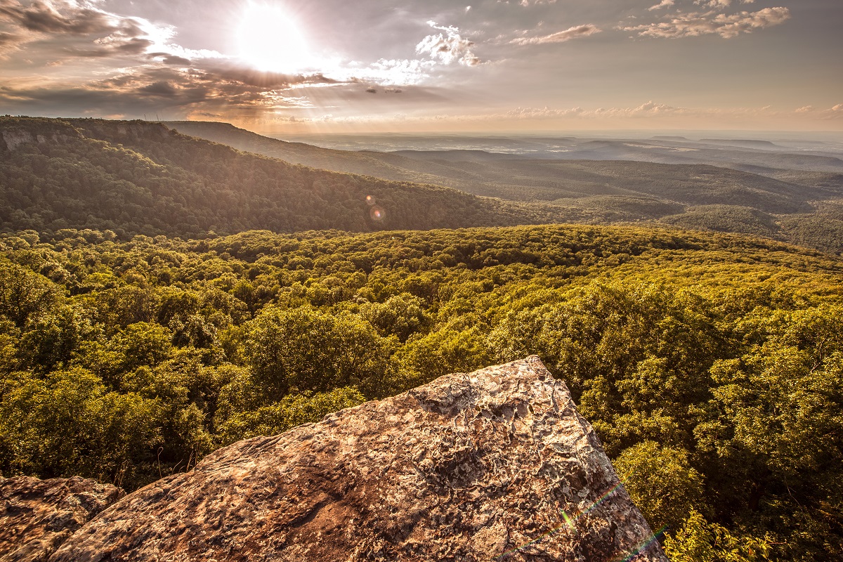
You might cuss me after each climb, but the rewarding view will be even sweeter.
A Rolling River Valley
The Arkansas River Valley offers a variety of terrain due to its fascinating (for me, at least) geological history. The valley was formed by a downward warping of the sandstone and shale. There are some areas, however, that broke, buckled, and lifted into the plateau mountains scattered along the river.
After humping up and over Mount Magazine, you’ll be rewarded with some paved, rolling roads along the Arkansas River, as well as flat stretches along the bottoms at Dardanelle and Conway. Like the Big Dam Bridge in Little Rock — the longest specially built bicycle and pedestrian bridge in the country — another dam bridge for pedestrians and cyclists is planned at Dardanelle.
Heading North into the Ozarks
The Northwest Loop and the Central Loop spend most of their time traversing the three mountain ranges of the Ozark Plateau. The Boston Mountains are the highest, most rugged, and least populated. I can ride my bikes for miles of gravel and not see a single car.
Each little town and store throughout the Boston Mountains is a cyclist’s oasis. The Ozark Café in Jasper, as well as the Oark General Store, Turner Bend Grocery, Mount Judea General Store, and Cindy’s Country Store in Witts Springs serve up the best burgers, sandwiches, and desserts in the whole world.
In contrast, the most urban part of the Northwest Loop guides you away from busy roads and onto the Razorback Greenway, one of the greatest urban bike routes in the country. It connects Fayetteville to Bentonville and features Crystal Bridges Art Museum, the Arkansas Naturals minor league baseball park, and about a dozen breweries, as well as other services for the touring cyclist.
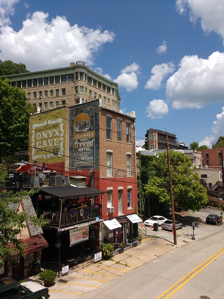
The tourist towns of Eureka Springs and Mountain View are a fun mix of hillbilly music and hippie tie-dye. Park your bike downtown in each and wander through the quaint shops and restaurants.
Saving the Best for Last
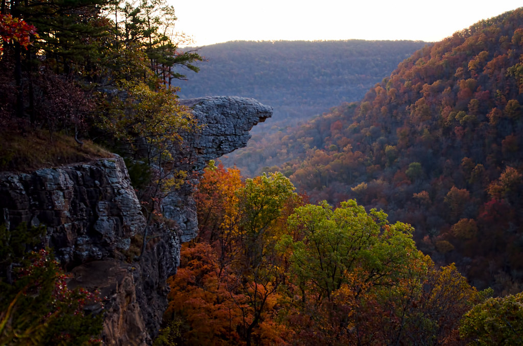
And finally, the ultimate measuring stick for bike touring beauty is the Buffalo National River. It was my second home as a teenager, where I worked many summers at Camp Orr for the Boy Scouts of America.
As you cycle along the Buffalo River from its headwaters (home to the Hawksbill Crag) down to the confluence with the White River, you’ll see the whole length of Boxley Valley, with its towering limestone bluffs and resident elk herd. The Peter Cave and Compton-Erbie (County Rd 2700) roads showcase the scenic backroads of this wonderful place.
Since it can’t all be sunshine and dry shoes, I hope you won’t cuss me too hard for taking you through Calf Creek. It ain’t Arkansas if there’s not a knee-deep creek crossing.
After riding this route, you will always need to refer to other adventures as “almost as good as the Buffalo.”